
Download
3D Flyover
Add to list
More
7.0 km
~1 hrs 32 min
88 m
Loop
“A gentle loop from town to lakeshore and hilltop, blending boats, broad views, and Victorian charm.”
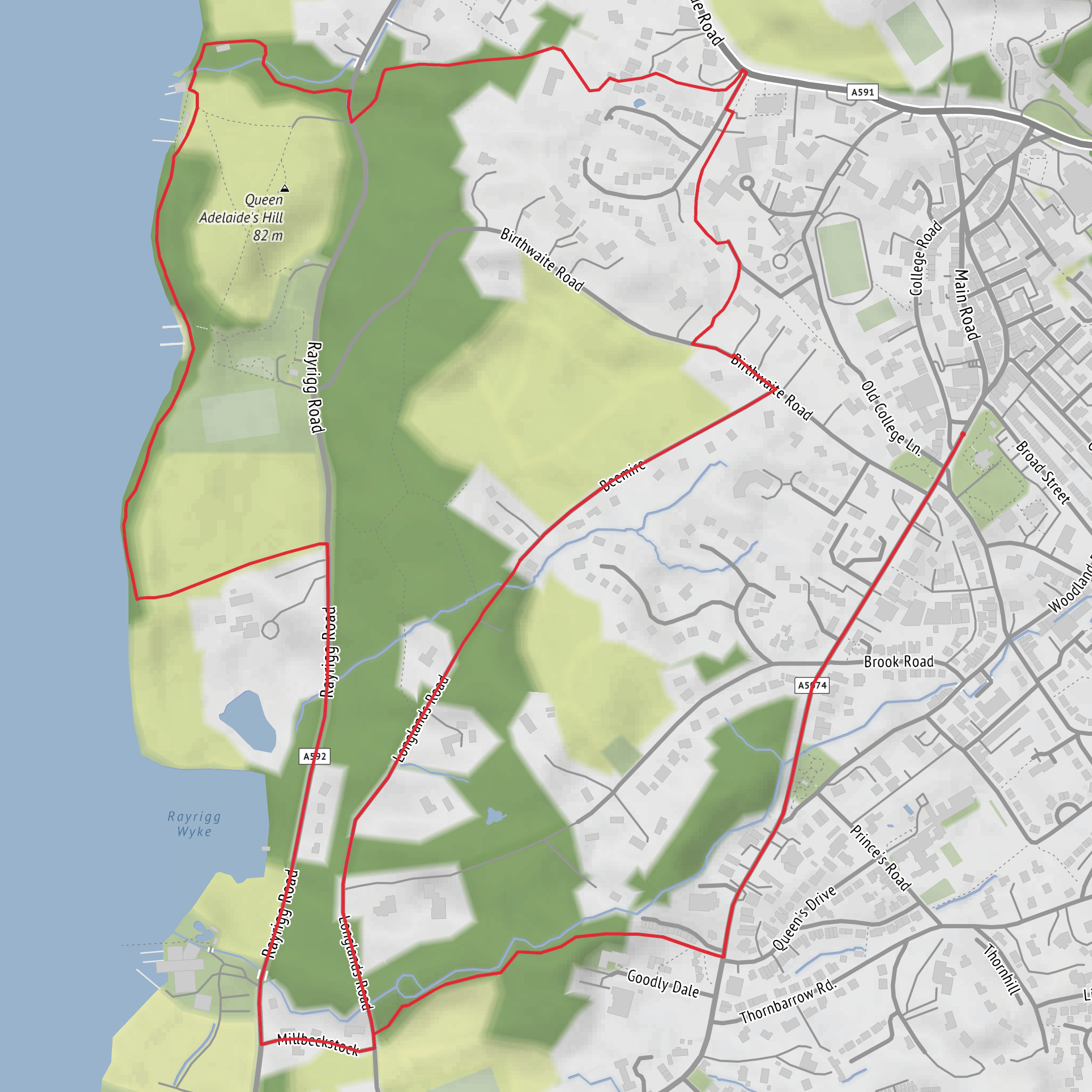
This easy loop near Windermere Railway Station, Station Precinct, Windermere LA23 1AH, links the town with the lakeshore and the low summit of Queen Adelaide’s Hill for a relaxed outing of about 7 km / 4.3 miles with roughly 100 m / 330 ft of ascent. The terrain is generally straightforward, but it mixes pavements, lakeside paths, woodland tracks, and short road sections, so it feels more like a varied scenic circuit than a purely rural trail. The area is popular year-round, and nearby mapped versions of the route are often described as easy, family-friendly, and partially paved. (nationalrail.co.uk)
From the station, the walk typically heads downhill through Windermere toward Bowness and the eastern shore of Windermere, England’s largest lake. Early on, expect a blend of village streets and busier local roads before the route settles into more scenic ground near the water. Because several route variations exist in this area, the total distance can come out shorter or longer depending on whether you include extra shoreline wandering around Millerground or approach Queen Adelaide’s Hill by the gentler path rather than the steeper direct climb. That helps explain why some published versions are closer to 5 km / 3.1 miles with around 149 m / 489 ft of ascent, while your planned outing is around 7 km / 4.3 miles and 100 m / 330 ft. (alltrails.com)
What to expect on the route
The first half of the loop is usually the most urban, with a steady descent from Windermere toward the lake. Once near the shore, the character changes quickly: stone walls, mature trees, glimpses of jetties and boats, and broad views across the water toward the western fells. Around Millerground, the route becomes especially attractive, with open lakeside scenery and one of the best chances to pause and take in the widest-feeling stretch of the lake in this part of the basin. Queen Adelaide’s Hill rises just above here, so the climb is short rather than sustained, but it is the main uphill section of the day. (lakedistrictgems.co.uk)
The ascent to the hill is modest overall, though some paths can be short, narrow, and stony, especially on the more direct line. A gentler option approaches from the A592 side through a gate and wider path, which can be more comfortable for walkers wanting an easier gradient. At the top, the reward is a panoramic viewpoint over Windermere, with sightlines extending both north and south along the lake when visibility is good. Benches and open grassy ground make this a natural rest stop. (lakedistrictgems.co.uk)
After the viewpoint, the loop usually returns by a mix of descending paths, roadside walking, and town streets back toward the station. Even though the hike is rated easy, the road sections deserve attention, particularly if walking with children or dogs, because some nearby route descriptions note stretches on narrow lanes and faster roads. Good footwear is still worthwhile, especially after rain when the unpaved sections can turn slick. (alltrails.com)
Landmarks, nature, and wildlife
The standout landmark is Queen Adelaide’s Hill itself, a small but memorable viewpoint above the east shore of Windermere. The hill was formerly known as Rayrigg Bank and was later renamed after Queen Adelaide, who visited Windermere in 1840 and is said to have come ashore at Millerground below. The hill later became valued as a public viewpoint, with local efforts helping preserve access for wider enjoyment. That gives the walk a pleasing historical layer: this is not just a scenic knoll, but a place tied to Victorian-era tourism and the growing appreciation of the Lake District as a landscape to be shared. (hdrawnsley.com)
The lakeshore section also passes close to the story of Windermere’s boating heritage. Nearby, Windermere Jetty Museum interprets more than 200 years of boats, boating, and boat-building on the lake, and the museum stands on the eastern shore within walking distance of Bowness Pier. Even if it is only seen from outside during the hike, it helps explain why the shoreline here feels shaped not just by nature but by a long relationship between the lake and transport, leisure, and craftsmanship.
Surfaces
Asphalt
Unknown
Dirt
Grass
Ground
Comments and Reviews
User comments, reviews and discussions about the Windermere and Queen Adelaide's Hill Loop, England.
average rating out of 5
0 rating(s)



