
Simpson's Ground Reservoir, Cartmel Fell, Sow How Tarn and Gummer's How from Astley's Plantation
Download
3D Flyover
Add to list
More
13.0 km
~3 hrs 13 min
375 m
Loop
“A richly varied circuit from hushed woodland to open fell, crowned by Gummer’s How’s sweeping views.”
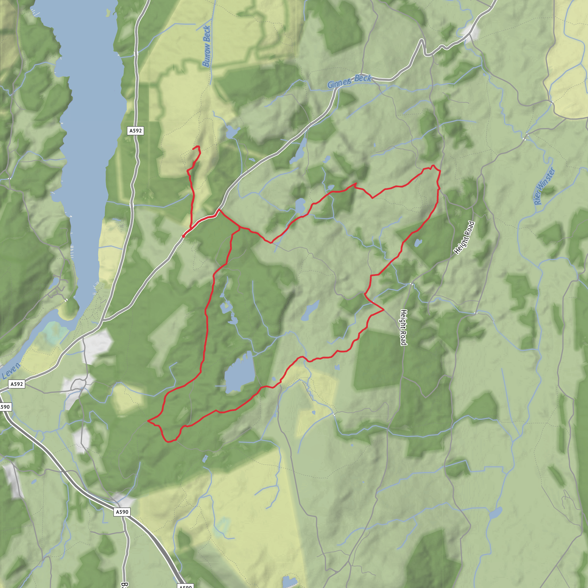
This medium-grade loop explores the wooded lower slopes above Windermere before widening out onto open fell, tarn-side tracks and one of the best modest-summit viewpoints in the south of the Lake District. Expect roughly 13 km / 8 miles with about 400 m / 1,310 ft of ascent overall, which is enough to feel like a proper day walk without becoming a full mountain outing. The route starts near the Astley’s Plantation / Gummer’s How car park on Fell Foot Brow, above Newby Bridge and Staveley-in-Cartmel, and quickly mixes forestry tracks, bridleways, short road links, rougher fell paths and a steeper summit pull to Gummer’s How. (visorando.com)
The start point is best understood as the Gummer’s How car park at Astley’s Plantation, on Fell Foot Brow near Newby Bridge rather than a formal village-centre trailhead. The commonly used parking area sits high on the road and is associated with Forestry England’s Chapel House forest, where the Gummer’s How car park has space for around 30 cars. (forestryengland.uk)
By car, the simplest approach is from the A592 at Newby Bridge, climbing west on Fell Foot Brow toward the signed parking for Gummer’s How / Astley’s Plantation. Roads are narrow in places, so allow extra time and be prepared for oncoming traffic on the fell lanes. By public transport, the most practical option is usually to take the Stagecoach 6 corridor serving Newby Bridge and Windermere, then continue by taxi or a long uphill road walk to the trailhead, because the bus serves the valley but not the car park itself. Westmorland and Furness Council lists the 6 as the Barrow–Ulverston–Newby Bridge–Windermere service. (westmorlandandfurness.gov.uk)
The opening section is gentle and useful for settling into the day. From the car park, permissive paths and tracks lead through the plantation and across the road onto Sow How Lane, then back into the forest. This early part is mostly on good surfaces, but after rain the edges can be soft and some junctions in the woods are easy to overrun if you are moving quickly. HiiKER is the best tool to keep handy here because several forestry tracks branch off at similar angles. (visorando.com)
Terrain and route character
After the first woodland section, the route trends south and east on forest tracks before climbing on bridleway toward the more open country around Sow How Tarn and the lanes near Sow How Farm. This middle part gives the walk its variety: enclosed conifer plantation, glimpses through clear-felled areas, open pasture, tarn-edge scenery and then the more expansive fellside around Gummer’s How. The total ascent is spread out rather than delivered in one long grind, though the summit approach itself is noticeably steeper and rockier than the rest. (visorando.com)
Sow How Tarn is one of the quieter landmarks on the circuit and often feels more intimate than the bigger Lake District waters. It is a good place to pause, but the ground nearby can be wet and uneven, especially after prolonged rain. Around the tarn and farm lanes, expect gates, livestock country and occasional muddy stretches where boots with decent grip are far preferable to lightweight road-style shoes. (visorando.com)
Simpson’s Ground Reservoir is more hidden than many walkers expect. Parts of the route pass through or beside forestry where the water may only appear in fragments through trees or from cleared sections, so it can feel more like a secretive woodland reservoir than a broad open-water feature. That makes navigation more important than simply “following the water,” especially in mist or low cloud. (visorando.com)
Landmarks, views, and what to look out for
Gummer’s How is the standout viewpoint of the day. At about 321 m / 1,053 ft, it is not
Surfaces
Unknown
Gravel
Asphalt
Unpaved
Dirt
Grass
Ground
Paved
Comments and Reviews
User comments, reviews and discussions about the Simpson's Ground Reservoir, Cartmel Fell, Sow How Tarn and Gummer's How from Astley's Plantation, England.
average rating out of 5
0 rating(s)


