Download
3D Flyover
Add to list
More
126.1 km
~5 days
1445 m
Multi-Day
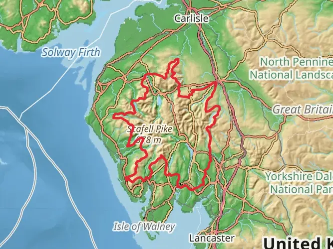
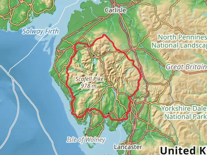
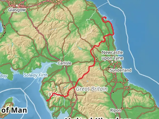
The Ravenglass to Bowness-on-Solwayvia England Coast Path is a 126.1 km trail that starts in Copeland, Cumbria, England. Based on our data, the hike is graded as Easy. For information on how we grade trails, please read measuring the difficulty of a hiking trail on hiiker. Also, check our latest community posts for trail updates. This hike can be completed in approx 5 days. Caution is advised on trail times as this depends on multiple variables. For more info read about how we calculate hike time.

What to expect?
Activity types
Frequently asked questions
How long is the Ravenglass to Bowness-on-Solwayvia England Coast Path and how many days does it take?
The Ravenglass to Bowness-on-Solwayvia England Coast Path is 126.07 km long with 1,445 m of total elevation gain. For most walkers, that distance works well as a multi-day trip of about 5 to 8 days, depending on daily mileage, overnight stops, and weather along the exposed Cumbrian coast.
Is the Ravenglass to Bowness-on-Solwayvia England Coast Path difficult?
This route is graded easy, which fits its generally low-level coastal terrain rather than steep mountain walking. Even so, 126.07 km is still a substantial undertaking, and the full route includes long walking days, sea-front sections, and cumulative elevation gain of 1,445 m over the length of the trail.
What towns and coastal places does the Ravenglass to Bowness-on-Solwayvia England Coast Path pass through?
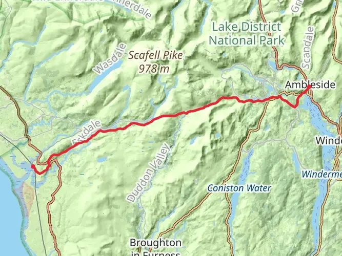
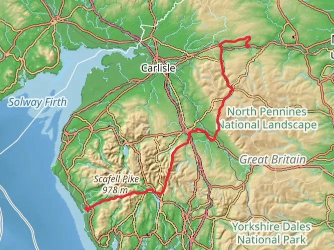
The route follows the Cumbrian coast north from Ravenglass toward Bowness-on-Solway and links a string of well-known coastal settlements. Places on or along this stretch include Whitehaven, Maryport, Allonby, Silloth, Port Carlisle, and Bowness-on-Solway, giving the walk a strong town-to-town structure for resupply and overnight planning.
Can you get to the start and finish of the Ravenglass to Bowness-on-Solwayvia England Coast Path by public transport?
Yes. Ravenglass has a station on the Cumbrian Coast Line with rail connections toward Carlisle and Lancaster, making the southern end practical without a car. At the northern end, Bowness-on-Solway is served by the Stagecoach 93 bus route to Carlisle, so the two ends can be linked with public transport rather than a car shuttle.
Is the Ravenglass to Bowness-on-Solwayvia England Coast Path dog friendly?
Dogs can be taken on this coast path, but control matters. On land next to the King Charles III England Coast Path, dogs must be kept under close control, and extra care is needed around livestock, shorebirds, and sensitive coastal habitats on the Solway and west Cumbrian shore.
What is the best time of year to walk the Ravenglass to Bowness-on-Solwayvia England Coast Path?
Late spring through early autumn is usually the most straightforward period for this route, when daylight is longer and coastal services are easier to use. The trail stays low and is not an upland walk, but exposed sections around the Irish Sea and Solway Firth can feel much harder in strong wind, heavy rain, or winter weather.
Are there any notable landmarks near the end of the Ravenglass to Bowness-on-Solwayvia England Coast Path?
Yes. Bowness-on-Solway is well known as the western end of Hadrian's Wall Path, so the finish has a strong historical identity as well as coastal scenery over the Solway Firth. Along the wider route corridor, walkers also pass places tied to Cumbria's Roman and industrial heritage, especially around Whitehaven and Maryport.
Comments and Reviews
User comments, reviews and discussions about the Ravenglass to Bowness-on-Solwayvia England Coast Path, England.
4.0
average rating out of 5
1 rating(s)