Download
3D Flyover
Add to list
More
9.7 km
~2 hrs 48 min
522 m
Loop
“A rugged Kentmere loop rises from quiet pastures to airy fells, rewarding prepared walkers with sweeping views.”
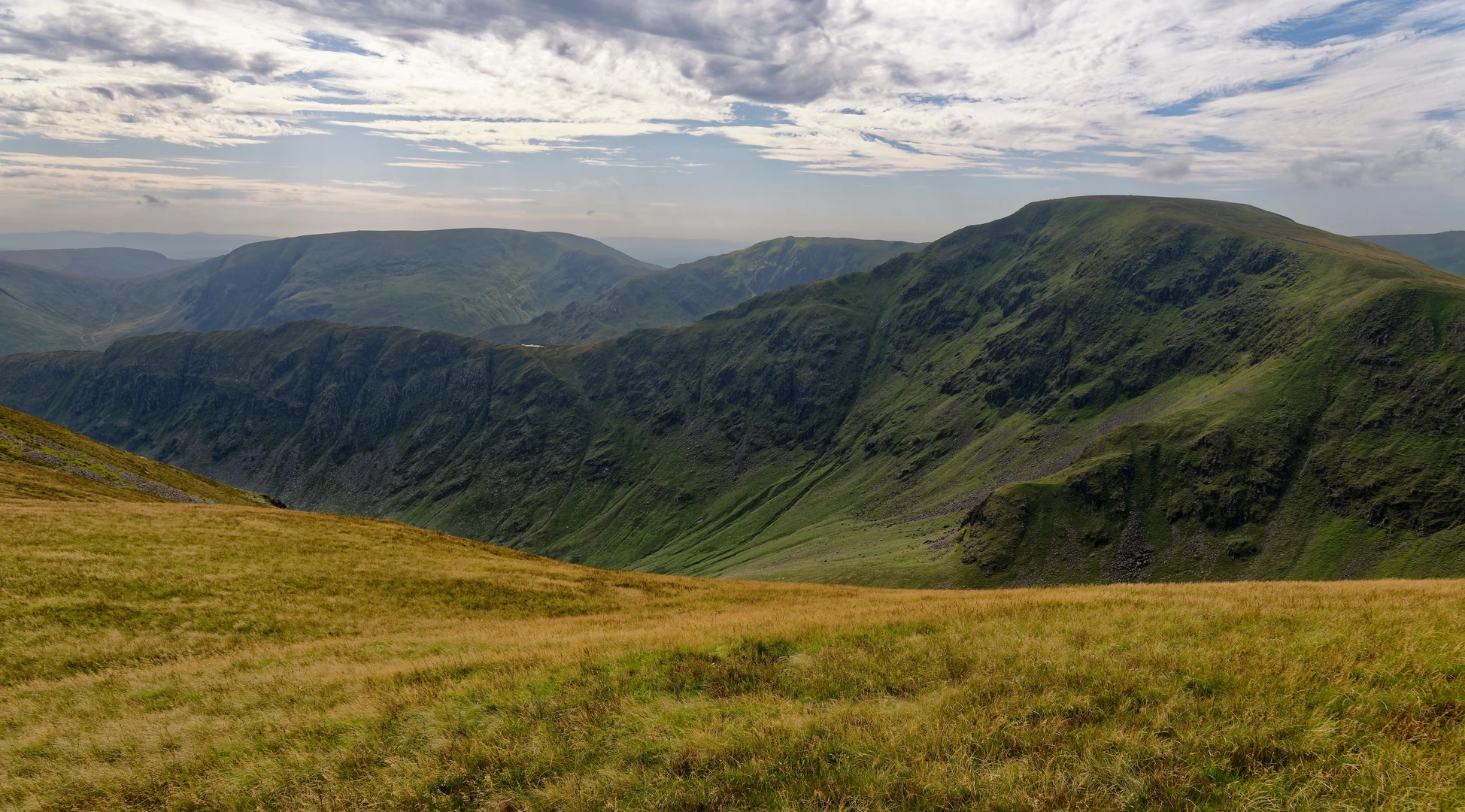
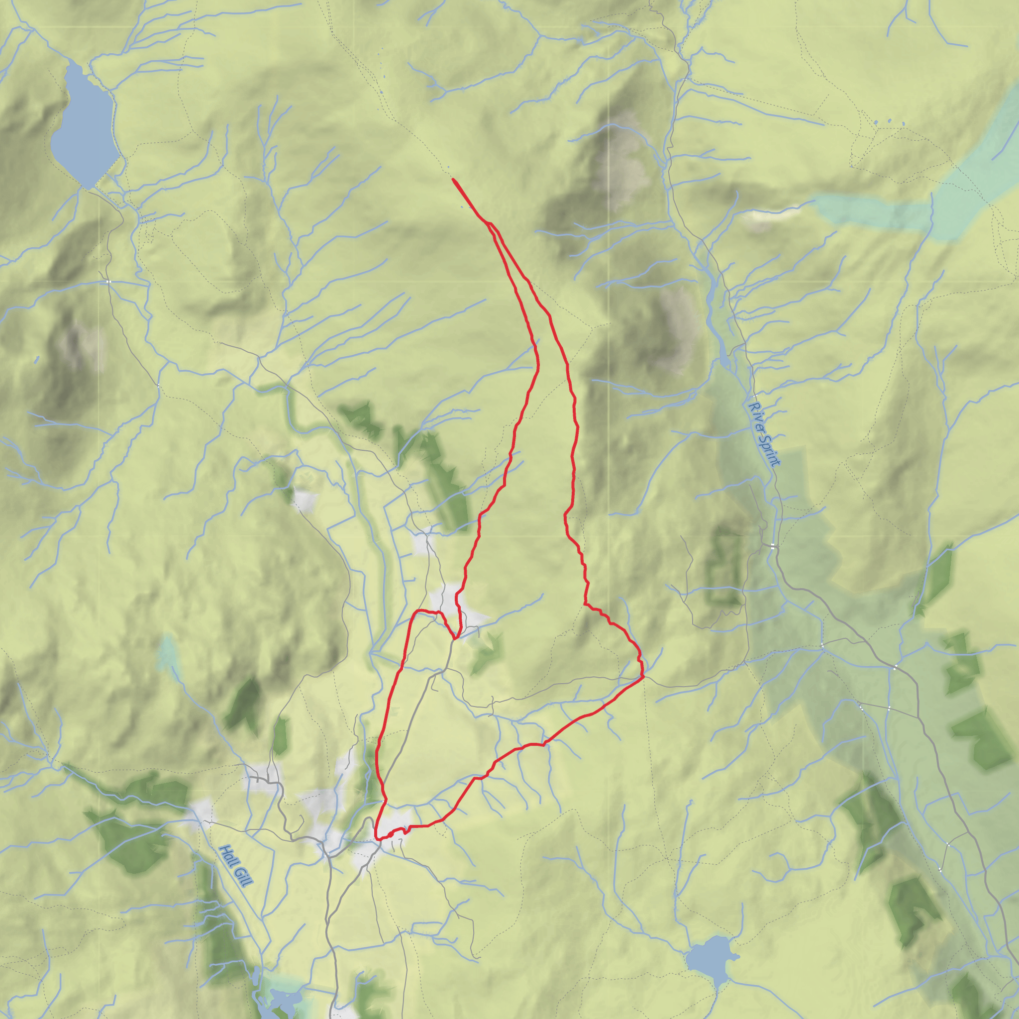
This medium-grade loop in the Kentmere valley packs a lot into roughly 10 km / 6.2 miles, with about 500 m / 1,640 ft of ascent. It climbs from the quiet pastoral floor of Kentmere onto open fellside, reaches the broad summit area of Kentmere Pike, then returns by way of Wray Crag and the rougher western shoulder above Hallow Bank. Expect a route that feels bigger than its mileage suggests: the ascent is sustained, the higher ground is exposed, and the descent can feel steep and uneven in places, especially if the turf is wet. Kentmere Pike itself rises to about 730 m / 2,395 ft and is one of the best viewpoints in the Far Eastern Fells. (en.wikipedia.org)
The walk is generally started near Kentmere village, close to St Cuthbert’s Church and Kentmere Village Hall, which is the nearest clear landmark for the trailhead area. The small parking area by the village hall is the most commonly referenced public start point, opposite the church. If you are arriving by car, approach via Staveley on the narrow valley road into Kentmere; roads are single-track in places, so allow extra time and be prepared for passing places. Public transport is limited: there is no direct bus service to the start, so the usual option is to travel to Staveley or Windermere by rail or bus and then continue by taxi. (lakedistrict.gov.uk)
The opening section usually heads out from the village green and climbs on the no-through road toward Hallow Bank / Green Quarter, before joining the rising fell path. This lower part is a useful warm-up, but it quickly turns into a more committed ascent. The path steepens as it gains the western side of the ridge, with expanding views back over the Kentmere valley and across the craggy slopes that give this area its rugged character. On clear days, the contrast between enclosed pasture below and open upland above is one of the most striking features of the route. (walkingbritain.co.uk)
On the climb
From Hallow Bank, the route trends upward over rough fell terrain toward the high ground linking Wray Crag, Shipman Knotts and Kentmere Pike. Underfoot, expect a mix of grassy trods, stonier sections, and occasionally boggy or slick patches after rain. Because this is a medium-difficulty outing rather than a valley stroll, good boots or trail shoes with solid grip are important. In mist, the upper fell can feel featureless in places, so carrying and knowing how to use HiiKER for route-following is especially helpful on the broad ridge and at junctions where sheep paths can be misleading. The climb to the main ridge is the hardest part of the day, with most of the 500 m / 1,640 ft of ascent gained before or around the summit area. (masarnenramblers.com)
Kentmere Pike is the high point and the main landmark of the loop. The summit area is broad rather than dramatically pointed, but the panorama is extensive: the Kentmere Horseshoe fells dominate nearby, while farther views can stretch toward the central Lake District, the Yorkshire Dales and, in very clear weather, even Morecambe Bay and the North Pennines. Wind exposure can be significant here, so even on mild days an extra insulating layer is worth packing. (ukhillwalking.com)
Wray Crag and the return
The return by Wray Crag gives the walk a different character. After the summit plateau and grassy ridge, the route begins to break into more textured ground with craggy outcrops and steeper slopes. Wray Crag is not a huge summit feature, but it adds a more dramatic edge to the descent and gives excellent backward views to Kentmere Pike. This section needs care in wet or windy conditions, as the path can be faint in places and the ground uneven. Trekking poles can be useful for the descent, particularly if knees are sensitive on steep grass. (walkingbritain.co.uk)
As the route drops back toward Stile End and Hallow Bank, the landscape softens again into enclosed valley scenery. Dry-stone walls, intake fields and scattered farm buildings mark the transition from high fell to working pastoral land. This lower section can be muddy after prolonged rain, and gates should always be left as found since this is active sheep country. (masarnenramblers.com)
Nature and wildlife
Kentmere is quieter than many central Lake District valleys,
Surfaces
Unknown
Paved
Comments and Reviews
User comments, reviews and discussions about the Hallow Bank, Kentmere Pike and Wray Crag Loop, England.
average rating out of 5
0 rating(s)
