Download
3D Flyover
Add to list
More
11.2 km
~2 hrs 38 min
248 m
Loop
“A soulful Lake District loop weaving waterfall, ancient bridge, lonely tarn, and brooding prehistoric moorland.”
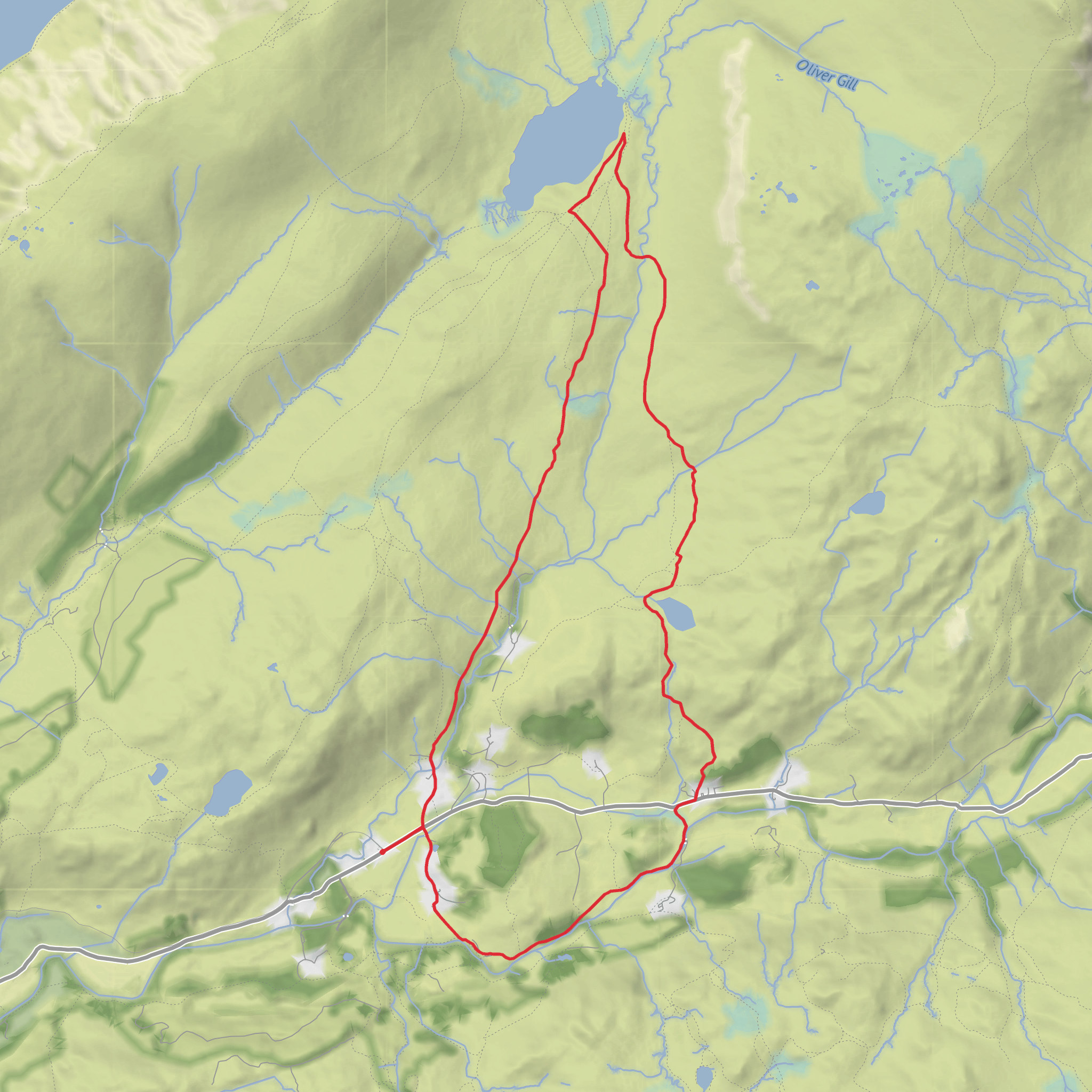
This medium-grade loop of about 11 km / 6.8 miles with roughly 300 m / 985 ft of ascent explores one of the quieter and more atmospheric corners of the western Lake District, linking riverside paths, old bridges, open fell, a high tarn, and a remarkable prehistoric landscape. The route is generally associated with the Wasdale–Eskdale side of the national park, with the nearest well-known start area being Wasdale Head / Lake Head car park, Wasdale Head, Seascale CA20 1EX. That is the most useful landmark to plan around if your mapping only shows an incomplete trailhead. (nationaltrust.org.uk)
Expect a varied day rather than a single sustained climb. The lower sections are usually on clear paths and tracks, but once the route reaches the open ground around Burnmoor the feel changes quickly: underfoot can become wet, peaty, and uneven, especially after rain, and the line of travel is less obvious in mist. This is why the route sits comfortably in the medium category—nothing especially technical in dry, calm weather, but the moorland terrain and exposure demand sound preparation and careful route-finding. For navigation, carrying the route on HiiKER is the sensible option. A paper backup and the ability to use it remain wise on this kind of fellside terrain.
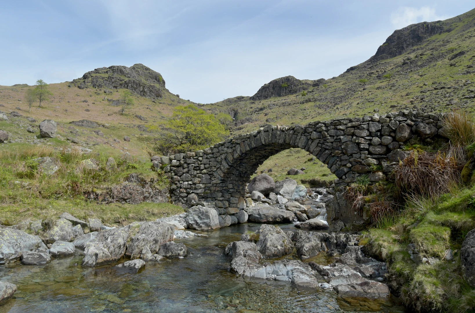
The opening part of the walk is shaped by water. Gill Force is one of those compact but memorable Lake District waterfalls that feels more dramatic after wet weather, and the nearby crossing at Doctor’s Bridge adds a strong sense of local character. Doctor’s Bridge began life as a packhorse bridge and was widened in 1734 so that surgeon Edward Tyson could take his trap across, which gives the bridge its name and makes it one of the route’s most interesting historic features. (nationaltrust.org.uk)
Terrain and what to expect
From the valley floor, the route rises gradually rather than brutally, giving you time to settle into the walk before the more open upland section. Around Gill Force and the river crossings, paths can be damp, stony, and slippery, with short muddy stretches after showers. Similar nearby National Trust route notes in this area describe generally good paths lower down but warn that wet ground and uneven sections are common, which is a fair expectation here too. (static.nationaltrust.org.uk)
As the loop works higher toward Burnmoor Tarn and Eller How, the landscape opens into broad moorland with a much wilder feel. Burnmoor Tarn sits at about 253 m / 830 ft above sea level in a moraine hollow and is widely noted as the largest entirely natural tarn in the Lake District. The approach to it is one of the highlights of the day: the ground broadens, the views lengthen, and the surrounding fells begin to dominate the skyline. (en.wikipedia.org)
This upper section is where hikers should be most alert. In poor visibility, the moor can feel featureless, and local guidance on routes near Burnmoor specifically notes that the path can be boggy and that walkers need map-and-compass competence. Even on a modest-distance day, wind, rain, and low cloud can make this section feel much more serious than the mileage suggests. Waterproof footwear, spare layers, and a conservative weather check are important. (eskdalemill.co.uk)
Landmarks, wildlife, and atmosphere
Gill Force and Doctor’s Bridge provide the route’s early focal points, but Burnmoor Tarn is the emotional centre of the walk. The tarn has a lonely, spacious character, and the surrounding ground around Boat How and Eller How is rich in archaeological remains as well as natural interest. On calmer days, the water and moorland can feel deceptively gentle; in wind, the same area becomes stark and exposed.
Wildlife is typical of upland Lakeland moor and rough pasture. Depending on season and conditions, hikers may notice meadow pipits, skylarks, ravens, and wheatears on the open ground, with wetter margins around becks and tarn edges attracting insects and amphibian life. Bracken, heather, rushes, and rough grasses dominate much of the higher ground, while lower sections near
Surfaces
Unknown
Unpaved
Grass
Asphalt
Dirt
Paved
Comments and Reviews
User comments, reviews and discussions about the Gill Force Waterfall, Doctor Bridge, Burnmoor Tarn and Eller How Loop, England.
average rating out of 5
0 rating(s)
