Download
3D Flyover
Add to list
More
11.7 km
~3 hrs 22 min
619 m
Loop
“A sweeping Howgill adventure of grassy ridges, misty cols, and big-sky views from The Calf.”
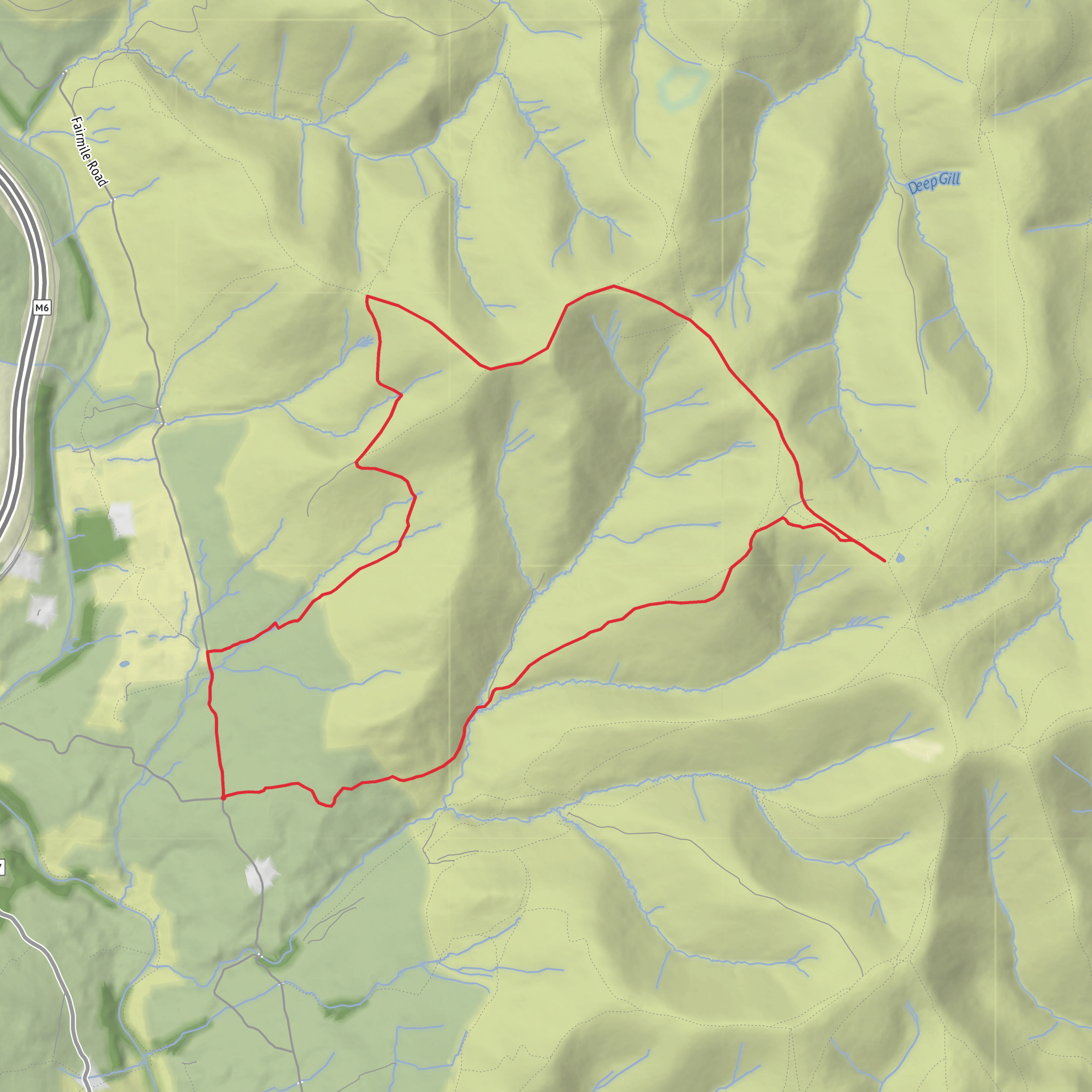
This medium-grade loop in the Howgill Fells packs a lot into roughly 12 km / 7.5 miles, with about 600 m / 1,970 ft of ascent: a steady climb onto high grassy ridges, a crossing of broad upland cols, and a final visit to The Calf, the highest point in the Howgills at 676 m / 2,217 ft. The route sits in the hills above Sedbergh, with the start most closely associated with Holy Trinity Church, Howgill, Howgill Lane, Sedbergh LA10 5JD, a well-known landmark used for access into this part of the fells. (achurchnearyou.com)
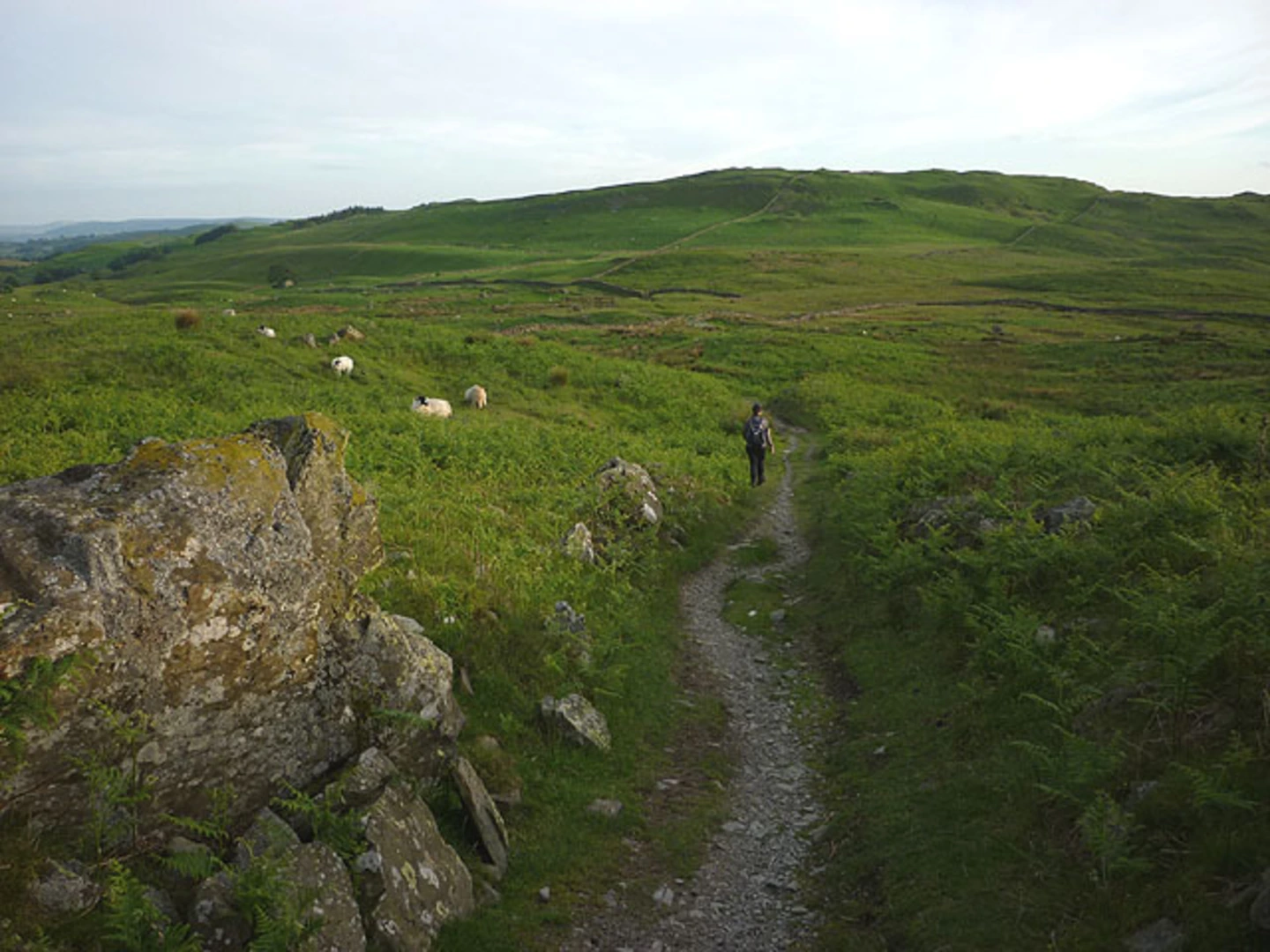
Expect a landscape that feels open almost from the outset. The Howgills are famous for their smooth, steep-sided profiles and deeply cut gills, often described as looking like a herd of sleeping elephants. Unlike rockier mountain groups, these fells are largely grassy, but that does not make them easy: the slopes can be relentless, the ground can turn slick after rain, and the rounded terrain can become confusing in mist. A medium rating is fair in dry, clear weather, but poor visibility or strong wind can make the day feel much more serious. HiiKER is the navigation tool to rely on here, especially around the broader summit plateau and the less distinct sections near Windscarth Wyke. (allthegearwithnoidea.wordpress.com)
The opening section is usually the most sustained effort. From the church and lane network near Howgill, the route climbs north and east toward Fell Head, gaining most of the day’s height over the first half of the walk. Fell Head itself rises to about 643 m / 2,110 ft and gives a strong sense of the character of the Howgills: long backs of grass, sudden side valleys, and wide views toward both the Yorkshire Dales and the Cumbrian fells when the air is clear. On a 12 km loop of this type, you can expect to reach the higher ground within roughly 3.5 to 5 km / 2.2 to 3.1 miles, depending on the exact line taken from the start. (allthegearwithnoidea.wordpress.com)
On the high ground
From Fell Head, the route trends across to Windscarth Wyke, a high col that acts as a natural hinge in the walk. This is one of the most important terrain changes on the loop: after the first summit, there is a noticeable dip before the next climb begins. That descent and re-ascent can feel more tiring than it looks on a map, particularly if the grass is wet or if there is a strong crosswind sweeping through the saddle. Windscarth Wyke is also where the surrounding topography becomes especially impressive, with the folds of the hills and the heads of the gills showing just how deeply water has carved into the massif. (ldwa.org.uk)
Beyond the wyke, the route rises again toward Bush Howe and then on to The Calf. This is often the most enjoyable part of the day for hikers who like airy ridge walking without exposure in the scrambling sense. The gradients are generally walkable rather than technical, but they are still demanding. The Calf’s summit area is broad and grassy rather than dramatic and craggy, so in cloud it can feel featureless; in good weather, though, it opens out into one of the best panoramas in the range. On a loop of around 12 km / 7.5 miles, The Calf is typically reached around the 7 to 9 km / 4.3 to 5.6 mile mark. (sedbergh.org.uk)
The descent is where many walkers lose time. The Howgills are notorious for steep grassy drops that look simple from above but can be awkward underfoot. If the route returns by a different line toward Howgill Lane and the church, expect a quick loss of height over springy turf, occasional boggier patches, and some path braiding where sheep tracks split away from the main trod. Trekking poles can be useful, especially after rain. In dry summer conditions the going is usually straightforward; in winter or after prolonged wet weather, the same slopes can become slippery and energy-sapping. (wainwrightwalking.co.uk)
Landmarks, wildlife and what to
Surfaces
Unknown
Dirt
Unpaved
Comments and Reviews
User comments, reviews and discussions about the Fell Head, Windscarth Wyke and The Calf Loop, England.
average rating out of 5
0 rating(s)
