
Download
3D Flyover
Add to list
More
13.9 km
~3 hrs 20 min
333 m
Loop
“A rolling Whitbarrow circuit blends shadowy woods, pale limestone scar, and wide valley views.”
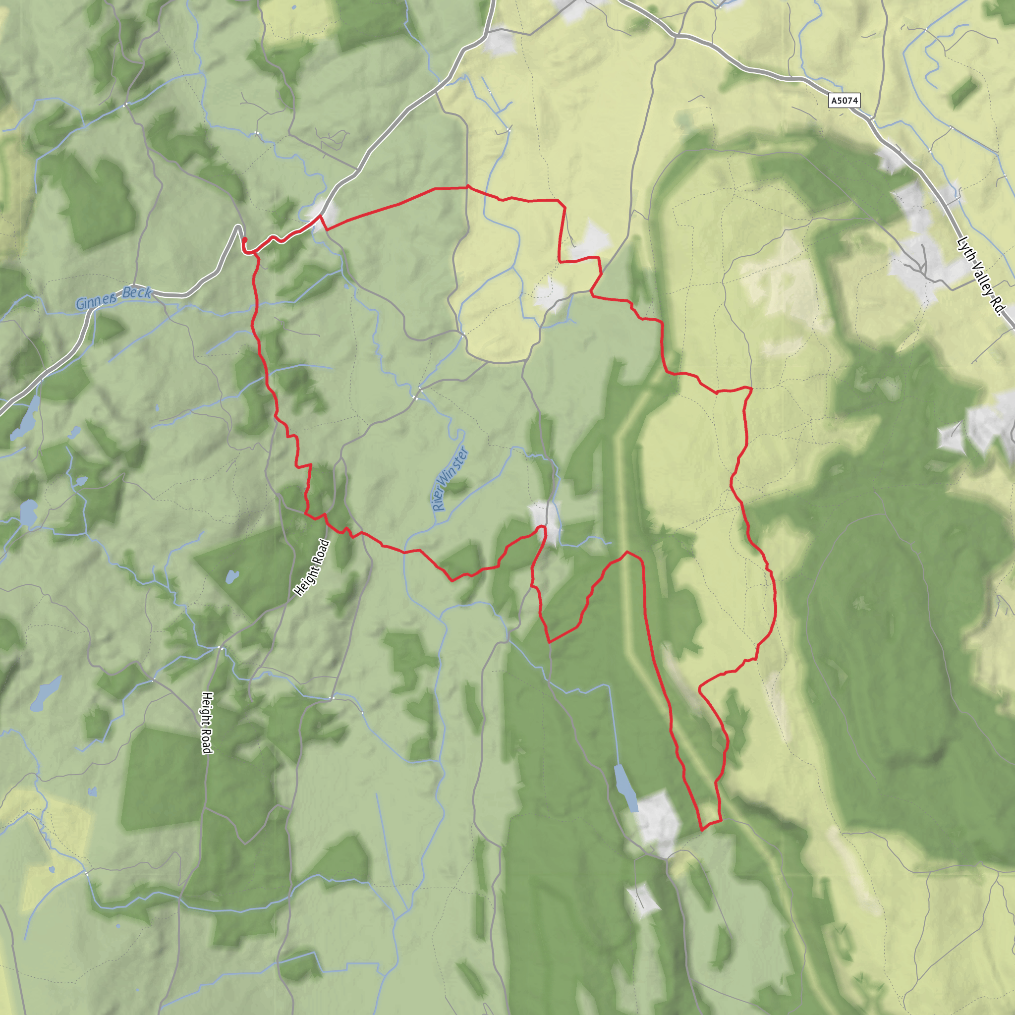
This 14 km / 8.7 mile loop on the limestone country of Whitbarrow is a varied medium-grade outing with around 300 m / 985 ft of ascent, combining woodland tracks, open scar, rough pasture and broad fellside views. It sits on the Whitbarrow massif in the southern Lake District, overlooking the Lyth Valley about 8 km / 5 miles southwest of Kendal, and much of the route passes through or beside nationally protected habitat within Whitbarrow National Nature Reserve. (forestryengland.uk)
The walk is best thought of as a rolling circuit rather than one long climb. Early on, expect enclosed woodland and farm-edge paths through Cowclose Wood and High Park Wood, where the ground can be damp, rooty and slippery after rain. As the route gains height toward Whitbarrow Scar, the character changes quickly: underfoot becomes stonier, gradients steepen in short bursts, and the landscape opens onto limestone pavement, rough grassland and exposed escarpment. Even though the total ascent is moderate, the uneven surface can make it feel harder than the numbers suggest, especially in wet or windy weather. HiiKER is the most useful tool for checking junctions through the woods and confirming the line across the more open sections.
Getting to the start is easiest by car. The most commonly used access for walks on this side of Whitbarrow is the roadside parking area near the Mill Side / Beck Head turning just off the A590, a short distance beyond the cattle grid at approximately grid reference SD 452 839. That places the start near the Mill Side and Beck Head junction, south of Whitbarrow and close to the southern approach to the scar. Parking in the wider Whitbarrow area is generally informal or limited, though Forestry England notes there are no parking charges at Whitbarrow. (daleswalks.co.uk)
Public transport is possible but less straightforward. Cumbria Wildlife Trust notes buses run from Barrow-in-Furness, Ulverston and Kendal to Witherslack, from where footpaths climb onto Whitbarrow; however, that approach is steeper and adds distance compared with the southern roadside start. The parish planning material also indicates public transport in the immediate area is very limited, so it is worth checking current bus times carefully before committing to a car-free day. (cumbriawildlifetrust.org.uk)
Terrain and route character
From the lower woods, the route usually begins gently, with a steady warm-up through mixed woodland and along field boundaries. Cowclose Wood and High Park Wood provide shelter and a sense of enclosure, but they also hide some of the route’s trickier footing: mud, leaf-covered stones, exposed roots and short, awkward rises. Good waterproof footwear is a sensible choice year-round.
As the loop rises onto Whitbarrow Scar, the scenery becomes the main event. Whitbarrow is a carboniferous limestone outcrop just over 200 m high, and its protected habitats include woodland, lowland grassland and limestone pavement. That limestone pavement is one of the area’s defining features: broken slabs separated by deep fissures, beautiful to look at but demanding care underfoot. In dry conditions it is grippy enough, but in rain or frost it can become very slick. Hikers should watch children and dogs closely anywhere the route nears scar edges or broken rock. (gov.uk)
The higher ground gives broad views over the Lyth Valley and toward the surrounding fells, and on clearer days the contrast between wooded lower slopes and pale limestone crest is especially striking. Some sections can feel surprisingly wild for a relatively modest-height walk, particularly where the path crosses open access land and the line is less obvious than it was in the woods. In mist, the scar top can be disorienting, so having the route loaded in HiiKER is worthwhile.
Landmarks, wildlife and seasonal interest
Whitbarrow is valued for both scenery and biodiversity. The reserve is managed by Forestry England, the Lake District National Park Authority and Cumbria Wildlife Trust, and it is protected as a National Nature Reserve. The limestone habitats support a rich flora, and spring into summer is often the most rewarding period for wildflowers. (gov.uk)
Woodland sections can be especially attractive in spring, when the ground flora is at its best. The wider Whitbarrow area is also known for herb-rich limestone grassland and notable butterfly habitat, while the reserve supports grazing by cattle and sheep as part
Surfaces
Unknown
Dirt
Asphalt
Grass
Gravel
Concrete
Paved
Wood
Comments and Reviews
User comments, reviews and discussions about the Cowclose Wood, High Park Wood and Whitbarrow Scar Loop, England.
average rating out of 5
0 rating(s)

