Download
3D Flyover
Add to list
More
13.1 km
~3 hrs 22 min
453 m
Loop
“A wild loop of tarn, peat and old mining tracks, with sweeping Pennine solitude.”
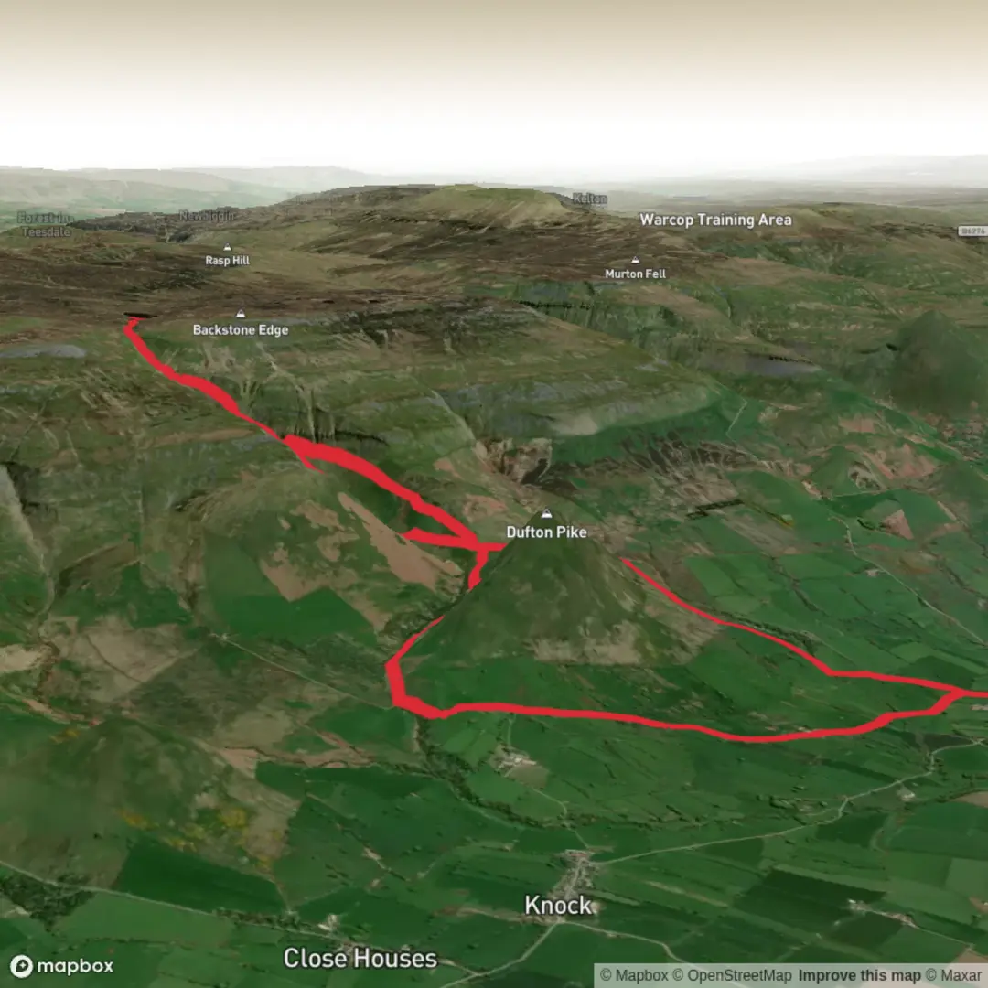
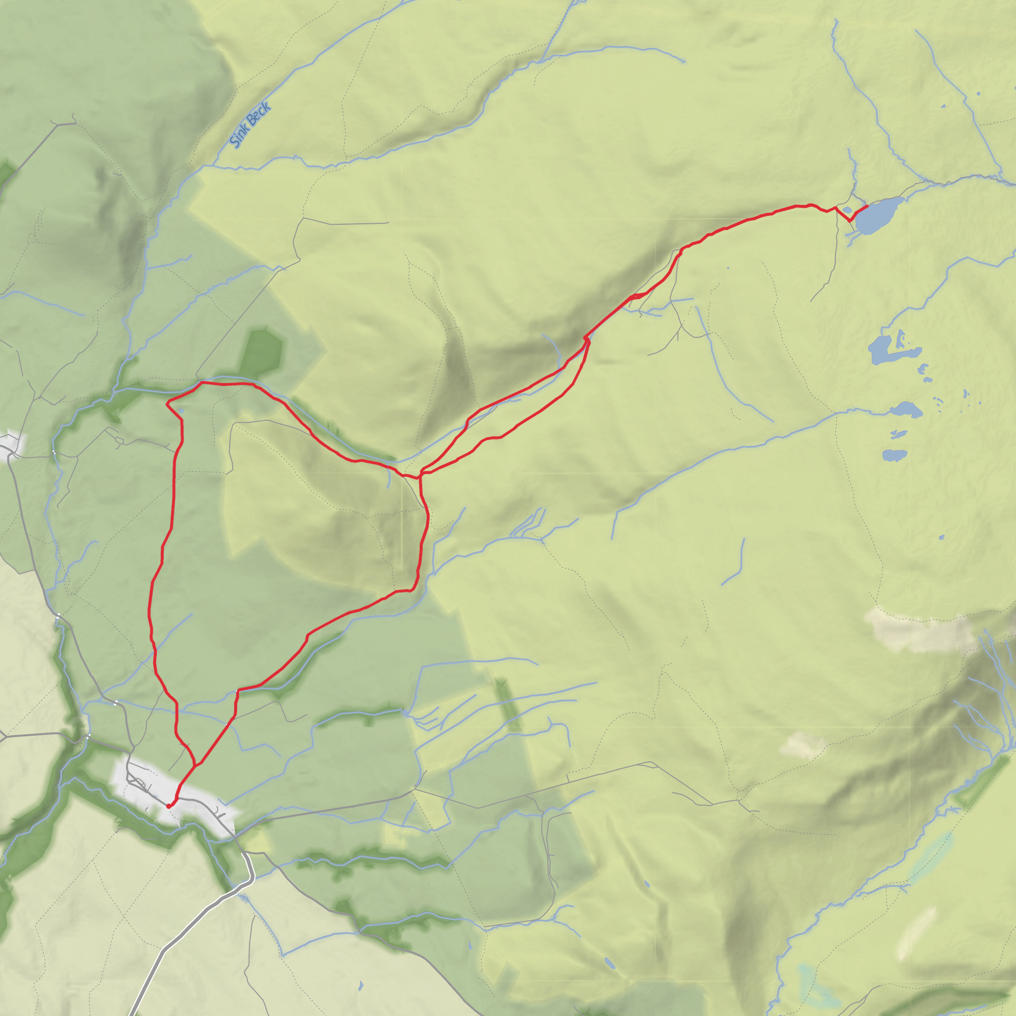
This medium-difficulty loop explores the high, open country east of Dufton in the North Pennines, linking the broad shoulder of Cosca Hill with the lonely basin of Great Rundale Tarn and the rougher ground around Bluethwaite Hill. At around 13 km / 8.1 miles with roughly 500 m / 1,640 ft of ascent, it is a compact fell walk that still feels remote, with long stretches of exposed moorland, old mining country, and wide views toward Dufton Pike, Knock Pike, Great Dun Fell, and the Pennine escarpment. The usual start point is Dufton village, near the village car park and public toilets, a well-known base for Pennine Way walkers. (wainwrightwalking.co.uk)
The route generally begins from Dufton, a small village just outside Appleby-in-Westmorland in Cumbria. If arriving by car, the most practical landmark for the start is the village car park beside the public conveniences in Dufton. If using public transport, the nearest rail access is Appleby, and bus links in the area connect Appleby with surrounding villages, though services can be limited and seasonal, so checking current timetables before setting out is important. Appleby is also served by regular bus connections on the wider Eden Valley corridor, making it the main transport hub for reaching the walk. (duftonvillagehall.com)
The opening section is usually the easiest underfoot, leaving the village on lanes and field paths before the ground begins to rise toward Halsteads and the flank of Cosca Hill. This lower part can be muddy after rain, especially around farm tracks and gates, and it is worth allowing extra time if the weather has been wet. The climb onto Cosca Hill is not especially technical, but it is steady enough to raise the heart rate early, gaining a good portion of the day’s ascent in a relatively short distance. As height is gained, the enclosed farmland quickly gives way to open fell, and the sense of space increases dramatically. (wainwrightwalking.co.uk)
Terrain and navigation
Once on the higher ground, the character of the walk changes from pastoral to distinctly upland. Expect a mix of grassy trods, stony tracks, wetter moorland sections, and occasional peatier patches near the tarn and on the plateau. Great Rundale itself is a steep-sided valley cutting into the western flank of the northern Pennines, and the old track through it has long been associated with access to mining ground higher up. Near Great Rundale Tarn, the landscape becomes more austere: peat banks, pools, rough grass, and a broad, wind-exposed skyline where visibility can deteriorate quickly in mist. (civicwalker.org.uk)
This is a route where strong navigation matters even though parts of it follow obvious lines. In clear weather, the main landmarks are easy to read: Cosca Hill behind you, the cleft of Great Rundale, the tarn itself, and the distant white radome on Great Dun Fell. In poor visibility, however, the plateau can feel featureless and confusing, especially around the wetter ground near the tarn and where paths fade into sheep trods. HiiKER is the best tool to have ready alongside a map and compass, particularly for confirming line choices around the upper loop and any descent back toward Dufton. (wainwrightwalking.co.uk)
Landmarks, landscape, and history
One of the most distinctive landmarks is Great Rundale Tarn, a high and isolated mountain tarn sitting in bleak moorland country at over 650 m / about 2,130 ft. Despite appearing tied to the valley below, its drainage is unusual: water from the tarn flows east toward Maize Beck and ultimately the North Sea rather than down Great Rundale toward the Eden. That small hydrological quirk adds to the sense that this is a watershed landscape in every sense. Nearby, walkers may also notice a shooting box or hut, one of the few man-made shelters on these high fells. (civicwalker.org.uk)
The area also carries clear traces of its industrial past. The tracks and disturbed ground around Threlkeld Side and Great Rundale are linked with historic lead-mining activity, part of the wider mining heritage of the North Pennines. These old access routes were not created purely for recreation; they were working lines into a harsh upland environment where ore extraction once shaped movement across the fell. That industrial layer sits within
Surfaces
Unknown
Asphalt
Comments and Reviews
User comments, reviews and discussions about the Bluethwaite Hill, Great Rundale Tarn and Cosca Hill Loop, England.
average rating out of 5
0 rating(s)
