Download
3D Flyover
Add to list
More
6.0 km
~2 hrs 9 min
576 m
Loop
“Embark on the Yewbarrow Loop for stunning views, challenging climbs, and rich historical charm.”
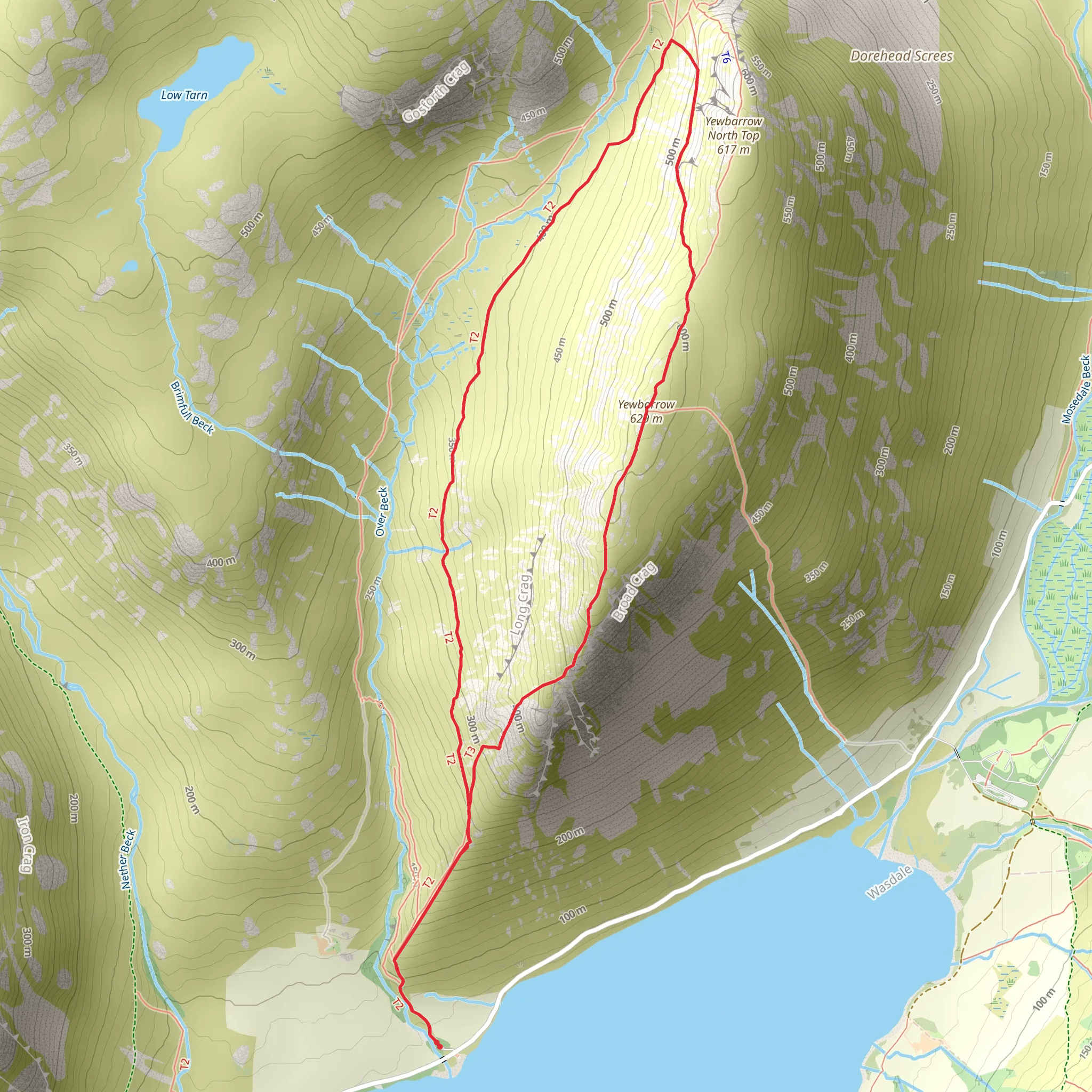
Starting your adventure near the serene Wast Water in Cumberland, England, the Yewbarrow Loop is a captivating 6 km (approximately 3.7 miles) trail with an elevation gain of around 500 meters (1,640 feet). This loop trail is rated as medium difficulty, making it suitable for hikers with some experience and a reasonable level of fitness.
Getting There
To reach the trailhead, you can drive or use public transport. If driving, head towards Wasdale Head, which is the nearest significant landmark. There is a car park available at Wasdale Head, providing convenient access to the trail. For those using public transport, the nearest train station is Seascale, from where you can take a local bus or taxi to Wasdale Head.
Trail Overview
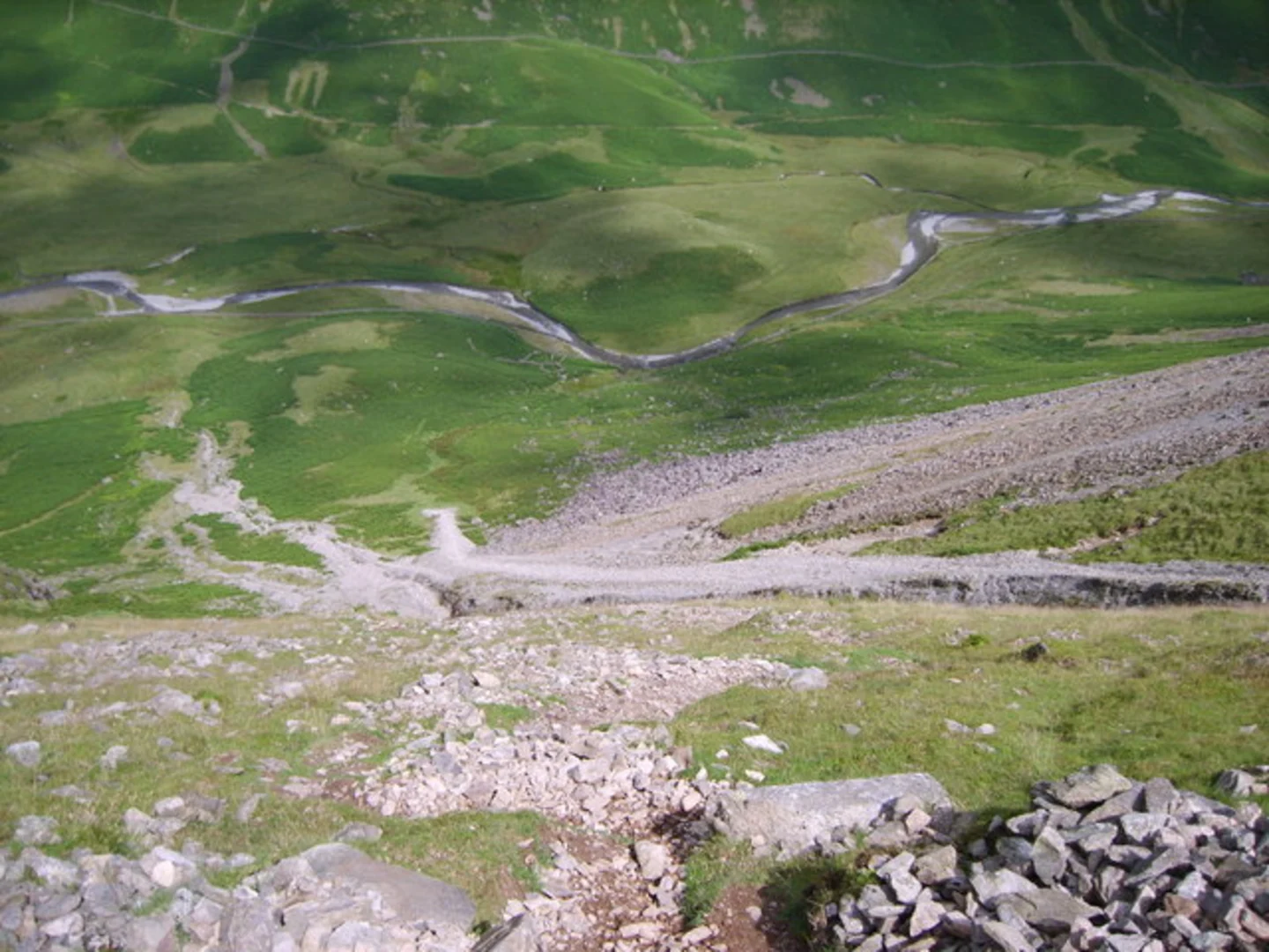
The trail begins near the shores of Wast Water, England's deepest lake, offering breathtaking views right from the start. As you ascend, the path becomes steeper and more rugged, so sturdy hiking boots are recommended. The initial climb takes you through a mix of grassy slopes and rocky terrain, with the first significant elevation gain occurring within the first 2 km (1.2 miles).
Key Landmarks and Sections
Wast Water
At the beginning of your hike, take a moment to appreciate Wast Water. This glacial lake is surrounded by some of the highest peaks in England, including Scafell Pike. The lake's dark, reflective waters create a dramatic contrast against the rugged landscape.
Bell Rib
Around the 3 km (1.9 miles) mark, you'll encounter Bell Rib, a prominent rocky outcrop that offers panoramic views of the surrounding fells and valleys. This is a great spot for a short break and some photography.
Yewbarrow Summit
Continuing your ascent, you'll reach the summit of Yewbarrow at approximately 4 km (2.5 miles) into the hike. The summit provides stunning 360-degree views, including vistas of Great Gable, Scafell Pike, and the distant Irish Sea. The climb to the summit is steep and involves some scrambling, so be prepared for a challenging but rewarding experience.
Flora and Fauna
The Yewbarrow Loop is rich in natural beauty. Keep an eye out for native wildlife such as red deer, peregrine falcons, and various species of butterflies. The flora varies with altitude, from lush green ferns and mosses at lower elevations to hardy grasses and heather as you climb higher.
Historical Significance
The Wasdale Valley has a rich history, with evidence of human activity dating back to the Neolithic period. The area was also significant during the Viking Age, and you may come across ancient stone circles and burial mounds along the way. The valley's rugged terrain has long been a source of inspiration for poets and artists, adding a layer of cultural significance to your hike.
Navigation
Given the trail's rugged nature and variable weather conditions, it's advisable to use a reliable navigation tool like HiiKER to ensure you stay on track. The app provides detailed maps and real-time updates, which can be invaluable in this remote area.
Final Descent
The descent from Yewbarrow is steep and can be slippery, especially after rain. Trekking poles can be helpful for maintaining balance. As you make your way back towards Wast Water, the path levels out, allowing for a more leisurely walk to complete the loop.
This trail offers a perfect blend of natural beauty, challenging terrain, and historical intrigue, making it a must-visit for any avid hiker.
What to expect?
Activity types
Comments and Reviews
User comments, reviews and discussions about the Yewbarrow Loop from Wast Water, England.
4.5
average rating out of 5
4 rating(s)
