Download
3D Flyover
Add to list
More
14.7 km
~4 hrs 32 min
964 m
Loop
“Embark on a breathtaking 15 km loop from Boot, blending rugged peaks, serene tarns, and historical intrigue.”
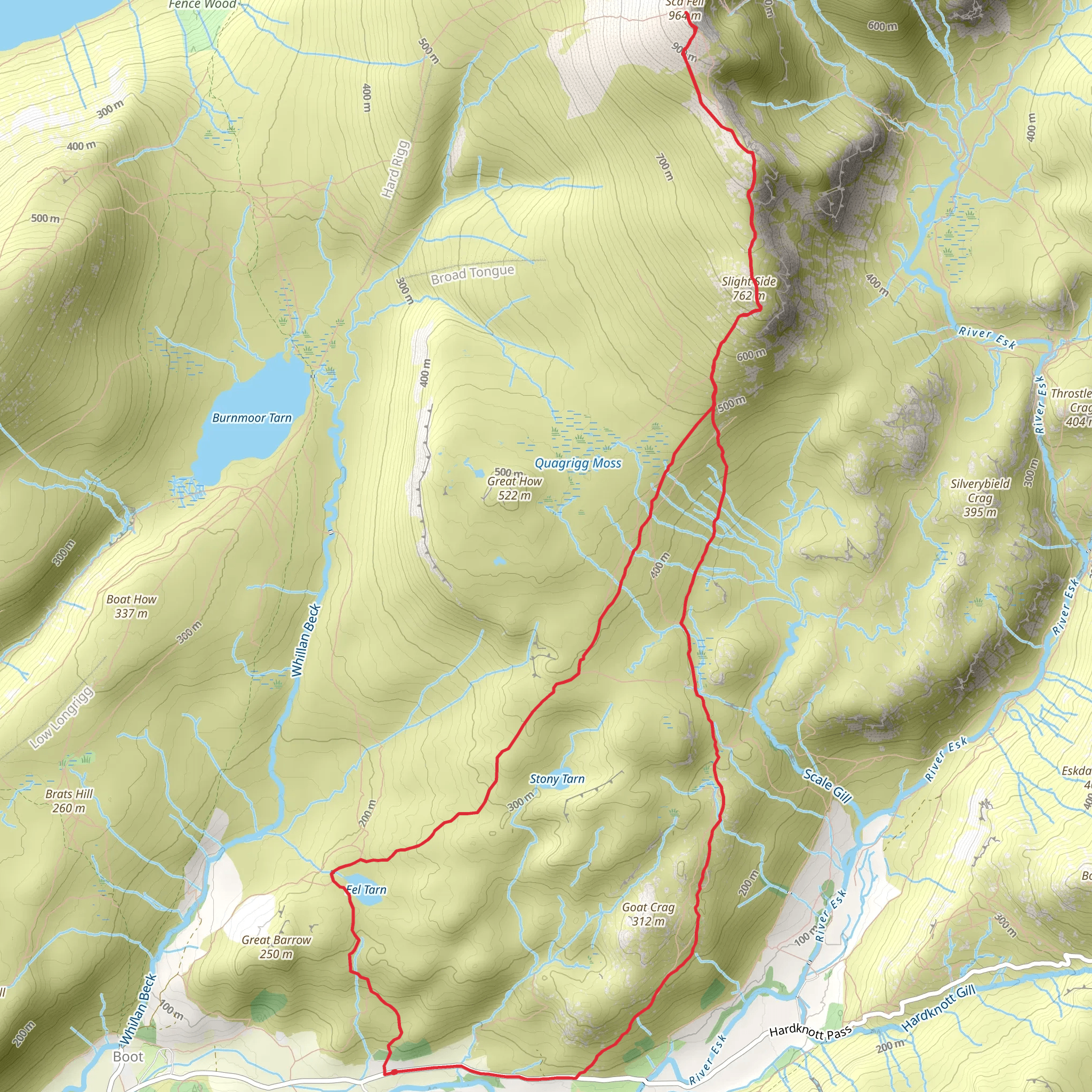
Starting near the charming village of Boot in Cumberland, England, the Slight Side and Sca Fell Peak Walk via Eel Tarn is a captivating loop trail that stretches approximately 15 km (9.3 miles) with an elevation gain of around 900 meters (2,950 feet). This medium-difficulty hike offers a blend of rugged terrain, serene tarns, and panoramic views, making it a rewarding adventure for those prepared for a full day of exploration.
Getting to the Trailhead
To reach the trailhead, you can drive to Boot, which is accessible via the A595 and minor roads leading into the Eskdale Valley. For those relying on public transport, the nearest train station is Ravenglass, from where you can catch a local bus or taxi to Boot. The village itself is a picturesque starting point, with its traditional stone cottages and the historic Eskdale Mill.
Initial Ascent and Eel Tarn
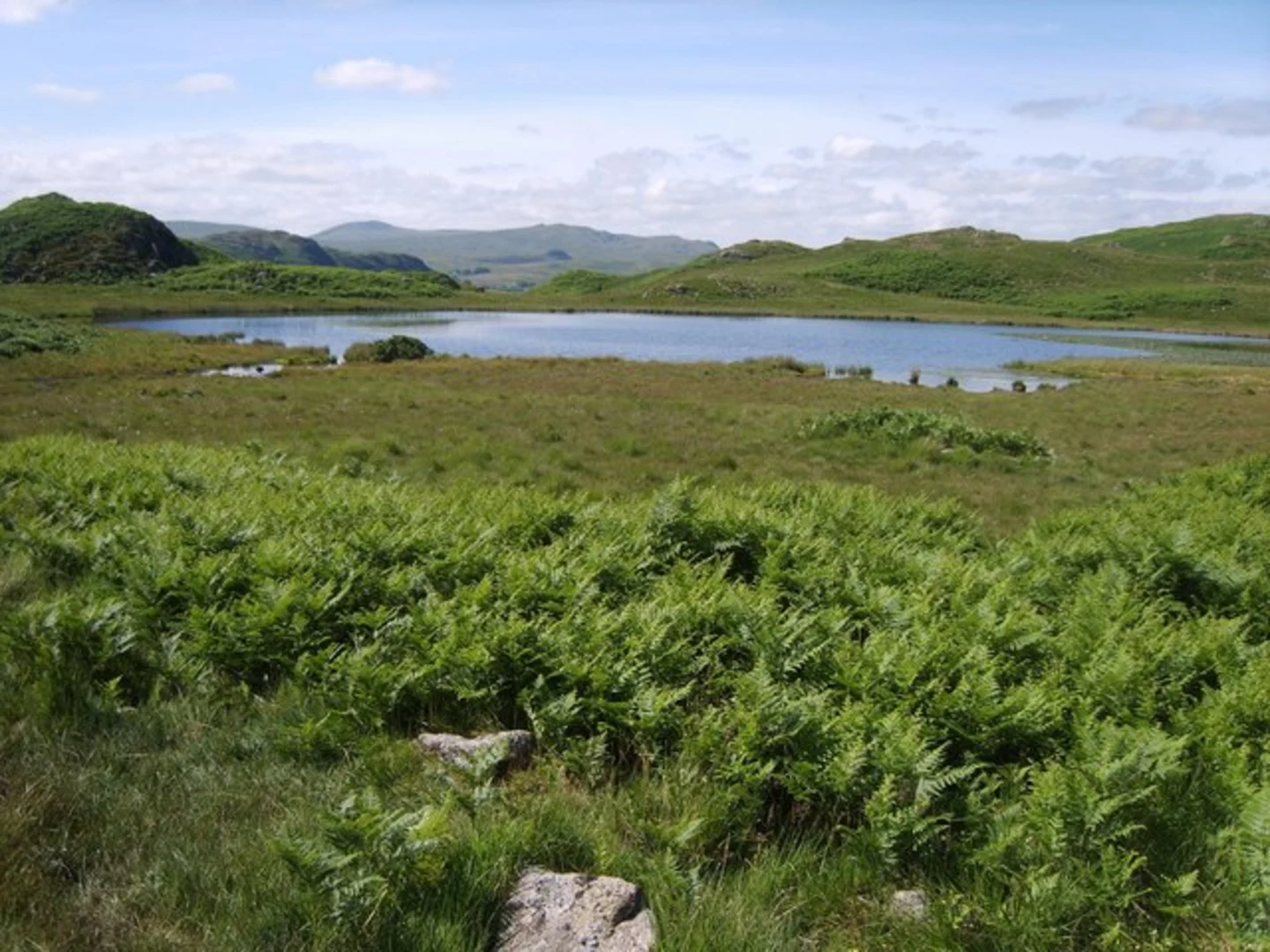
The hike begins with a gentle ascent through lush meadows and woodlands, gradually leading you to Eel Tarn, located about 3 km (1.9 miles) from the start. This tranquil tarn is a perfect spot for a short break, offering reflections of the surrounding fells on calm days. The path here is well-trodden but can be boggy after rain, so waterproof boots are advisable.
Climbing Slight Side
Continuing from Eel Tarn, the trail becomes steeper as you approach Slight Side, the first major peak of the hike. This section covers roughly 4 km (2.5 miles) with an elevation gain of about 400 meters (1,300 feet). The terrain is rocky and requires careful footing, especially in wet conditions. As you ascend, the views expand, revealing the vast expanse of the Lake District National Park.
Reaching Sca Fell
From Slight Side, the path to Sca Fell involves a further 3 km (1.9 miles) of challenging terrain, with an additional elevation gain of approximately 300 meters (980 feet). This part of the hike is the most demanding, with some scrambling required near the summit. Sca Fell, standing at 964 meters (3,162 feet), is the second-highest peak in England and offers breathtaking 360-degree views, including a stunning vista of Wast Water, England's deepest lake.
Descent and Return Loop
The descent from Sca Fell takes you down a steep and rocky path towards Burnmoor Tarn, a large and serene body of water nestled in the fells. This section is about 4 km (2.5 miles) and can be tough on the knees, so trekking poles might be useful. From Burnmoor Tarn, the trail loops back towards Boot, covering the final 4 km (2.5 miles) through rolling hills and past ancient stone walls, remnants of the region's agricultural history.
Historical Significance
The area around Boot and the Eskdale Valley is rich in history. The nearby Hardknott Roman Fort, located a short drive from Boot, dates back to the 2nd century AD and offers a glimpse into the Roman occupation of Britain. Additionally, the Eskdale Mill in Boot is one of the oldest working watermills in England, with a history spanning over 1,000 years.
Navigation and Wildlife
For navigation, it is recommended to use the HiiKER app, which provides detailed maps and real-time tracking to ensure you stay on course. Wildlife enthusiasts may spot red deer, peregrine falcons, and a variety of other bird species along the trail. The diverse flora includes heather, bilberry, and various mosses that thrive in the damp conditions of the fells.
This hike is a perfect blend of natural beauty, physical challenge, and historical intrigue, making it a must-do for any avid hiker exploring the Lake District.
What to expect?
Activity types
Comments and Reviews
User comments, reviews and discussions about the Slight Side and Sca Fell Peak Walk via Eel Tarn, England.
4.0
average rating out of 5
1 rating(s)
