Download
3D Flyover
Add to list
More
20.6 km
~6 hrs
1131 m
Loop
“Discover breathtaking landscapes and rich history on the challenging 21 km Scoat Fell, Haycock, and Iron Crag Loop.”
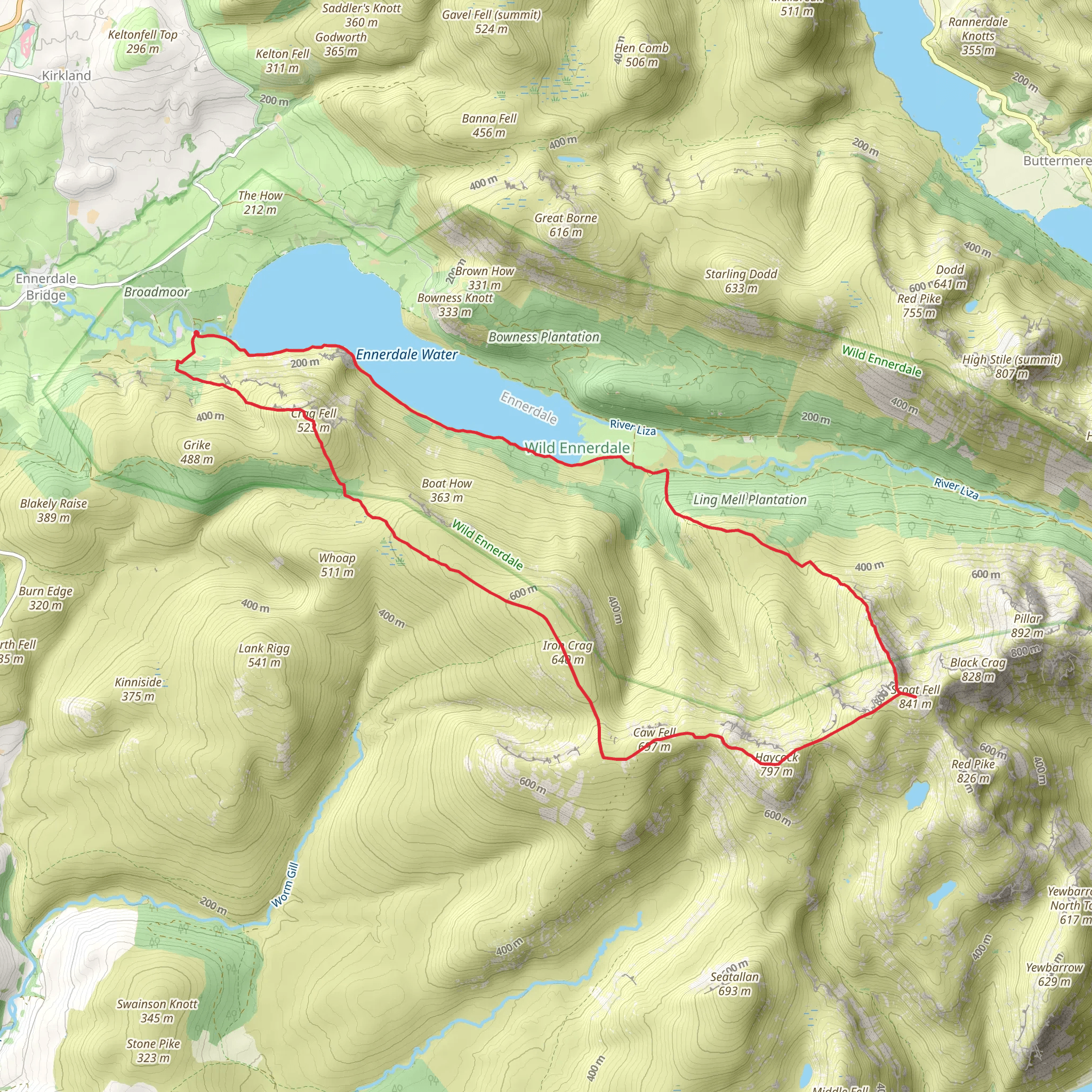
Starting your adventure near Cumberland, England, the Scoat Fell, Haycock, and Iron Crag Loop via Ennerdale Water is a captivating 21 km (13 miles) loop trail with an elevation gain of approximately 1100 meters (3609 feet). This medium-difficulty hike offers a blend of stunning landscapes, historical landmarks, and diverse wildlife, making it a must-explore for avid hikers.
Getting There
To reach the trailhead, you can drive or use public transport. If driving, head towards Ennerdale Bridge, where parking is available near the Ennerdale Water car park. For those using public transport, the nearest significant landmark is the town of Whitehaven. From Whitehaven, you can take a local bus to Ennerdale Bridge, which is a short walk from the trailhead.
Trail Overview
The loop begins near Ennerdale Water, one of the most serene lakes in the Lake District. The initial section of the trail is relatively flat, allowing you to warm up as you walk along the lakeshore. This part of the trail is approximately 3 km (1.9 miles) with minimal elevation gain.
Ascending to Scoat Fell
As you leave the lakeside, the trail starts to ascend towards Scoat Fell. This section is more challenging, with an elevation gain of about 500 meters (1640 feet) over 5 km (3.1 miles). The path can be rocky and uneven, so sturdy hiking boots are recommended. Along the way, you'll pass through lush woodlands and open moorlands, offering panoramic views of the surrounding fells.
Haycock Summit
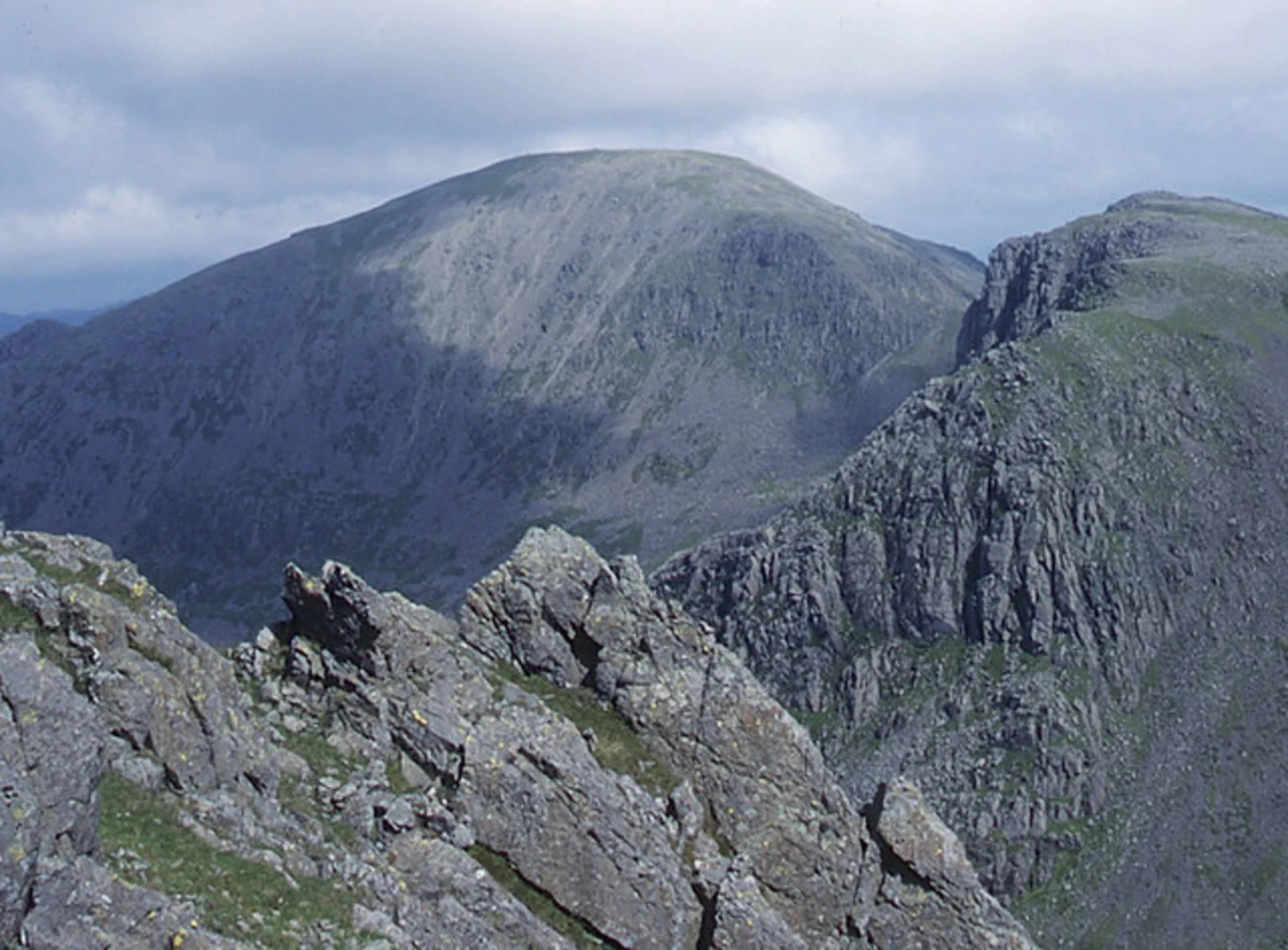
Reaching the summit of Haycock, which stands at 797 meters (2618 feet), is a rewarding experience. The views from the top are breathtaking, with vistas stretching across the Lake District and beyond. This is a great spot to take a break and enjoy a packed lunch. The climb to Haycock adds another 300 meters (984 feet) of elevation gain over 4 km (2.5 miles).
Iron Crag and Descent
From Haycock, the trail continues to Iron Crag. This section is less steep but still requires careful navigation. The descent from Iron Crag back towards Ennerdale Water is gradual, covering about 9 km (5.6 miles) with a descent of approximately 300 meters (984 feet). The path winds through picturesque valleys and past ancient stone walls, remnants of the area's rich agricultural history.
Historical Significance
The region around Ennerdale Water has a deep historical significance. Ennerdale itself is one of the most remote valleys in the Lake District, and its isolation has preserved its natural beauty. The area was historically used for sheep farming, and you can still see the old stone barns and sheepfolds scattered across the landscape. Additionally, the valley was once home to iron mining operations, which is reflected in the name "Iron Crag."
Wildlife and Nature
The Ennerdale Valley is part of a rewilding project, aiming to restore natural habitats and encourage biodiversity. As you hike, keep an eye out for red squirrels, deer, and a variety of bird species, including peregrine falcons and ospreys. The flora is equally diverse, with ancient woodlands, heathlands, and rare alpine plants.
Navigation
Given the varied terrain and potential for rapidly changing weather conditions, it's advisable to use a reliable navigation tool like HiiKER to stay on track. The app provides detailed maps and real-time updates, ensuring you can navigate the trail safely and efficiently.
This loop trail offers a perfect blend of physical challenge, natural beauty, and historical intrigue, making it an unforgettable hiking experience in the heart of the Lake District.
What to expect?
Activity types
Comments and Reviews
User comments, reviews and discussions about the Scoat Fell, Haycock and Iron Crag Loop via Ennerdale Water, England.
4.67
average rating out of 5
3 rating(s)
