5.0 (1)
·
Easy
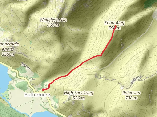
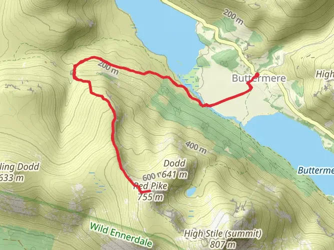
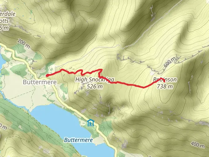
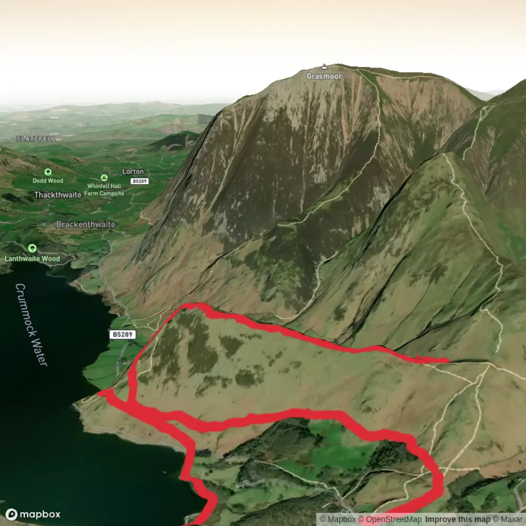
Hike from Buttermere, bluebell valley up Rannerdale Knott's and back
Download
Preview
Add to list
More
Trail length
9.0 km
Time
~2 hrs 24 min
Elevation Gain
373 m
Hike Type
Loop
An easy circular hike from Buttermere, this 8.9 km route gently explores the valley and surrounding fells. Over about 2.5 hours you’ll enjoy classic Lake District scenery, with a steady 383 m of ascent and 405 m of descent spread along the path. The route starts and ends at the same point near the lake, offering waterside stretches, views of nearby peaks, and a relaxed introduction to the area’s dramatic landscapes.
Created by
Andy H

What to expect?
volcanic-features
waterfalls
bridges
rivers
pub-walk
native-woods
rock-formations
lakes
mountain-views
forest
wildlife
scenic-views
dog-friendly
wildflowers
Surfaces
Unknown
Grass
Gravel
Asphalt
Comments and Reviews
User comments, reviews and discussions about the Hike from Buttermere, bluebell valley up Rannerdale Knott's and back, England.
5.0
average rating out of 5
1 rating(s)