
Download
3D Flyover
Add to list
More
9.1 km
~2 hrs 56 min
682 m
Loop
“The High Spy and Dalehead Tarn Loop offers a picturesque, challenging hike with stunning views and historical landmarks.”
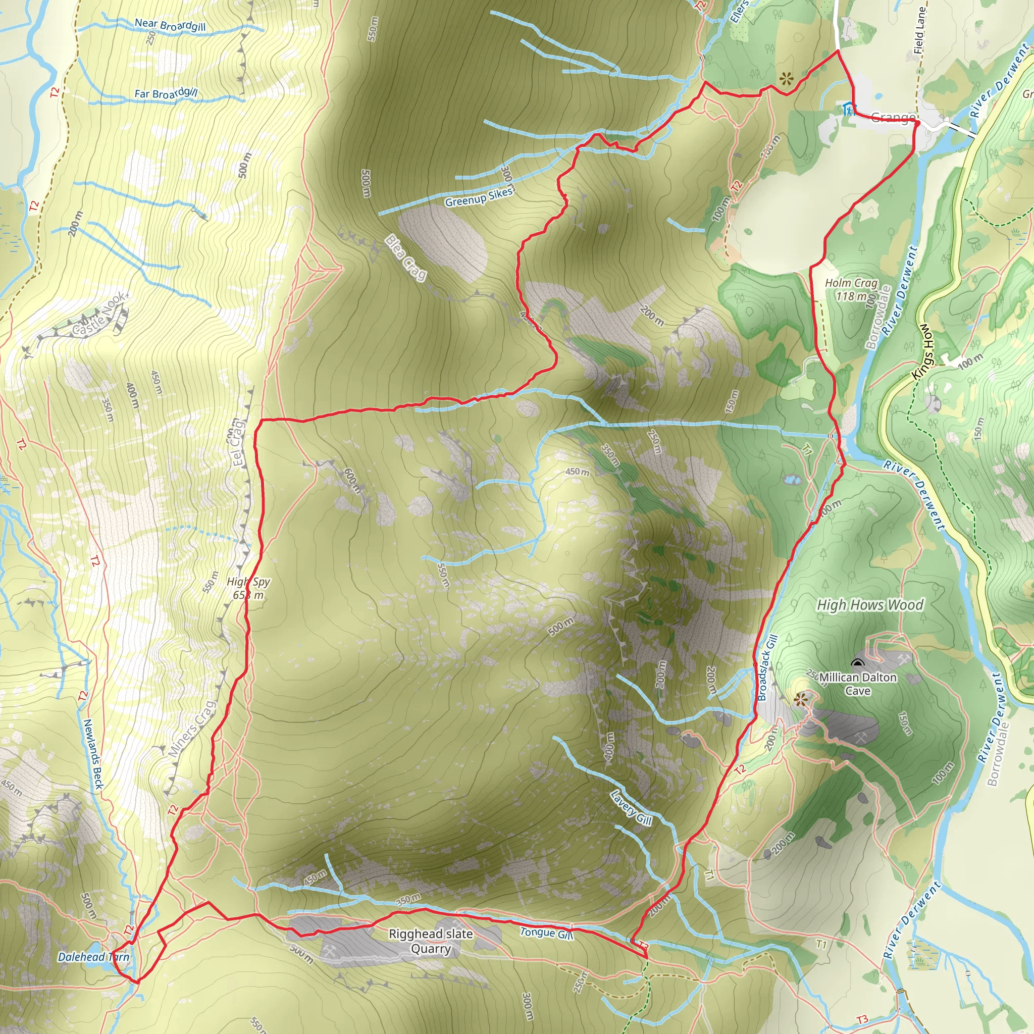
Starting near the picturesque village of Rosthwaite in the Borrowdale Valley, the High Spy and Dalehead Tarn Loop is a captivating 9 km (5.6 miles) trail with an elevation gain of approximately 600 meters (1,970 feet). This loop trail offers a blend of rugged terrain, sweeping vistas, and historical landmarks, making it a rewarding hike for those prepared for a medium difficulty adventure.
Getting There
To reach the trailhead, you can drive to Rosthwaite, which is accessible via the B5289 road from Keswick. Parking is available at the National Trust car park in Rosthwaite. For those relying on public transport, the nearest bus stop is in Rosthwaite, serviced by the 78 bus route from Keswick.
Trail Overview
The trail begins in Rosthwaite, where you will start your ascent towards High Spy. The initial section is a steady climb through lush woodlands and open fields, offering a gradual introduction to the elevation gain. As you ascend, the path becomes rockier and more challenging, so sturdy hiking boots are recommended.
High Spy Summit
At approximately 3 km (1.9 miles) into the hike, you will reach the summit of High Spy, standing at 653 meters (2,142 feet). From here, you are rewarded with panoramic views of the Borrowdale Valley and the surrounding fells. On a clear day, you can see as far as the Skiddaw range to the north and the Scafell Pike to the south.
Descent to Dalehead Tarn
From High Spy, the trail descends towards Dalehead Tarn, a serene mountain tarn nestled in a glacial valley. This section of the trail is about 2 km (1.2 miles) and features a mix of grassy paths and rocky sections. The tarn is an ideal spot for a rest, offering tranquil waters and the chance to spot local wildlife such as red deer and various bird species.
Ascent to Dale Head
After a break at Dalehead Tarn, the trail ascends once more towards Dale Head, which stands at 753 meters (2,470 feet). This climb is steeper and more strenuous, but the effort is well worth it. The summit of Dale Head provides breathtaking views of the Newlands Valley and the distant peaks of the Lake District.
Historical Significance
The area around Dale Head is rich in mining history. The remains of old lead mines can be seen along the trail, offering a glimpse into the region's industrial past. These mines were once a significant source of employment and economic activity in the 18th and 19th centuries.
Return to Rosthwaite
The final leg of the loop takes you back down to Rosthwaite, covering approximately 4 km (2.5 miles). The descent is less demanding, allowing you to enjoy the scenic beauty of the valley. The path winds through grassy slopes and past ancient stone walls, eventually leading you back to the village.
Navigation and Safety
Given the varied terrain and potential for rapidly changing weather conditions, it's advisable to use a reliable navigation tool like HiiKER to stay on track. Ensure you carry sufficient water, snacks, and appropriate clothing for the hike.
This trail offers a perfect blend of natural beauty, challenging climbs, and historical intrigue, making it a must-do for any avid hiker exploring the Lake District.
What to expect?
Activity types
Comments and Reviews
User comments, reviews and discussions about the High Spy and Dalehead Tarn Loop, England.
4.5
average rating out of 5
4 rating(s)



