
Download
3D Flyover
Add to list
More
6.1 km
~1 hrs 52 min
402 m
Out and Back
“High Pike’s windswept trail weaves history, solitude, and sweeping views into a rewarding Lake District adventure.”
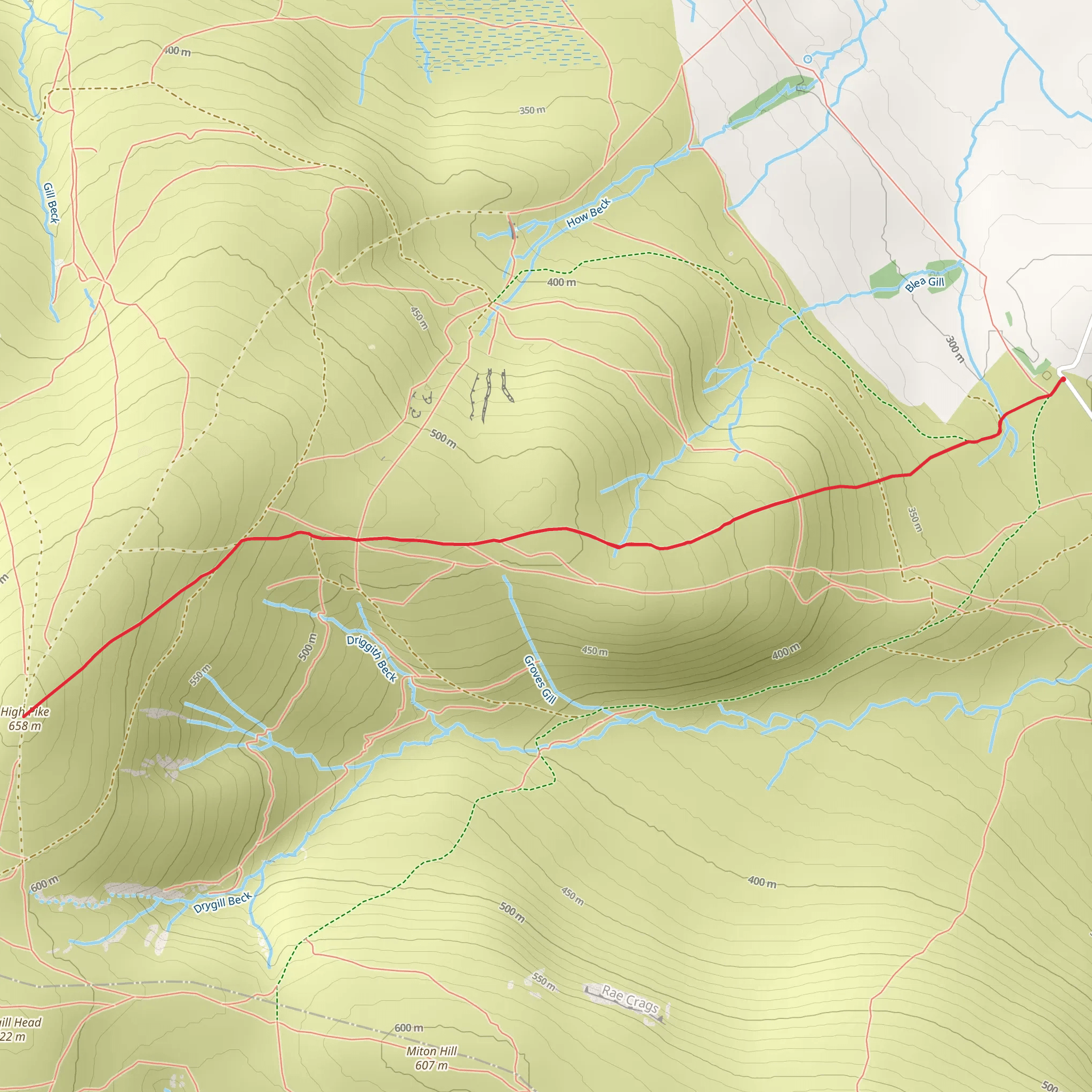
Starting from the vicinity of Caldbeck village, just a short drive from the market town of Wigton in Cumbria, the High Pike trail offers a challenging yet rewarding out-and-back route through the northern fells of the Lake District National Park. The trailhead is easily accessible by car, with parking available in Caldbeck. For those using public transport, buses from Carlisle and Keswick connect to Caldbeck, though schedules can be limited, so planning ahead is essential.
Initial Ascent and Terrain
The route begins gently, following a well-trodden path out of Caldbeck, quickly transitioning into open moorland. Early on, you’ll pass through farmland and low stone walls, with the landscape opening up to sweeping views of the Caldbeck Fells. The first 2 km (about 1.2 miles) are a steady climb, gaining around 150 metres (490 feet) in elevation. The ground can be boggy after rain, so waterproof boots are recommended.
Landmarks and Historical Features
At approximately 2.5 km (1.5 miles), you’ll encounter the remnants of old mining operations—this area was once a hub for lead and copper mining, with High Pike itself crowned by a cairn and a memorial bench dedicated to local miners. The summit, at 658 metres (2,159 feet), is reached after about 3 km (1.9 miles) and a total ascent of 400 metres (1,312 feet). On clear days, the summit offers panoramic views across the Solway Firth to Scotland and southwards over the Lake District’s central fells.
Wildlife and Natural Highlights
The open fellside is home to skylarks, meadow pipits, and occasionally kestrels or buzzards circling overhead. In spring and summer, the heather and bilberry bushes attract butterflies and bees, while the rough grassland supports small mammals and, sometimes, grazing sheep. The area is known for its solitude compared to the busier central Lake District, making wildlife sightings more likely.
Navigation and Safety
Weather conditions can change rapidly, with mist and strong winds common at higher elevations. The path is generally clear but can become indistinct in poor visibility, especially near the summit plateau. Carrying a map and compass is essential, and HiiKER is recommended for up-to-date digital navigation and trail conditions. Mobile signal can be patchy, so download maps in advance.
Return Journey
The descent retraces your steps, offering a different perspective on the landscape and a chance to spot features missed on the way up. The total distance is around 6 km (3.7 miles) out and back, with the return to Caldbeck providing a gentle finish after the steeper sections near the summit.
Prepare for exposed conditions, bring layers, and ensure you have sufficient water and snacks, as there are no facilities on the trail itself. The High Pike route is best suited to experienced hikers comfortable with navigation and variable weather, offering a blend of natural beauty, historical intrigue, and sweeping Lake District vistas.
What to expect?
Activity types
Comments and Reviews
User comments, reviews and discussions about the High Pike, England.
4.0
average rating out of 5
4 rating(s)

