Download
3D Flyover
Add to list
More
24.8 km
~6 hrs 19 min
818 m
Loop
“Explore diverse landscapes and rich history on the captivating Ennerdale Water, Wild Ennerdale, and Seavy Knott Loop!”
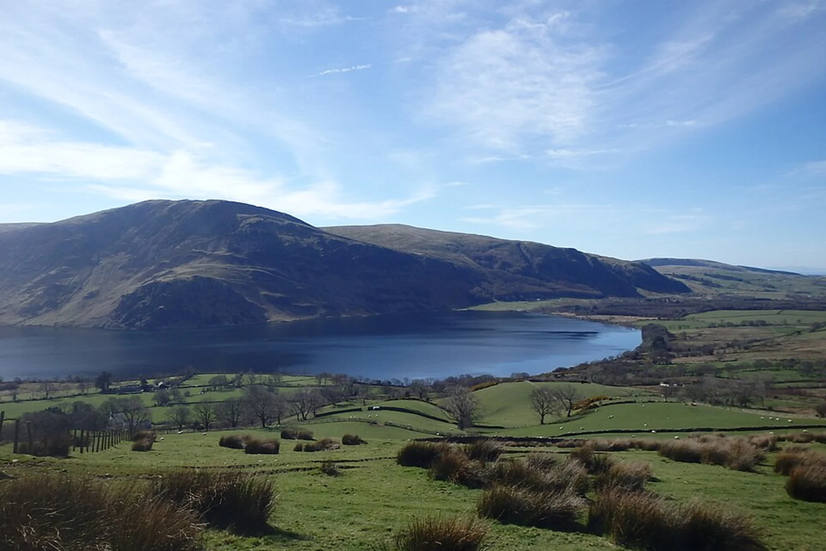
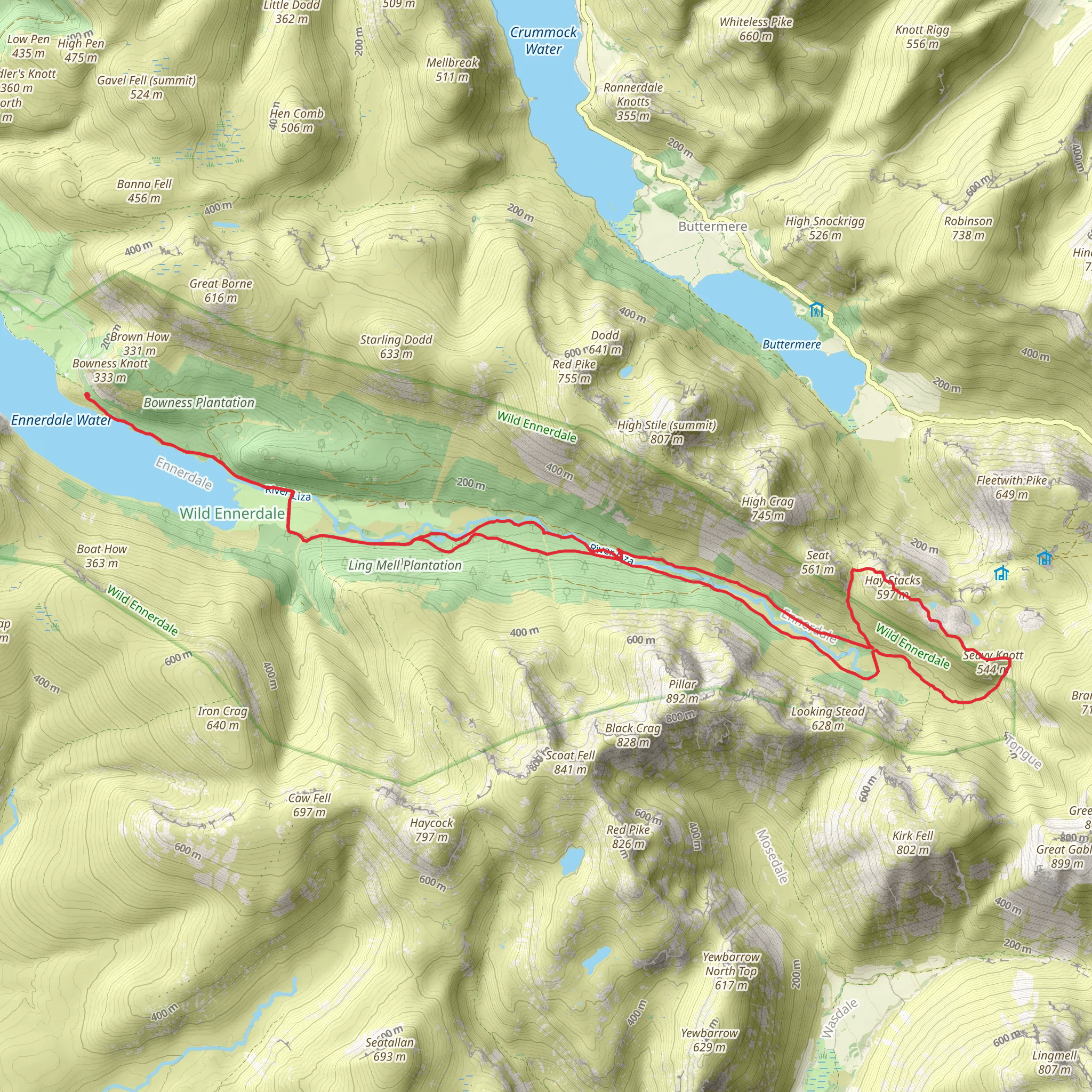
Starting near the picturesque village of Ennerdale Bridge in Cumberland, England, the Ennerdale Water, Wild Ennerdale, and Seavy Knott Loop is a captivating 25 km (15.5 miles) loop trail with an elevation gain of approximately 800 meters (2,625 feet). This medium-difficulty trail offers a blend of serene lakeside paths, rugged mountain terrain, and lush forested areas, making it a diverse and rewarding hike.
Getting There
To reach the trailhead, you can drive to Ennerdale Bridge, where limited parking is available. For those using public transport, the nearest major town is Whitehaven, which is accessible by train. From Whitehaven, you can take a local bus or taxi to Ennerdale Bridge.
Trail Overview
The trail begins near Ennerdale Bridge, leading you along the northern shore of Ennerdale Water. This initial section is relatively flat, allowing you to ease into the hike while enjoying stunning views of the lake and surrounding fells. Keep an eye out for red squirrels and various bird species that inhabit the area.
Wild Ennerdale
As you continue, you'll enter the Wild Ennerdale area, a rewilding project aimed at restoring natural processes and habitats. This section of the trail is more rugged, with undulating terrain and a mix of open moorland and dense woodland. The path here can be narrow and uneven, so sturdy footwear is recommended. The rewilding efforts have led to an increase in wildlife, including deer and rare plant species, making this a particularly interesting segment for nature enthusiasts.
Seavy Knott
The trail then ascends towards Seavy Knott, offering panoramic views of the Ennerdale Valley and the surrounding peaks. This is the most challenging part of the hike, with a steep climb that will test your endurance. The effort is well worth it, as the summit provides a perfect spot for a rest and some breathtaking photography. The elevation gain in this section is significant, so take your time and stay hydrated.
Historical Significance
Ennerdale has a rich history, with evidence of human activity dating back to the Bronze Age. The valley was once home to a thriving mining community, and remnants of old mine workings can still be seen along the trail. Additionally, the area played a role during World War II, serving as a training ground for troops.
Navigation and Safety
Given the varied terrain and potential for rapidly changing weather conditions, it's advisable to use a reliable navigation tool like HiiKER to stay on track. The trail is well-marked, but fog and rain can obscure markers, making digital navigation essential. Always check the weather forecast before setting out and be prepared for sudden changes.
Final Stretch
The descent from Seavy Knott brings you back towards Ennerdale Water, completing the loop. This final section is less strenuous, allowing you to reflect on the diverse landscapes and rich history you've encountered. The path winds through more woodland before emerging back at the lakeshore, where you can enjoy a well-deserved rest by the water.
This trail offers a comprehensive experience of the Lake District's natural beauty and historical depth, making it a must-do for any avid hiker.
What to expect?
Activity types
Comments and Reviews
User comments, reviews and discussions about the Ennerdale Water, Wild Ennerdale and Seavy Knott Loop, England.
4.67
average rating out of 5
3 rating(s)
