Download
Preview
Add to list
More
8.6 km
~2 hrs 9 min
254 m
Loop
“Explore the Lake District's hidden gems on the scenic Ellas Crag and Yewthwaite Gill Loop.”
Starting near the charming village of Braithwaite in Cumberland, England, the Ellas Crag and Yewthwaite Gill Loop offers a delightful 9 km (approximately 5.6 miles) journey through the picturesque landscapes of the Lake District. With an elevation gain of around 200 meters (656 feet), this loop trail is rated as medium difficulty, making it suitable for moderately experienced hikers.
Getting There
To reach the trailhead, you can drive to Braithwaite, which is easily accessible from the A66 road. There is limited parking available in the village, so arriving early is advisable. For those using public transport, the nearest train station is in Keswick, about 3 miles (4.8 km) away. From Keswick, you can take a local bus or taxi to Braithwaite.
Trail Overview
The trail begins in Braithwaite, where you will start your ascent towards Ellas Crag. The initial part of the hike takes you through lush woodlands and open fields, offering a gentle introduction to the terrain. As you climb, the path becomes steeper and rockier, so sturdy hiking boots are recommended.
Key Landmarks and Sections
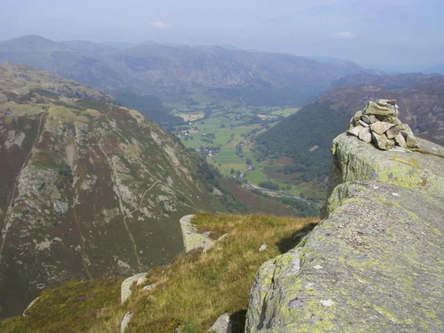
Ellas Crag
At approximately 2 km (1.2 miles) into the hike, you will reach Ellas Crag. This vantage point provides stunning panoramic views of the surrounding fells and valleys. It's a perfect spot for a short break and some photography. The elevation gain to this point is around 100 meters (328 feet).
Yewthwaite Gill
Continuing from Ellas Crag, the trail descends slightly before following the course of Yewthwaite Gill. This section is characterized by its serene stream and lush greenery. The gill is home to various species of birds and small mammals, so keep an eye out for wildlife. The path here is relatively flat, making for a pleasant and easy walk.
Historical Significance
As you hike along Yewthwaite Gill, you will come across remnants of old mining activities. The area was historically significant for its lead mining operations in the 18th and 19th centuries. Informational plaques along the trail provide insights into the mining history and its impact on the local community.
Final Stretch
The last 3 km (1.9 miles) of the loop take you through open moorland and back towards Braithwaite. This section offers expansive views of the Lake District, including glimpses of Derwentwater and the surrounding peaks. The descent is gradual, allowing you to enjoy the scenery without too much strain.
Navigation and Safety
Given the varied terrain and historical sites, it's advisable to use a reliable navigation tool like HiiKER to stay on track. The trail is well-marked, but weather conditions can change rapidly, so always be prepared with appropriate clothing and gear.
Flora and Fauna
Throughout the hike, you'll encounter a diverse range of flora, including heather, bracken, and various wildflowers. The area is also home to red squirrels, deer, and a variety of bird species, making it a haven for nature enthusiasts.
This loop trail offers a balanced mix of natural beauty, historical intrigue, and moderate physical challenge, making it a rewarding experience for those looking to explore the Lake District's lesser-known paths.

What to expect?
Activity types
Comments and Reviews
User comments, reviews and discussions about the Ellas Crag and Yewthwaite Gill Loop, England.
4.33
average rating out of 5
3 rating(s)