Download
3D Flyover
Add to list
More
4.1 km
~1 hrs 14 min
256 m
Loop
“Explore the Darling Fell Loop: a 4 km trail with stunning views, moderate climbs, and rich history.”
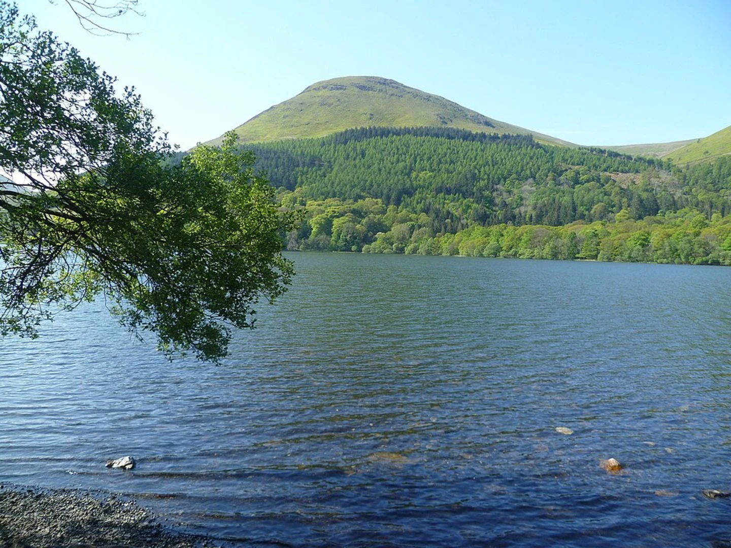
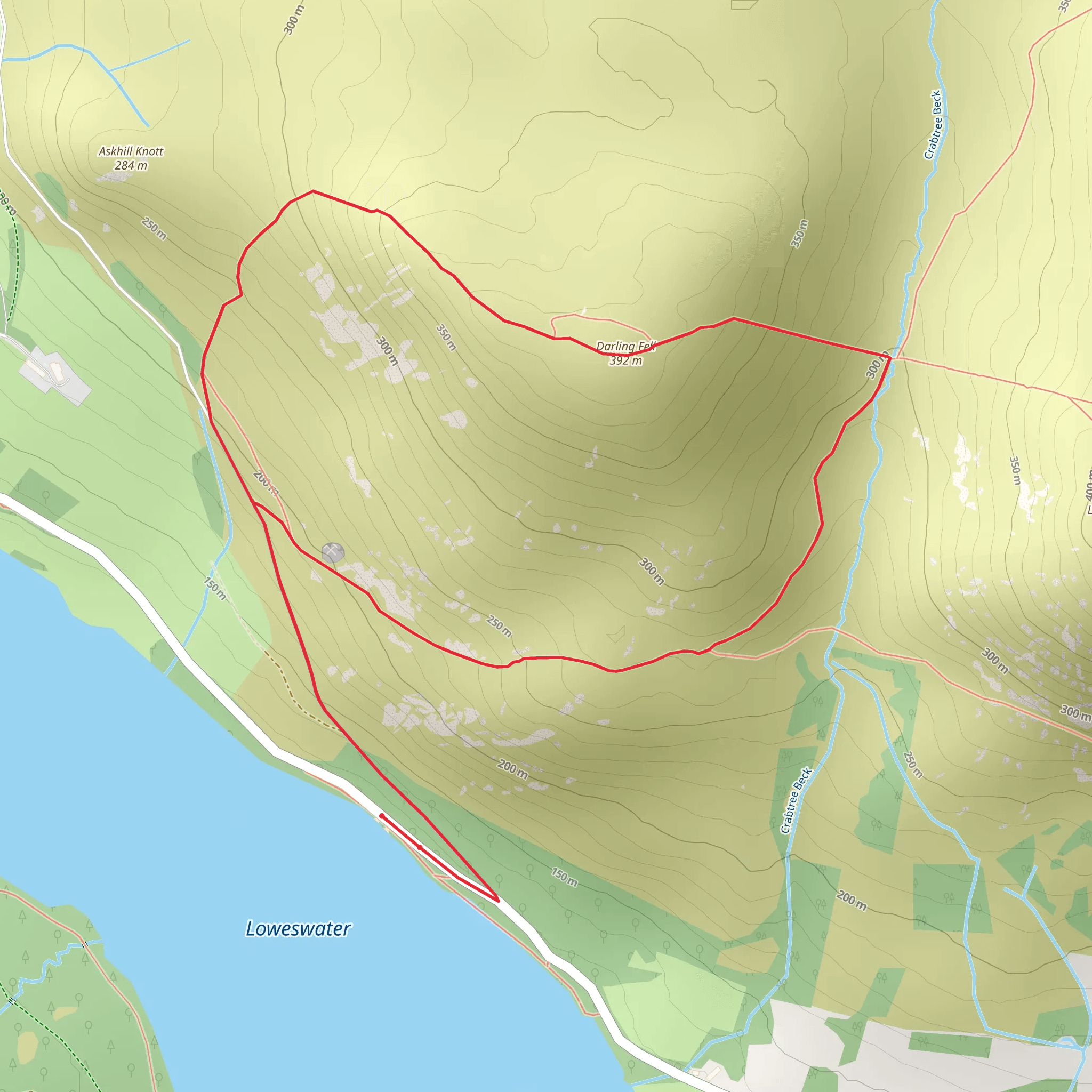
Starting near the charming village of Loweswater in Cumberland, England, the Darling Fell Loop is a delightful 4 km (2.5 miles) trail with an elevation gain of approximately 200 meters (656 feet). This loop trail is rated as medium difficulty, making it accessible for most hikers with a moderate level of fitness.
Getting There
To reach the trailhead, you can drive to Loweswater, where limited parking is available near the village. If you prefer public transport, the nearest major town is Cockermouth, which is well-connected by bus services. From Cockermouth, you can take a local bus to Loweswater, though services may be infrequent, so check the schedule in advance.
Trail Overview
The trail begins near the Loweswater village, a picturesque starting point that sets the tone for the hike. As you set off, you'll quickly find yourself immersed in the serene beauty of the Lake District National Park. The initial section of the trail is relatively gentle, allowing you to warm up as you walk through lush meadows and past ancient stone walls.
Ascent to Darling Fell
Approximately 1 km (0.6 miles) into the hike, the trail begins to ascend more steeply. This section will take you through a mix of open fellside and patches of woodland. Keep an eye out for local wildlife, including red squirrels and a variety of bird species. The climb continues for another 1 km (0.6 miles), gaining about 150 meters (492 feet) in elevation. The path can be rocky and uneven, so sturdy hiking boots are recommended.
Summit Views
Reaching the summit of Darling Fell, you'll be rewarded with panoramic views of the surrounding landscape. To the north, you can see the Solway Firth and the distant hills of Scotland. To the south, the majestic peaks of the Lake District unfold before you. This is an excellent spot for a rest and some photography.
Descent and Return
The descent begins gently, winding through grassy slopes and offering more stunning vistas. After about 1 km (0.6 miles), the trail levels out and you will re-enter a wooded area. This section can be muddy, especially after rain, so take care with your footing. The final stretch of the loop brings you back to Loweswater, completing the 4 km (2.5 miles) circuit.
Historical Significance
The area around Loweswater and Darling Fell is steeped in history. The village itself dates back to medieval times, and the surrounding landscape has been shaped by centuries of farming and land use. As you hike, you may notice remnants of old stone walls and farmsteads, offering a glimpse into the region's past.
Navigation
For navigation, it is highly recommended to use the HiiKER app, which provides detailed maps and real-time GPS tracking to ensure you stay on the correct path. This is particularly useful in the more remote sections of the trail where signage may be sparse.
Flora and Fauna
Throughout the hike, you'll encounter a variety of plant life, from hardy fell grasses to vibrant wildflowers in the spring and summer months. The mixed woodland areas are home to oak, birch, and rowan trees, creating a diverse habitat for wildlife.
This trail offers a perfect blend of natural beauty, moderate challenge, and historical intrigue, making it a must-visit for any hiking enthusiast exploring the Lake District.
What to expect?
Activity types
Comments and Reviews
User comments, reviews and discussions about the Darling Fell Loop, England.
4.6
average rating out of 5
5 rating(s)
