Download
3D Flyover
Add to list
More
5.8 km
~1 hrs 21 min
123 m
Loop
“A compact Teesdale loop blending waterfall drama, wild pasture, and haunting mining remains in shifting landscapes.”
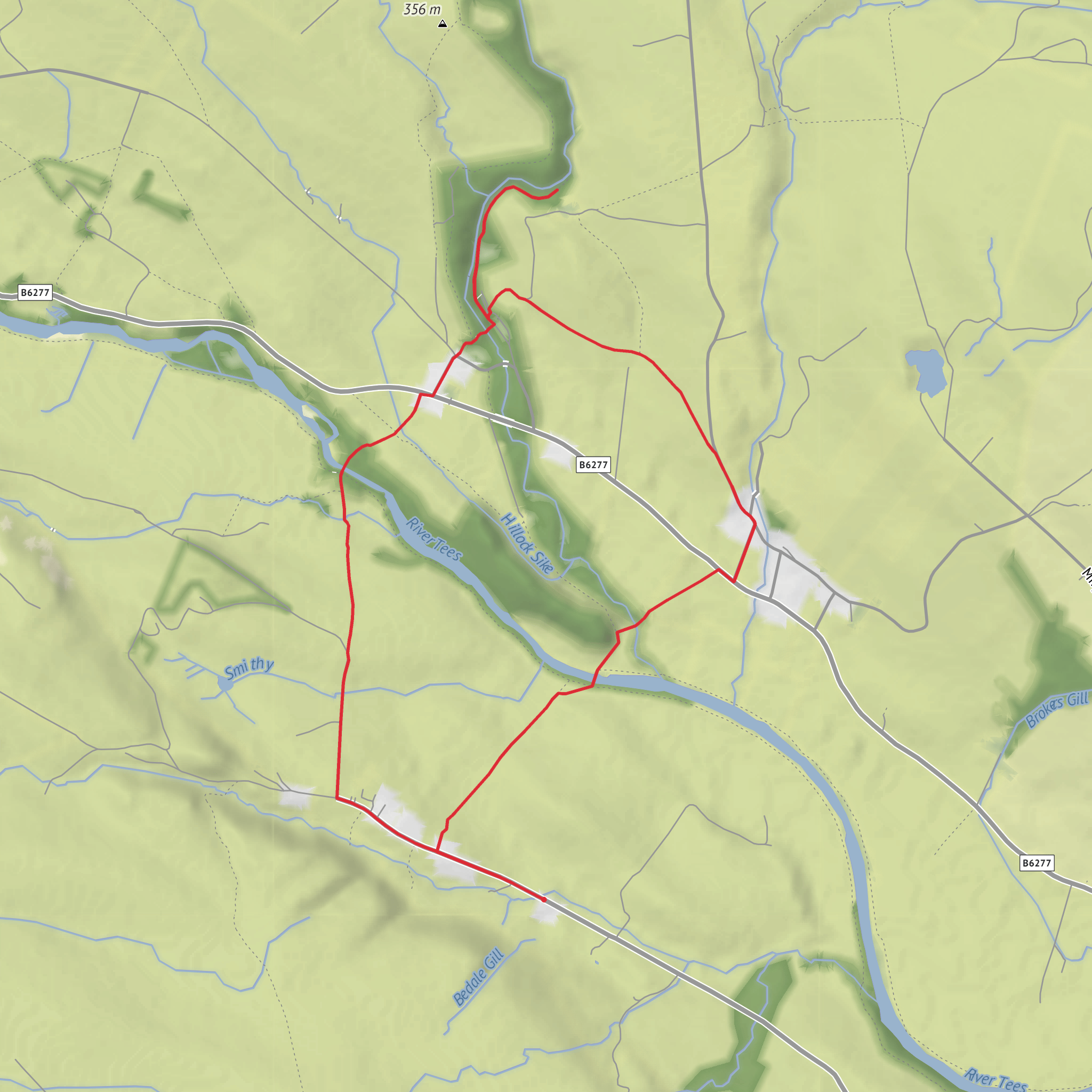
This medium-difficulty loop in Upper Teesdale packs a lot into roughly 6 km / 3.7 miles, with about 100 m / 330 ft of ascent. The route is best understood as a varied circuit from Bowlees that combines an easy opening section to Gibson’s Cave with rougher pasture paths, short steeper banks, old mining ground, and a quiet return through Newbiggin. Expect a mix of riverside scenery, open fell-edge views, historic lead-mining remains, and one of the area’s most distinctive small waterfalls. The usual trailhead is Bowlees Visitor Centre, Bowlees, Newbiggin, Barnard Castle DL12 0XE, which is the nearest clear address and the main signed access point for walks in this part of the North Pennines. (northpennines.org.uk)
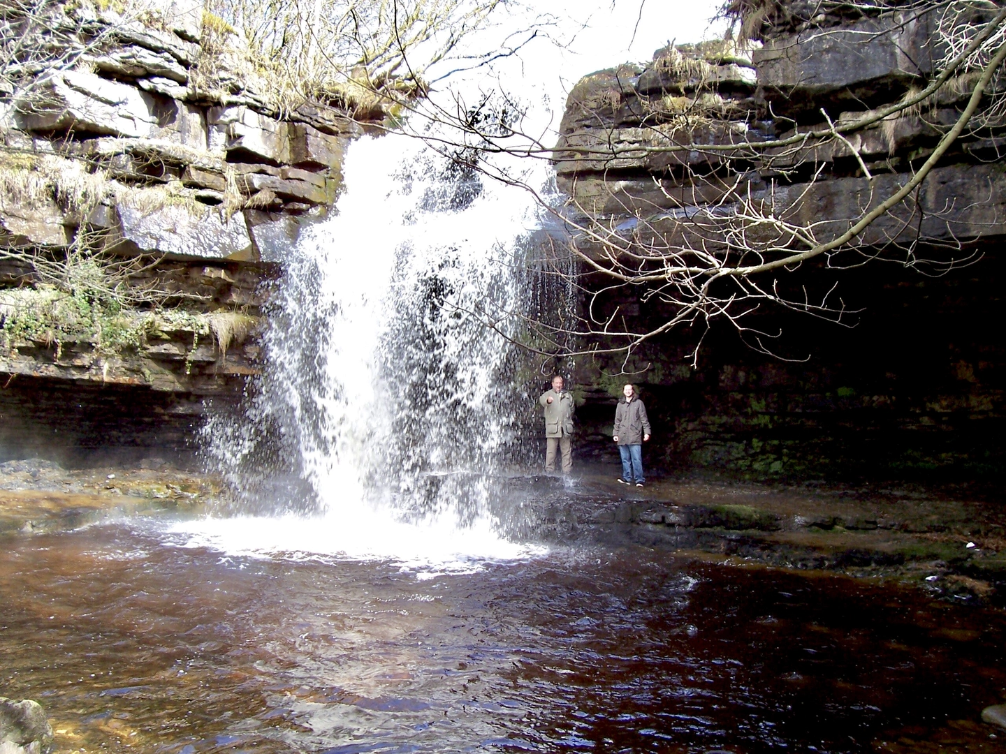
The first part of the walk is straightforward and well suited to warming up. From Bowlees, paths lead past the visitor centre area and along Bowlees Beck toward Summerhill Force and Gibson’s Cave. This section is especially attractive because the beck cuts through woodland and old quarry ground before reaching the waterfall, which drops over the rock face above the cave. The official short walk to the cave is only about 1 km / 0.6 miles each way and retraces to Bowlees, but the longer loop continues beyond the visitor centre into higher pasture and moor-fringe terrain. (northpennines.org.uk)
What the route feels like on the ground
Although the overall distance is modest, the “medium” rating makes sense. The terrain changes often, and some sections are more demanding than the numbers suggest. Near Gibson’s Cave, paths can be stony and uneven, with steps and damp patches beside the beck. On the wider loop, there are rough grassy lines across fields, short but noticeable descents into little valleys, and stream crossings that can become awkward after wet weather. One route description for the longer Bowlees–Gibson’s Cave–Newbiggin circuit specifically warns that some streams may be difficult or impassable after heavy rain, so this is not a route to underestimate if conditions are poor. (northpennines.org.uk)
Navigation is easiest in clear weather, but some field-path junctions can be faint or easy to miss. Hikers should have the route loaded in HiiKER before setting out, especially for the middle section beyond the visitor centre where the line across pasture is less obvious than the opening walk to the cave. Good waterproof footwear is advisable year-round because the ground around the becks and valley bottoms can stay wet even in drier spells. (happyhiker.co.uk)
Landmarks, scenery, and wildlife
Gibson’s Cave and Summerhill Force are the headline features. The cave sits behind or beside the waterfall recess, creating one of the most photogenic spots in Upper Teesdale. The beck corridor around Bowlees also has geological and ecological interest, with old quarry exposures and a strong sense of how water has shaped the landscape. The Bowlees quarry area is identified as a local wildlife site and a special invertebrate site. Seasonal interest is excellent: orchids and butterwort can be found in the quarry area, while birds recorded around Bowlees include spotted flycatcher, chiffchaff, willow warbler, and dipper; golden-ringed dragonflies are also noted in the area. In autumn and winter, the woodland turns color and the beck often runs in full spate, making the waterfalls more dramatic. (northpennines.org.uk)
As the loop rises away from Bowlees, the character shifts from enclosed beckside walking to broader Teesdale views. You can expect open outlooks across the valley toward Holwick and the surrounding scars and moorland edges, then a more industrial-historic landscape near the old workings above Newbiggin. A flooded quarry and the remains around Red Grooves add contrast to the softer meadow and pasture scenery. (happyhiker.co.uk)
Historical significance of the area
This part of Teesdale is deeply shaped by lead mining. The route passes close to Red Grooves and the wider Coldberry mining landscape, where hushes, spoil, levels, dressing floors, and other remains survive. “Hushing” was a mining technique that used stored water released down a slope to strip away soil and expose ore-bearing ground. At Coldberry Gutter
Surfaces
Unknown
Grass
Unpaved
Paved
Asphalt
Dirt
Wood
Comments and Reviews
User comments, reviews and discussions about the Low Pikestone, Gibson's Cave and Newbiggin Bridge Loop, England.
average rating out of 5
0 rating(s)
