
Download
3D Flyover
Add to list
More
17.3 km
~4 hrs 4 min
367 m
Loop
“A rewarding Teesdale circuit threads riverside calm, wild fell, and dramatic black crags.”
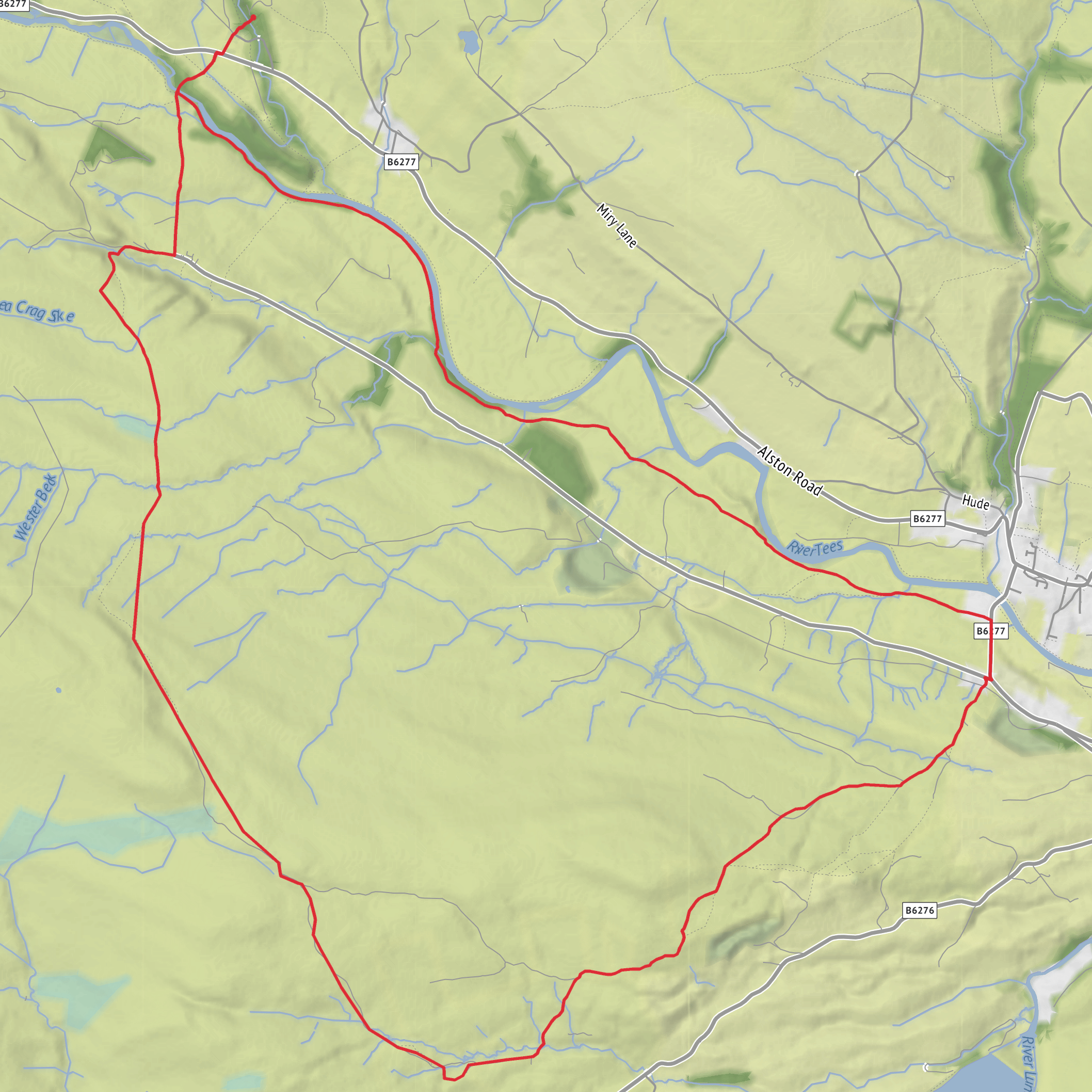
This 17 km / 10.6 mile loop in Upper Teesdale is a medium-grade outing that mixes open fell, riverside walking, old pastoral land and striking volcanic geology. With around 400 m / 1,312 ft of ascent, it is not especially technical in dry, calm weather, but it is long enough and varied enough to demand decent fitness, good footwear and a little care with pacing. The route is best understood as a broad circuit above and beside the River Tees, linking the craggy edge of Holwick Scars with the rounded upland forms of Collin Hill and Intake Hill before returning through the dale. Holwick itself is the key landmark for the start area, a small hamlet near Middleton-in-Teesdale in County Durham. (en.wikipedia.org)
For drivers, the most practical start area is usually around Holwick village or the approach road near Holwick, depending on the exact line of the loop and available signed parking. If you prefer a more established facility with toilets and refreshments, Bowlees Visitor Centre, Bowlees, Newbiggin, Barnard Castle DL12 0XE, is the nearest major walking hub for this part of Upper Teesdale and is commonly used for walks around Holwick Scars and the River Tees. Bowlees has parking, visitor facilities and access to nearby footpaths. (northpennines.org.uk)
Public transport is limited. The North Pennines information for this area notes very sparse service coverage, including Service 75 on Wednesdays for Bowlees, so most hikers should plan carefully and verify current timetables before setting out. In practice, many walkers reach Middleton-in-Teesdale first and then continue by taxi or a pre-arranged lift to the start area near Holwick. (northpennines.org.uk)
The walking begins gently enough through the enclosed fields and lanes of upper Teesdale, where the landscape still carries the feel of a working farming dale. Early sections are often the easiest underfoot, with grassy tracks, gates and field paths, but the character changes as the route rises. Once you begin climbing toward the higher ground around Collin Hill and Intake Hill, the loop becomes more exposed. Gradients are generally steady rather than severe, yet the cumulative ascent can feel more demanding than the numbers suggest, especially if the ground is wet or the wind is strong across the open fell.
Terrain and navigation
Expect a mixture of pasture paths, moorland tracks, rougher fellside sections and short stretches of minor road or access lane. In Upper Teesdale, even moderate routes can become serious in poor visibility because paths may fade across open ground and junctions are not always obvious. This is the kind of walk where route-finding matters more than the raw mileage suggests, so having the route loaded in HiiKER is sensible. After rain, grassy slopes can be slick, riverside sections can be muddy, and stony ground near scar edges can be awkward underfoot. (northpennines.org.uk)
Holwick Scars are one of the defining features of the day. These dark cliffs are formed from the Whin Sill, a hard sheet of dolerite created when molten rock forced its way into older rocks about 295 million years ago. As it cooled, the rock contracted and cracked into rough vertical columns, which give the scar its broken, blocky appearance. The result is one of the most dramatic geological landmarks in Teesdale, and one of the reasons this area is so well known among geologists and landscape enthusiasts. (northpennines.org.uk)
The higher ground around Holwick is also shaped by ice-age processes. The smooth, rounded hills in the area are drumlins, streamlined mounds of glacial debris left and sculpted by ice flowing down Teesdale. That contrast between abrupt black crags and soft green mounds is one of the most distinctive visual qualities of the route. (northpennines.org.uk)
Landmarks, nature and wildlife
The River Tees is never far from the identity of this walk, even when the route climbs away from it. In this stretch of Upper Teesdale, the river has cut through resistant rock to create rapids, rocky banks and famous falls nearby, including Low Force and High Force. Even if this particular loop does not visit every waterfall
AI Planner
Days planned around your pace, with somewhere to stay each night.
Surfaces
Unknown
Grass
Dirt
Asphalt
Gravel
Cobblestone
Wood
Comments and Reviews
User comments, reviews and discussions about the Holwick Scars, Collin Hill, Intake Hill and River Tees Loop, England.
average rating out of 5
0 rating(s)


