
Download
3D Flyover
Add to list
More
14.4 km
~3 hrs 21 min
289 m
Loop
“A dramatic Teesdale loop pairs thunderous High Force with quieter moorland, wild tracks, and sweeping fell views.”
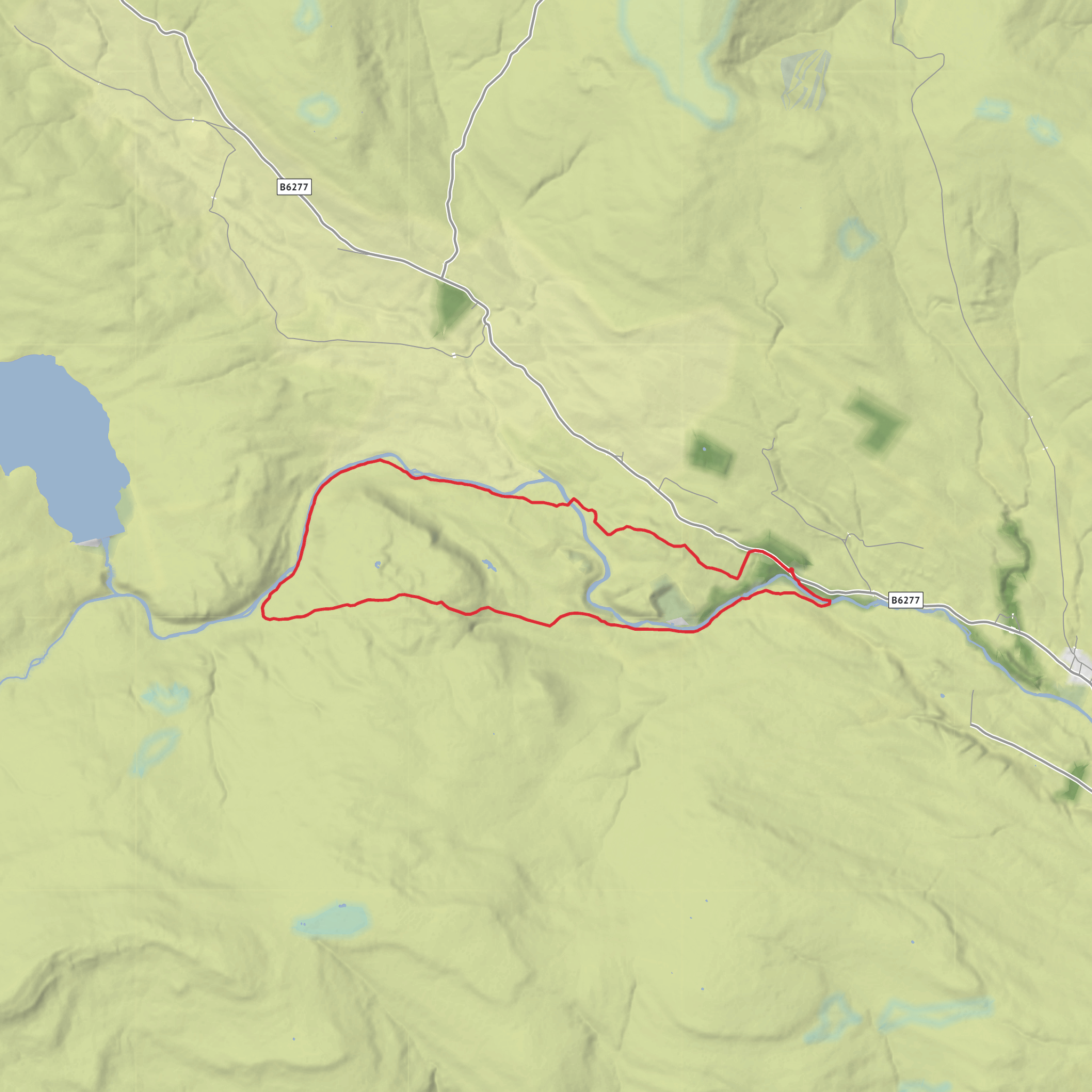
This 14 km / 8.7 mile loop in Upper Teesdale is a varied moor-and-waterfall circuit with around 300 m / 985 ft of ascent, combining one of northern England’s best-known waterfalls with quieter fellside tracks, open pasture, and broad views over the North Pennines. The route is generally classed as medium difficulty: there are no major technical obstacles in normal conditions, but the mix of riverside paths, rough moorland sections, wet ground, and exposed higher stretches means it feels more demanding than the numbers alone suggest. High Force itself drops about 21 m / 70 ft into a deep gorge on the River Tees. (northpennines.org.uk)
The walk is best understood as a circuit starting near High Force Hotel, Forest-in-Teesdale, Barnard Castle DL12 0XH, which is the nearest clear landmark and road access point for the High Force area. High Force lies about 5.2 miles / 8.4 km west of Middleton-in-Teesdale by road. (rome2rio.com)
For drivers, the usual approach is via the B6277 through Upper Teesdale, using the signed High Force area near the hotel and waterfall access. Roads are scenic but narrow in places, and this area can feel remote in poor weather or outside peak season. For public transport, the most practical hub is Middleton-in-Teesdale. From there, limited bus links run toward High Force; one current journey-planning source shows a direct service from Horsemarket in Middleton-in-Teesdale to the High Force hotel stop, but only on limited days and frequency, so checking live times before travel is essential. If arriving by rail, onward travel usually involves reaching Teesdale by bus or taxi from larger towns such as Durham or Darlington. (rome2rio.com)
The opening part of the loop is dominated by the River Tees and the drama of High Force. Expect a well-trodden approach near the falls, often busy compared with the rest of the route. The gorge is cut through layers of limestone, sandstone, and the hard igneous Whin Sill, which creates the sudden drop. This is one of the defining geological stories of the North Pennines National Landscape and UNESCO Global Geopark, and it gives the walk a strong sense of place right from the start. The word “Force” itself comes from Old Norse, reflecting Viking influence on local place-names. (northpennines.org.uk)
Terrain and route character
After the waterfall section, the route typically leaves the busiest footpaths and begins to feel more spacious and rural. The climb toward Birk Rigg is usually
Surfaces
Unknown
Dirt
Asphalt
Grass
Wood
Comments and Reviews
User comments, reviews and discussions about the High Force, Birk Rigg, Merrygill and Low Knott Loop, England.
average rating out of 5
0 rating(s)


