Download
3D Flyover
Add to list
More
44.6 km
~2 days
1021 m
Multi-Day
“From St Columb’s ancient heart to the shimmering Camel estuary, this is a varied, demanding Cornish ramble.”
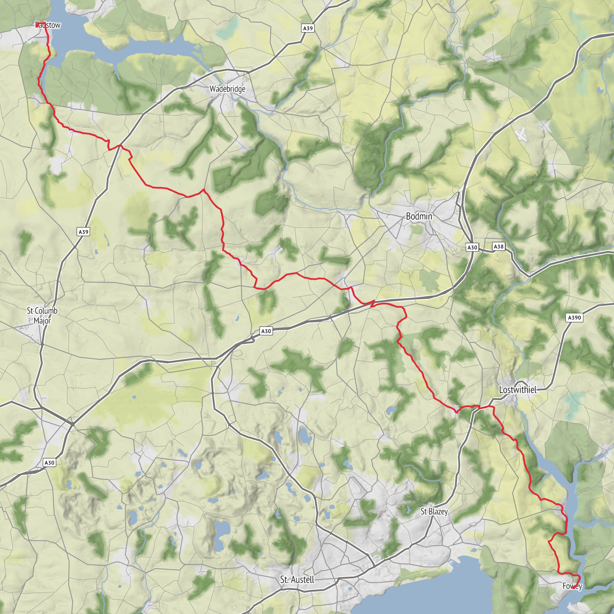
This roughly 44 km / 27.3 mile route with about 1,000 m / 3,280 ft of ascent is best approached as a full, energetic day walk or a gentler two-day outing. With a medium difficulty rating, it suits hikers who are comfortable covering long distances on a mix of quiet lanes, field-edge paths, green tracks, and sections of well-used multi-use trail. The overall feel is very Cornish: old market-town streets, rolling farmland, wooded valleys, and the broad tidal character of the Camel estuary as the route nears Wadebridge and Padstow. The walking is rarely alpine or technically difficult, but the repeated short climbs, uneven ground, muddy stretches after rain, and exposed sections in wind can make it feel more demanding than the numbers first suggest.
The route is closely tied to St Columb Major, whose parish church of St Columba is a major historic landmark and a useful nearest known start-point if your hike notes only say “near” without a clear trailhead. The Church of St Columba, in the Market Place, is Grade I listed and stands at the heart of this ancient town, where a market was granted in the medieval period and where Cornish hurling traditions still form part of local identity. (historicengland.org.uk) If you are planning from mapping coordinates, treating central St Columb Major, especially around Market Place and the church, as the practical start reference is the safest option unless your GPX shows otherwise.
What the walk feels like
Expect a route that changes character several times. Around St Columb Major, the landscape is inland Cornwall at its most pastoral: hedged lanes, old stone boundaries, grazing land, and pockets of woodland. Gradients here tend to come in short bursts rather than one sustained climb, so pacing matters. A steady rhythm works better than pushing hard early, especially if you are carrying a full day pack.
As the route trends north and northeast toward Wadebridge and the Camel corridor, the walking often becomes more flowing. If it uses or joins stretches associated with the Camel Trail, surfaces are generally easier underfoot and navigation becomes simpler, though you may share space with cyclists and other users. The Camel Trail follows a former railway and is one of Cornwall’s best-known traffic-free routes, linking Wadebridge and Padstow through estuary scenery and inland countryside. (cornwall.gov.uk)
Near Wadebridge and the estuary, the atmosphere opens out. Instead of enclosed hedges and farm lanes, you get wider skies, tidal views, and a stronger sense of coastal Cornwall even before reaching the sea. This is often the most visually expansive part of the walk, especially in clear weather.
Landmarks, nature, and wildlife
St Columb Major is one of the route’s most significant cultural landmarks. The churchyard contains early Christian remains, adding depth to the area’s long religious history and fitting the Columban theme of the walk. (facultyonline.churchofengland.org) The wider route also sits within a region shaped by early Christian traditions, medieval settlement, and later transport history.
If your line of travel reaches Wadebridge and continues toward Padstow, the Camel estuary becomes a major natural highlight. This estuary is part of Cornwall’s National Landscape, and its mudflats, creeks, reeds, and saltmarsh support overwintering wildfowl and waders. Depending on season and tide, hikers may notice egrets, oystercatchers, curlews, gulls, and other estuarine birdlife. (visitcornwall.com) Early morning and late afternoon are often the best times to watch for bird activity, especially where quieter side waters branch away from the main estuary.
The inland sections are more subtle but still rewarding. Cornish hedgebanks can hold ferns, mosses, foxgloves, bramble, and wildflowers in season, while farmland edges may attract buzzards, robins, wrens, and occasionally kestrels. After wet weather, shaded lanes and wooded hollows can stay slick for much of the day, so footwear with dependable grip is important.
Terrain and preparation
Although the route is only medium in overall difficulty, the combination of distance and cumulative ascent means it should not be underestimated. Around 44 km / 27.3 miles with 1,000 m / 3,280 ft of climbing is a substantial outing. Hikers should be prepared for:
- repeated short ascents and descents rather than one major climb
- muddy or waterlogged patches after rain
- hard surfaces on lanes and trail sections that can fatigue feet over time
- exposed wind on open ground and near the estuary
- limited shelter between settlements in poor weather
A realistic moving pace for many hikers will be around 4 to 5 km/h / 2.5 to 3.1 mph before breaks, but that can drop on rougher or hillier sections. For a one
Surfaces
Unknown
Asphalt
Dirt
Ground
Grass
Concrete
Paved
Wood
Comments and Reviews
User comments, reviews and discussions about the The Columban Way - Cornwall, England.
average rating out of 5
0 rating(s)
