
Download
3D Flyover
Add to list
More
9.5 km
~2 hrs 18 min
245 m
Loop
“Ancient yews, wind-bright chalk ridges, and Bronze Age barrows make this a stirring South Downs loop.”
This roughly 9 km (5.6 mile) loop with about 200 metres (656 feet) of climbing explores one of the most distinctive corners of the South Downs, combining open chalk ridge walking, ancient yew woodland, broad coastal views, and some of the most important prehistoric earthworks in West Sussex. The route is generally best suited to hikers comfortable with a medium-grade outing: the mileage is modest, but the chalk slopes can feel steeper than the numbers suggest, especially in wet weather when descents become slippery. Much of the interest is packed into the middle and upper sections, where the landscape shifts quickly from quiet valley floor to exposed downland crest. Kingley Vale is also a protected National Nature Reserve, known for one of the finest yew forests in western Europe and veteran trees that are among the oldest living things in Britain. (gov.uk)
The hike is near Kingley Vale National Nature Reserve, West Stoke, near Chichester, West Sussex, with the usual southern access at West Stoke car park, Downs Road, West Stoke, Chichester PO18 9BE. If starting from the northern side, the alternative access is Stoughton car park near Stoughton, Chichester, which is quieter and useful for groups. The reserve lies about 5 km (3 miles) northwest of Chichester. (gov.uk)
Getting there by car is straightforward from Chichester via the A286 and Downs Road toward West Stoke. Natural England notes that West Stoke car park has limited capacity, can fill quickly on weekends and school holidays, has a 2 m height restriction, and does not allow overnight parking. They also advise against roadside parking because it can block residents and emergency access. (gov.uk)
Public transport is less convenient. The nearest rail hub is Chichester station, around 5 km (3 miles) away, but Natural England states there is no direct bus link to the reserve. In practice, hikers using public transport usually take the train to Chichester and then continue by taxi or combine it with a longer approach on foot or by bike. If planning the route in detail, HiiKER is the best tool to check the exact line of approach and junctions before setting out. (gov.uk)
What the route feels like
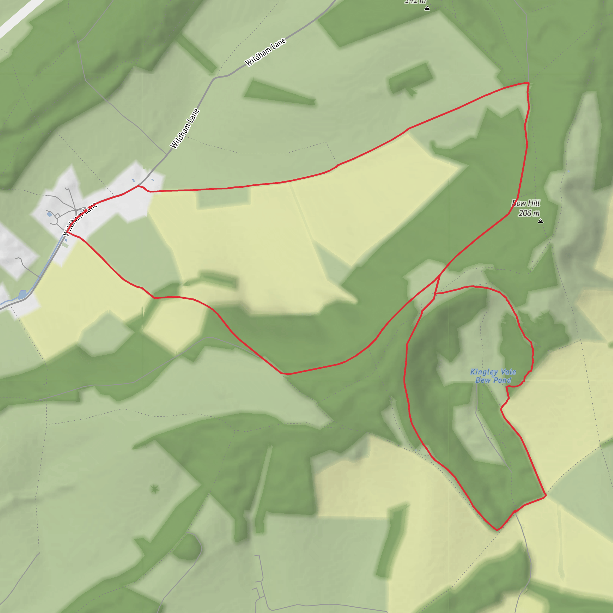
From the lower access near West Stoke, the opening section is usually gentle and gives little warning of how dramatic the upper ground becomes. The first part tends to follow easy paths into the reserve, where the terrain is relatively forgiving and the climbing builds gradually. This is the calmest part of the loop and a good place to settle into the walk before the steeper pull toward Bow Hill and the Devil’s Humps.
As the route rises, the character changes to classic South Downs chalk country: open slopes, cropped grassland, and wider views over the surrounding folds of the landscape. The total ascent is only around 200 metres (656 feet), but because it is gained in a few distinct pulls rather than one long steady climb, it can feel more strenuous than expected. Good footwear matters here, especially after rain, because chalk can become slick and polished underfoot.
The upper ridge is the highlight for many hikers. Expect a more exposed feel, with wind often stronger on the crest than below. On clear days there are expansive views south toward Chichester and the coast, including glimpses toward Pagham Harbour from higher ground within the reserve. (publications.naturalengland.org.uk)
Landmarks, archaeology, and landscape character
The most famous landmarks on this loop are the Devil’s Humps, a group of prominent Bronze Age burial mounds on Bow Hill. Historic England records them as part of a scheduled monument and identifies them as bowl barrows within a larger linear round barrow cemetery. These earthworks date to the Bronze Age, roughly 2000 to 700 BC, and are nationally important because they form part of an unusually rich chalk downland archaeological landscape. The barrows are also known locally as the King’s Graves, reflecting later folklore layered onto a much older ceremonial site. (historicengland.org.uk)
This is not a walk where history sits off to one side; it is built into the ground underfoot. The wider Kingley Vale landscape contains evidence of human activity stretching back thousands of years, including prehistoric flint mining, ancient field systems, burial mounds, and Roman-period remains. Natural England’s reserve material also notes evidence of a Roman temple in the area, while the reserve preserves traces of medieval grazing landscapes and even military use during the Second World War, when troops trained here for D-Day. (publications.naturalengland.org.uk)
Tansley Stone adds another point of interest on the loop, giving the walk a more megalithic feel even though the broader archaeological setting is more strongly defined by the barrows
Surfaces
Unknown
Unpaved
Ground
Asphalt
Comments and Reviews
User comments, reviews and discussions about the Tansley Stone, Kingley Vale and Devil's Humps Loop, England.
average rating out of 5
0 rating(s)


