Download
Preview
Add to list
More
4.2 km
~55 min
52 m
Loop
“Explore the Bridge 77, Macclesfield Canal Loop—a 4 km, history-rich, and accessible trail for all!”
Starting near Cheshire East, England, the Bridge 77, Macclesfield Canal Loop is a delightful 4 km (approximately 2.5 miles) trail with no significant elevation gain, making it accessible for a wide range of hikers. The trailhead is conveniently located near the Macclesfield Canal, a historic waterway that played a crucial role in the industrial revolution.
Getting There
For those traveling by public transport, the nearest significant landmark is the Macclesfield Railway Station. From the station, you can take a local bus or taxi to the trailhead. If you're driving, there are parking facilities available near the canal, specifically around the area of Bridge 77.
Trail Overview
The loop trail is estimated to be of medium difficulty, primarily due to its length rather than any challenging terrain. The path is well-maintained and follows the canal for most of its route, offering picturesque views of the water and surrounding countryside.
Historical Significance
The Macclesfield Canal, completed in 1831, was a vital link in the network of British waterways. It facilitated the transport of coal, silk, and other goods, contributing significantly to the local economy. As you walk along the canal, you'll notice remnants of this industrial past, including old warehouses and bridges.
Points of Interest
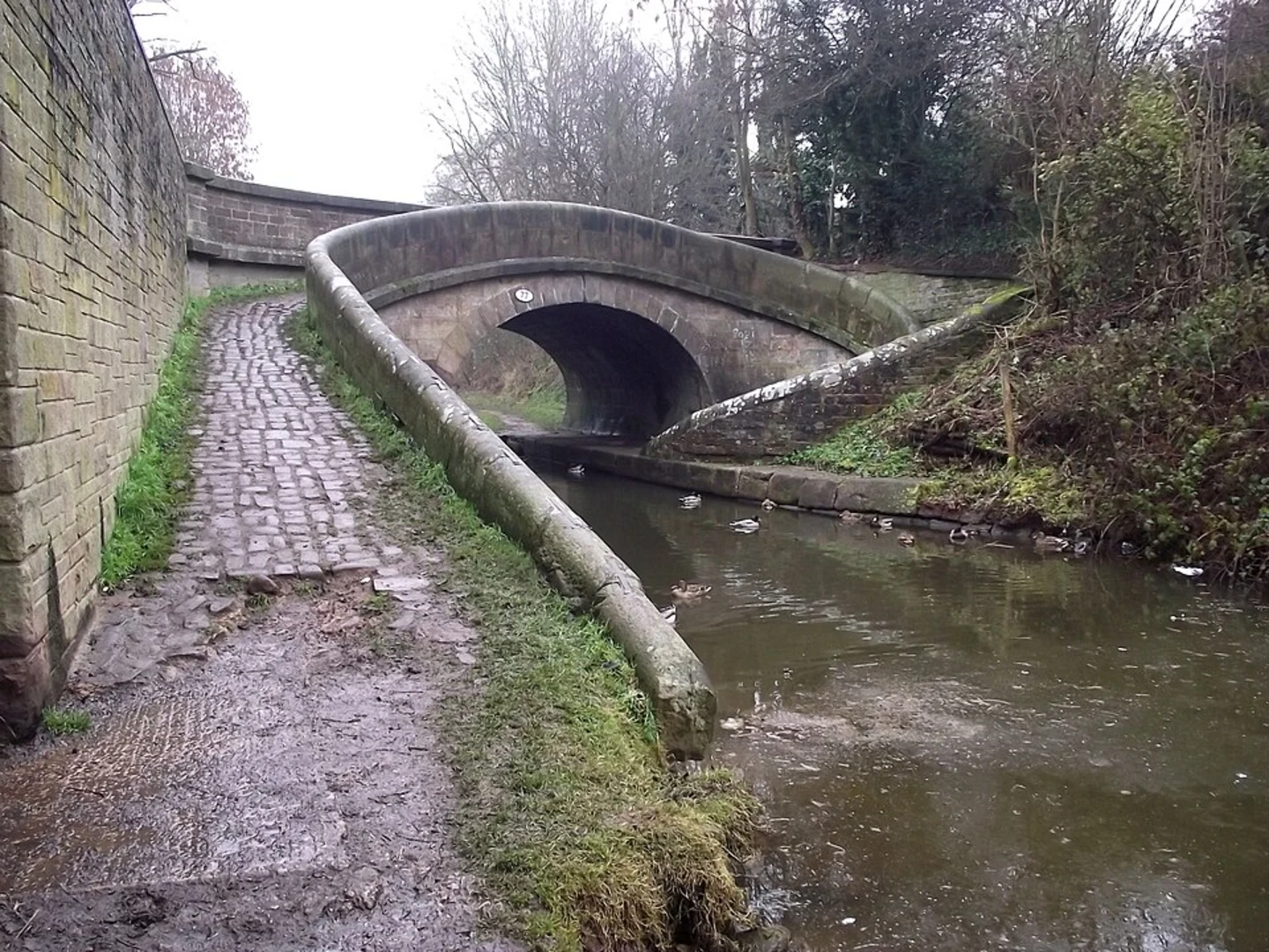
- Bridge 77: This historic bridge is a key landmark and the starting point of your loop. It's an excellent spot for photos and offers a glimpse into the engineering marvels of the 19th century.
- Wildlife: The canal is home to a variety of wildlife, including ducks, swans, and occasionally kingfishers. Keep an eye out for these beautiful birds, especially in the quieter sections of the trail.
- Flora: The path is lined with a mix of native trees and plants. In spring and summer, you'll find wildflowers in bloom, adding a splash of color to your hike.
Navigation
To ensure you stay on track, it's advisable to use HiiKER for navigation. The app provides detailed maps and real-time updates, making it easier to follow the loop without any detours.
Practical Tips
- Footwear: Given the flat terrain, comfortable walking shoes are sufficient. However, the path can be muddy after rain, so waterproof footwear is recommended.
- Weather: The trail is exposed in some sections, so check the weather forecast and dress accordingly. A light rain jacket can be handy.
- Amenities: There are a few benches along the route where you can rest and enjoy the scenery. Public restrooms are available near the trailhead.
Final Stretch
As you near the end of the loop, you'll return to Bridge 77, completing your journey. This trail offers a perfect blend of natural beauty and historical intrigue, making it a rewarding experience for any hiker.

What to expect?
Activity types
Comments and Reviews
User comments, reviews and discussions about the Bridge 77, Macclesfield Canal Loop, England.
4.0
average rating out of 5
1 rating(s)