
Download
3D Flyover
Add to list
More
12.7 km
~2 hrs 34 min
21 m
Loop
“Big skies and ancient fen-edge echoes make this gentle Witcham loop quietly captivating in changeable weather.”
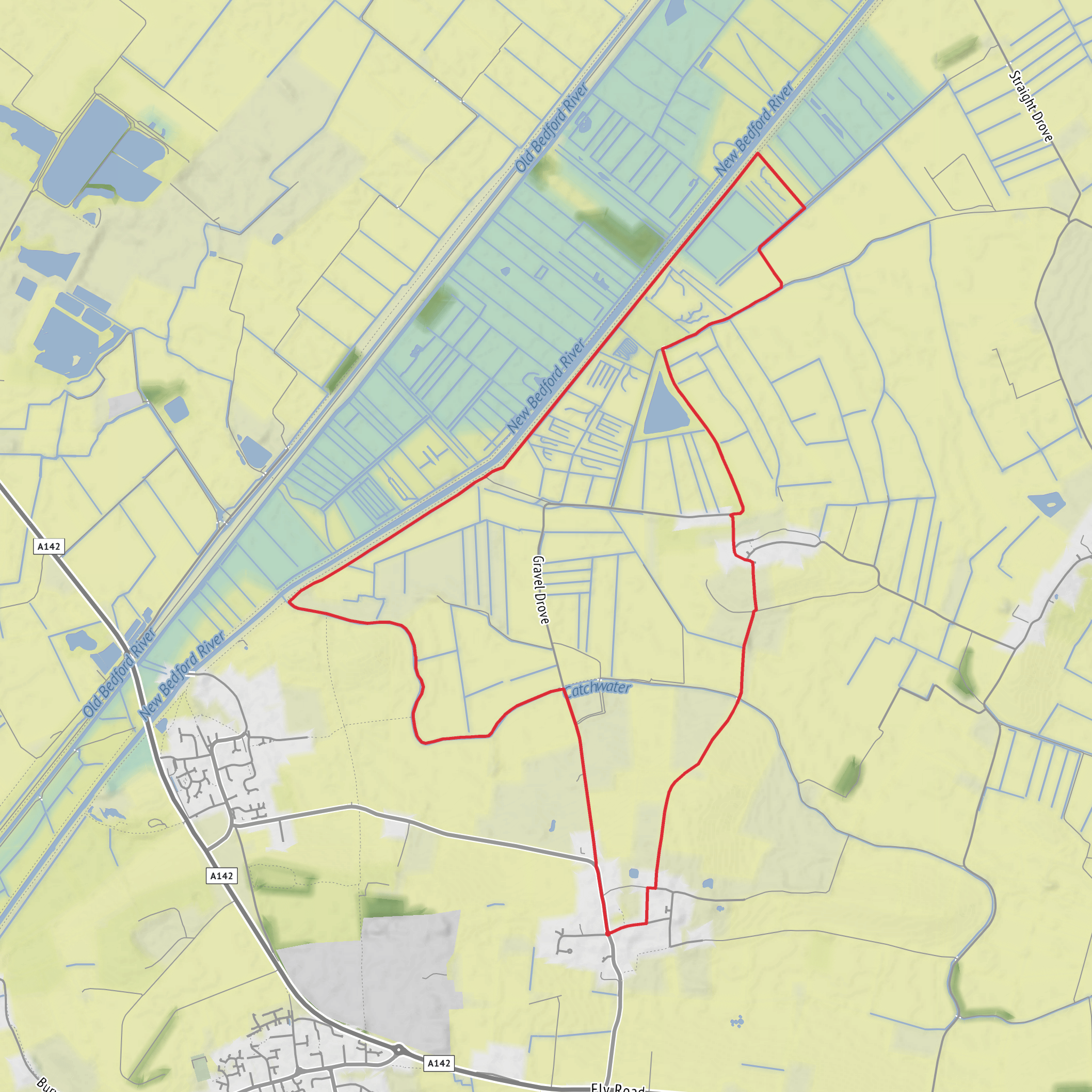
This easy fen-edge loop of about 13 km / 8.1 miles is a low-level walk with virtually no climbing, making it a good choice for hikers who want big skies, open views, and a strong sense of Cambridgeshire’s historic wetland landscape without a strenuous day out. Although the total elevation gain is only around 0 m / 0 ft, the route still feels varied because it moves between the slightly raised ground around Witcham and the broad, flat expanse of the surrounding fens. Expect exposed conditions, long straight sections, and a mix of quiet lanes, farm tracks, byways, and field-edge paths rather than rugged trail terrain. The nearest practical start point is around The Green, Witcham, near Ely, Cambridgeshire, with the bus stop at Witcham Toll, Haddenham Road serving as a useful landmark for access. (en.wikipedia.org)
Because the landscape is so open, this is a walk where weather matters more than elevation. In dry conditions the route should feel straightforward and fast underfoot, but after rain some byways and field margins can become muddy, rutted, or slick, especially on the road and track sections leading toward Wardy Hill. There is very little shelter from wind, sun, or rain, so even an easy route can feel more committing than the numbers suggest. Good waterproof footwear is sensible in wetter months, and in summer there may be very little shade for long stretches. For navigation, carrying the route on HiiKER is especially useful here, as fenland paths and agricultural tracks can look deceptively similar at junctions. (witchamparishcouncil.gov.uk)
What the route feels like
From Witcham, the loop heads out into a landscape shaped by the edge of the Isle of Ely, where slightly higher ground once overlooked marsh and open wetland. The walking is generally gentle and undemanding, with the first few kilometres likely to alternate between village edge, open farmland, and broad views across drained fen. Around 3 to 5 km / 1.9 to 3.1 miles in, the character becomes more expansive, with long sightlines, drainage channels, and the quiet, geometric feel typical of the Fens. This is not a route of dramatic ascents or rocky features; its appeal lies in space, atmosphere, birdlife, and the contrast between raised settlement ground and the surrounding lowlands. (fenedgetrail.org)
As the loop approaches the Wardy Hill area, roughly midway through the walk, the historical interest becomes one of the standout features. Wardy Hill is known as an important archaeological site on a prominent spur north of Witcham, overlooking what was once a marsh embayment on the north side of the Isle of Ely. Excavation has shown a complex prehistoric and Iron Age landscape here, including substantial Late Bronze Age activity and a later enclosure with banks and ditches. Even if the archaeology is not always obvious on the ground, this section gives the walk a real sense of depth: you are moving through terrain that was strategically important long before the modern drained fenland took shape. (hillforts.arch.ox.ac.uk)
Beyond Wardy Hill, the route continues through open country before curving back toward Witcham. The return leg is likely to feel especially peaceful, with broad agricultural horizons and a strong sense of remoteness despite the modest distance. On a clear day, the openness of the fen-edge setting is the main reward, and the final kilometres back into the village offer a change of scale as the route returns from exposed countryside to settled ground. (fenedgetrail.org)
Landmarks, wildlife, and local character
The most significant landmark on this loop is the Wardy Hill area itself, less for a single dramatic viewpoint than for its archaeological importance and its position above the former wetland margin. This part of Cambridgeshire preserves evidence of how communities used the fen edge for settlement, movement, and defence. The wider Witcham area also reflects the long history of the Isle of Ely as a zone of slightly raised, habitable land surrounded by wetter ground. Parish material notes routes leading down from Witcham toward Wardy Hill and the gravel and fen beyond, which helps explain why the walk feels like a transition between village, old droveways, and reclaimed wetland. (hillforts.arch.ox.ac.uk)
Wildlife is one of the quieter pleasures of the route. Fen-edge farmland and drainage landscapes can support a good range of birds, especially in open country where raptors, corvids, and seasonal wetland species may be seen. The broader Isle of Ely fenland is noted for breeding birds and
Surfaces
Unpaved
Grass
Gravel
Unknown
Dirt
Comments and Reviews
User comments, reviews and discussions about the Witcham Hythe and Wardy Hill Loop, England.
average rating out of 5
0 rating(s)
