
Download
3D Flyover
Add to list
More
11.3 km
~2 hrs 15 min
0 m
Loop
“Big skies, whispering reeds, and winding lodes make this flat fen loop quietly captivating.”
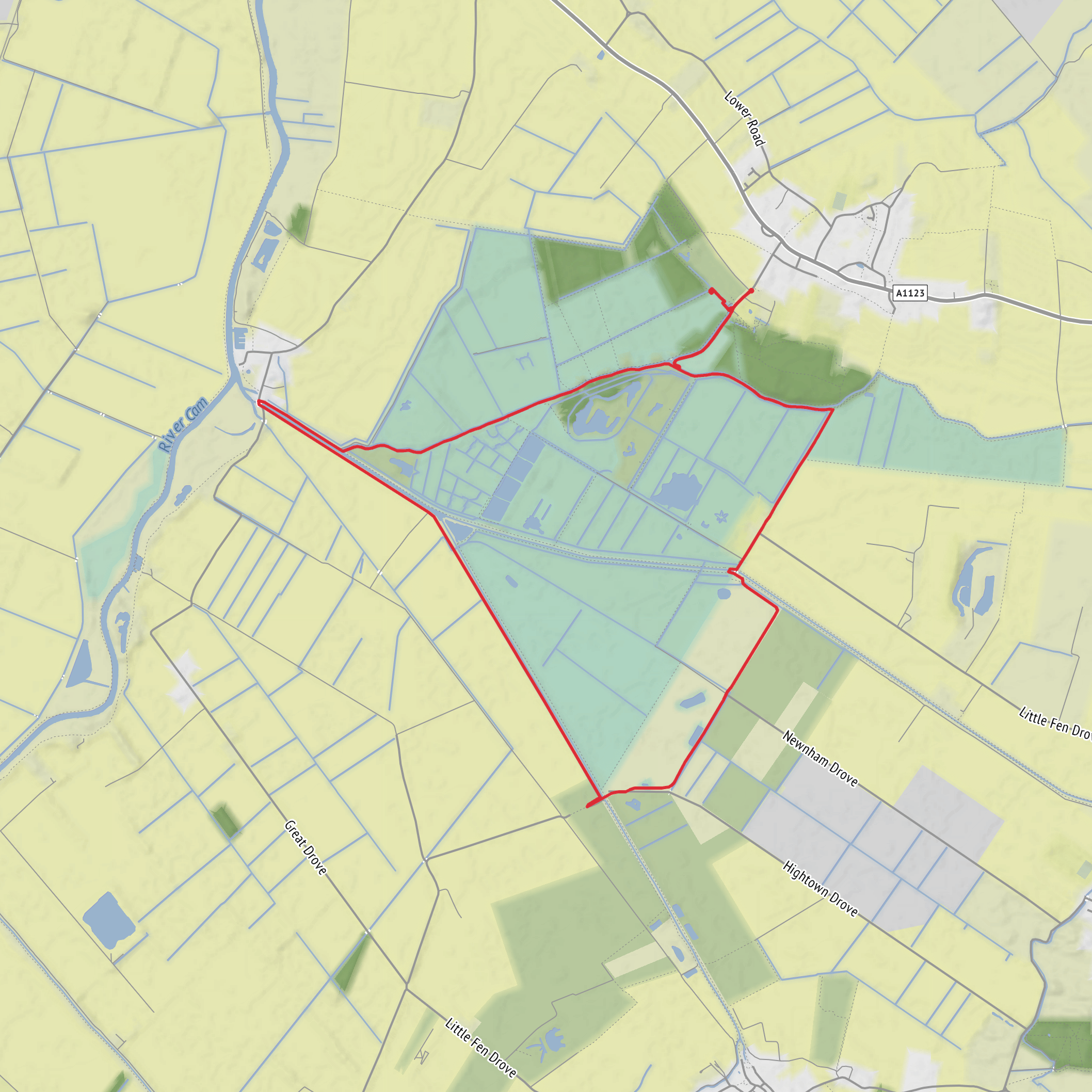
This is a flat, open fenland loop of about 11 km / 6.8 miles with virtually no climbing, making it a good choice for an easy half-day walk where the challenge comes less from gradients and more from exposure to wind, sun, and changing underfoot conditions. Expect broad skies, long views, drainage channels, reedbeds, rough grazing marsh, and the distinctive man-made waterways known as lodes that define this part of Cambridgeshire. The route links Burwell Fen, Wicken Fen, and Reach Lode, so although the elevation gain is only around 0 m / 0 ft, it still feels varied because the landscape shifts between open drove tracks, waterside sections, and nature-rich fen reserve edges. Wicken Fen is one of the National Trust’s best-known nature reserves and sits within a much larger restoration landscape known as the Wicken Fen Vision. (nationaltrust.org.uk)
The most practical trailhead reference is Wicken Fen Nature Reserve, Lode Lane, Wicken, Ely, Cambridgeshire CB7 5XP, which is the main signed visitor access for this area and the nearest clear landmark for planning and navigation. If you are approaching from the Burwell side, you may also encounter access points near Burwell Lode and the fen-edge drove roads, but for most hikers the Wicken Fen visitor area is the easiest place to orient yourself. (nationaltrust.org.uk)
For drivers, the main car park at Wicken Fen is the simplest option. The National Trust notes pay-and-display parking for non-members and free parking for members with membership validation. Roads into the reserve are minor fenland lanes, so drive slowly and expect narrow sections. If you are planning a true loop that starts closer to Burwell Fen, check access points carefully in HiiKER before setting out, as fen-edge tracks and permissive paths can be less obvious on the ground than the main reserve entrance. (nationaltrust.org.uk)
Public transport is possible, though less straightforward than arriving by car. The National Trust lists the Tiger on Demand bus service serving Wicken Fen from Monday to Saturday, and notes that Ely is a useful rail gateway, with taxis usually available there. If coming by train, Ely is the most practical station for onward travel, and cycling connections via National Cycle Network Route 11 are also mentioned for visitors combining rail and bike access. AccessAble notes there is not a bus stop within roughly 150 m of the site, so even with public transport, expect a short walk at the end. (nationaltrust.org.uk)
What the walk feels like
The first thing to expect is openness. This is classic lowland fen country, so there is very little shelter and almost no ascent to break the rhythm. In dry weather, the walking is generally straightforward on tracks, banks, and reserve paths, but after rain some sections can become muddy or soft, especially where paths cross lower-lying ground or run beside water. Because the route is so level, distance can feel easier than the weather: a breezy winter day can feel much harder here than the map suggests, while a still summer day can be hot with little shade.
A rough way to think about the route is in three parts. The opening section usually settles you into the fen landscape quickly, with broad tracks and drainage channels giving long uninterrupted views. Around the middle, the route becomes more strongly defined by the lodes and reserve land, where the water, reeds, and grazing marsh create the most distinctive scenery. The final part tends to feel expansive and quiet, with the return leg offering a different perspective across the same flat country, especially if the light is changing.
Because the route is around 11 km / 6.8 miles and almost entirely flat, many walkers complete it comfortably in about 2.5 to 3.5 hours, allowing extra time for birdwatching, photography, or pauses at viewpoints and hides near Wicken Fen.
Landmarks, wildlife, and character
The defining landmarks here are not peaks or crags but Reach Lode, Burwell Lode, and the wider fen drainage landscape. These waterways are central to the identity of the walk. Reach Lode is one of the historic Cambridgeshire lodes, and the crossing points and banks around it give some of the best sense of how engineered this landscape is. Burwell Lode is another key feature, and the route network around it forms part of the wider access into Burwell Fen and beyond. (en.wikipedia.org)
Wicken Fen itself is nationally important for wildlife and is famous for preserving a fragment of undrained fen habitat that once covered a much larger area of the region. The reserve and surrounding restoration land support reedbeds, sedge fen, wet grassland, and open water habitats. The National Trust highlights species such as **hen harriers, water voles, and bitterns
Surfaces
Grass
Unknown
Gravel
Asphalt
Wood
Comments and Reviews
User comments, reviews and discussions about the Burwell Fen and Wicken Fen and Reach Lode Loop, England.
average rating out of 5
0 rating(s)


