Download
3D Flyover
Add to list
More
13.0 km
~2 hrs 54 min
189 m
Loop
“The Sunderton Loop is a scenic, 13 km trail in Buckinghamshire, perfect for moderately experienced hikers.”
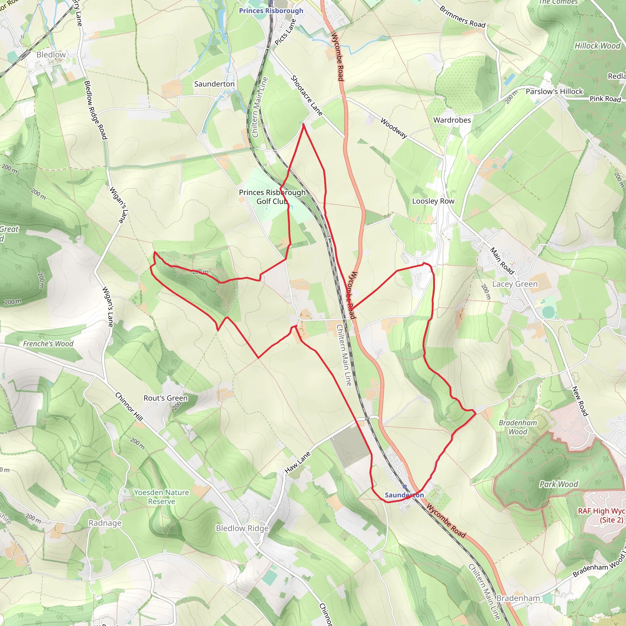
Starting near Buckinghamshire, England, the Sunderton Loop is a delightful 13 km (approximately 8 miles) trail with an elevation gain of around 100 meters (328 feet). This loop trail is rated as medium difficulty, making it suitable for moderately experienced hikers.
Getting There
To reach the trailhead, you can drive or use public transport. If driving, set your GPS to Buckinghamshire, and look for parking near the village of Sunderton. For those using public transport, the nearest train station is in High Wycombe. From there, you can take a local bus or taxi to Sunderton village.
Trail Overview
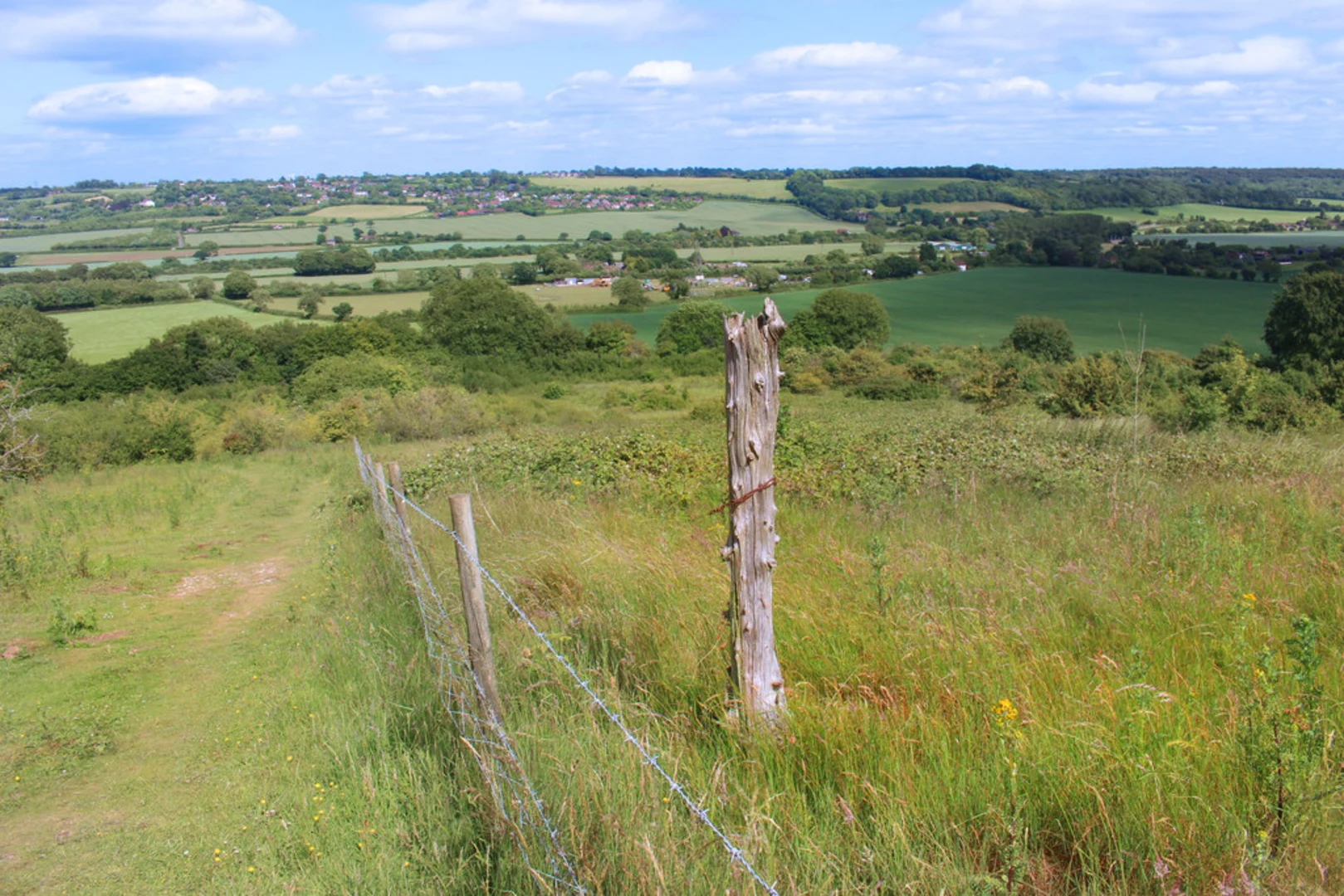
The Sunderton Loop offers a mix of woodland paths, open fields, and charming village scenery. The trail begins in Sunderton village, where you can find a small car park and a signpost marking the start of the loop.
Key Sections and Landmarks
Sunderton Village to Sunderton Woods (0-3 km / 0-1.9 miles)
Starting from the village, the first 3 km (1.9 miles) take you through picturesque countryside and gently rolling hills. Keep an eye out for the historic St. Mary's Church, a beautiful example of medieval architecture dating back to the 12th century. The path here is well-marked and relatively flat, making for an easy start.
Sunderton Woods to Highfield Farm (3-7 km / 1.9-4.3 miles)
As you enter Sunderton Woods, the trail becomes more shaded and the terrain slightly more challenging. This section is about 4 km (2.5 miles) long and features a gradual ascent of around 50 meters (164 feet). The woods are home to a variety of wildlife, including deer, foxes, and numerous bird species. In spring, the forest floor is often carpeted with bluebells, creating a stunning visual treat.
Highfield Farm to Ridgeway Viewpoint (7-10 km / 4.3-6.2 miles)
Exiting the woods, you'll come across Highfield Farm, a working farm where you might see sheep and cattle grazing. The trail here is a mix of dirt paths and gravel roads. After passing the farm, the path ascends another 50 meters (164 feet) over the next 3 km (1.9 miles) to reach the Ridgeway Viewpoint. This spot offers panoramic views of the Chiltern Hills and is an excellent place for a rest and some photos.
Ridgeway Viewpoint to Sunderton Village (10-13 km / 6.2-8 miles)
The final 3 km (1.9 miles) of the loop take you downhill back towards Sunderton village. This section is relatively easy, with well-maintained paths and clear signage. As you approach the village, you'll pass through open fields and meadows, often dotted with wildflowers in the warmer months.
Navigation and Safety
For navigation, it's highly recommended to use the HiiKER app, which provides detailed maps and real-time GPS tracking. The trail is generally well-marked, but having a reliable navigation tool can help you stay on course, especially in the wooded sections.
Historical Significance
The region around Sunderton is steeped in history. The village itself has roots going back to the Saxon era, and the surrounding countryside has been inhabited for thousands of years. The Ridgeway, which you briefly join near the viewpoint, is one of the oldest known paths in the UK, used since prehistoric times.
Wildlife and Flora
The Sunderton Loop is rich in biodiversity. In addition to the deer and foxes in Sunderton Woods, you might spot red kites soaring overhead, a bird of prey that has made a remarkable comeback in the Chilterns. The fields and meadows are home to various wildflowers, butterflies, and bees, making it a vibrant place for nature enthusiasts.
This trail offers a balanced mix of natural beauty, historical landmarks, and moderate physical challenge, making it a rewarding experience for those who undertake it.
What to expect?
Activity types
Comments and Reviews
User comments, reviews and discussions about the Sunderton Loop, England.
5.0
average rating out of 5
3 rating(s)
