
Download
3D Flyover
Add to list
More
14.6 km
~3 hrs 10 min
151 m
Loop
“A gentle, history-soaked loop through river meadows, estate landscapes and wide Vale views.”
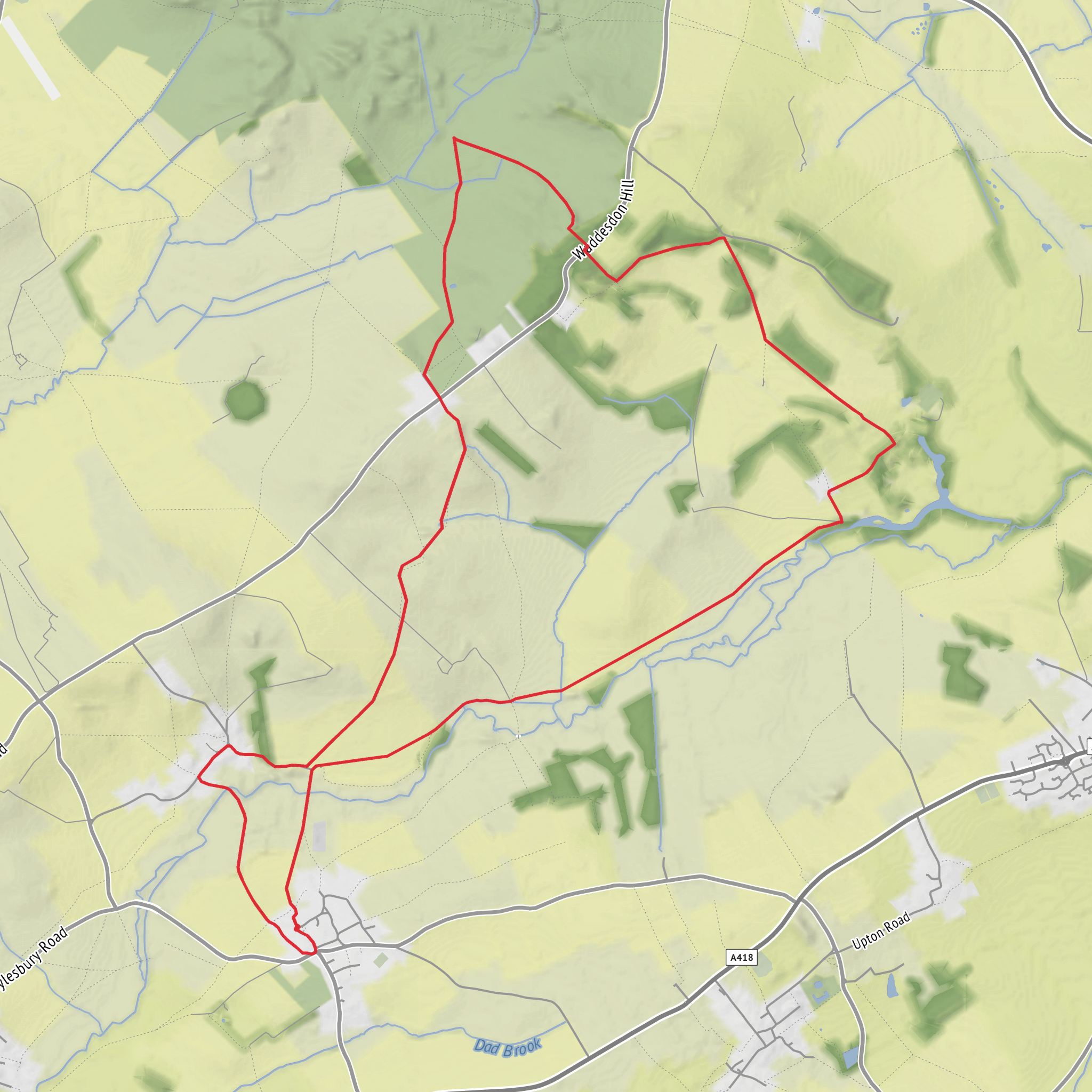
This easy loop explores the quiet edge of the Waddesdon and Eythrope estates, linking open farmland, estate tracks, the River Thame valley and the small ridge-top settlement of Upper Winchendon. At around 15 km / 9.3 miles with roughly 200 m / 656 ft of ascent, it is a gentle countryside outing rather than a strenuous hill walk, but the route still has enough undulation to keep it interesting. Expect a mix of field paths, farm tracks, estate roads and village lanes, with the higher ground around Upper Winchendon giving broader views over the Vale of Aylesbury. (osmaps.com)
The walk is best thought of as starting near Upper Winchendon, by Church Lane and Main Road, which is the clearest identifiable access point for the loop area and also the location of the local bus stop. Nearby named landmarks include Eythrope Park Farm, Upper Winchendon Road, Aylesbury, HP18 0EP and The Waterhouse, Upper Winchendon, both useful for orienting yourself when planning arrival and parking. (bustimes.org)
If arriving by car, the most practical approach is via Waddesdon and the local roads toward Upper Winchendon and Eythrope. Parking availability can be limited because much of the surrounding land is estate or farm property, so it is wise to use only clearly permitted roadside spaces or any signed public parking nearby rather than blocking gates, tracks or field entrances. The area is reached easily from the A41 and A418 corridor, with Waddesdon acting as the main road hub for the walk. (media.buckinghamshire.gov.uk)
For public transport, bus 112 serves Upper Winchendon, Church Lane, linking the area with Waddesdon and Aylesbury Bus Station on scheduled service days. Timetables are limited, so check the latest departure times before setting out. The nearest rail options are generally Aylesbury Vale Parkway, Aylesbury, or Haddenham & Thame Parkway, after which you would continue by bus or taxi. For route-following on the ground, HiiKER is the best tool to use. (bustimes.org)
What the route feels like
The character of the walk changes in stages. Lower sections near Eythrope are softer and greener, with river meadows, estate planting and sheltered lanes, while the climb toward Upper Winchendon brings a more open agricultural landscape. None of the ascents are especially long, but the cumulative rise of about 200 m / 656 ft comes from repeated gentle pulls rather than one major climb. In wet weather, field edges and gateways can become muddy, especially where livestock or farm vehicles have churned the ground. (osmaps.com)
Because this is an easy-rated route, it suits walkers looking for a half-day ramble, but “easy” here should still be read as rural rather than urban-easy. Sturdy footwear is useful year-round, and after rain waterproof boots are preferable. In summer, exposed stretches can feel warm with little shade away from the estate trees; in winter, the open ridge can catch the wind. (osmaps.com)
Landmarks, scenery and historical interest
One of the most distinctive parts of the loop is the edge of Eythrope Park, a historic estate landscape with deep aristocratic and horticultural roots. Historic England records Eythrope as a registered park and garden, and the wider estate developed significantly from the 18th century onward. The parkland setting, ornamental approaches and estate buildings give this section of the walk a noticeably designed landscape character rather than a purely agricultural one. (heritageportal.buckinghamshire.gov.uk)
Eythrope Park Farm is itself a listed building. Historic England describes it as a farmhouse incorporating an earlier 18th-century folly frontage, later altered in the 19th century. That means even the farm architecture here carries the layered, estate-driven history typical of Buckinghamshire’s great landed landscapes. Walkers should keep an eye out for the contrast between practical farm buildings and more decorative estate features, which often hints at the wealth and ambition behind the original design. (historicengland.org.uk)
The Eythrope area also has a much older story. Sources on the hamlet note that medieval Eythrope is now deserted, with surviving earthworks and traces of former settlement in the landscape. That gives the route an added historical depth: beneath the present estate and farmland lies evidence of
Surfaces
Unknown
Grass
Asphalt
Concrete
Comments and Reviews
User comments, reviews and discussions about the Eythrope Park and Upper Winchendon Loop, England.
average rating out of 5
0 rating(s)
