
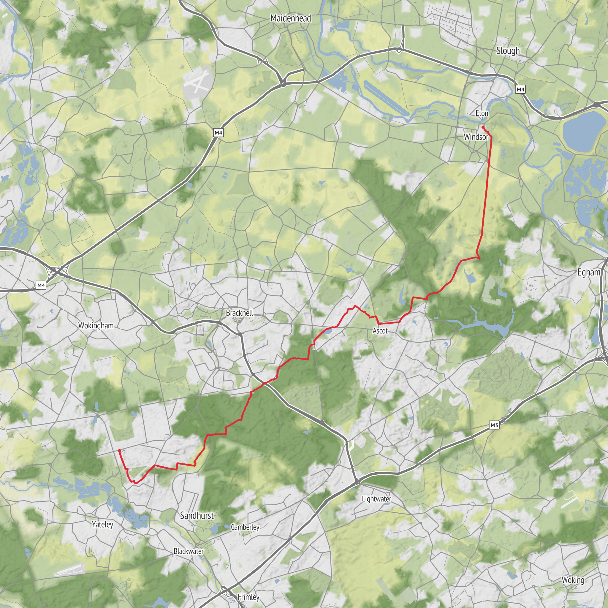
Windsor to Crowthorne via Windsor Castle, Englemere Pond, Swinley Park and Butter Hill
Download
3D Flyover
Add to list
More
28.5 km
~6 hrs 4 min
224 m
Point to Point
“From castle grandeur to whispering heath and pine, this full-day wander feels varied and quietly regal.”
This is a long but generally straightforward point-to-point walk of about 28 km / 17.4 miles with roughly 200 m / 656 ft of ascent, linking royal parkland, open heath, pine woodland, wetland habitat and the sandy ridges around Crowthorne. The overall difficulty is best thought of as easy in gradient and technical terms, but the distance makes it a full-day outing. Most hikers should plan for 6.5 to 8.5 hours of walking time before stops, with extra time if you want to linger around Windsor Castle, the Long Walk, Englemere Pond or the forest sections. The route begins near Windsor town centre, with the most practical start point being the area around Windsor & Eton Central station on Thames Street, directly opposite the main public approach to Windsor Castle, or Windsor & Eton Riverside station a short uphill walk away. (windsor.gov.uk)
The opening section is the most urban and historic. From central Windsor, the route quickly picks up one of the most recognisable landscapes in southern England: Windsor Castle and the approach into Windsor Great Park. Windsor Castle was founded by William the Conqueror in the 11th century and has remained a royal residence for centuries, giving this walk an unusually strong sense of continuity between medieval, Georgian and modern landscapes. (windsor.gov.uk) From there, the route typically heads onto the Long Walk, the great straight avenue running south from the castle toward Snow Hill. This avenue was begun for Charles II in 1680 and extends for about 4 km / 2.5 miles, making it one of the defining ceremonial and landscape features of the park. (windsorgreatpark.co.uk)
Underfoot early on, expect firm surfaced paths and broad estate tracks, with very gentle gradients. This is the easiest walking of the day and a good place to settle into pace. The views back to the castle are a major highlight, especially as the avenue opens behind you. Deer are often associated with this landscape, and the park’s scale can make the first few kilometres feel more rural than the map suggests. Because the route is exposed here, wind, sun and heat can be more noticeable than in the later wooded sections. Carry enough water from the start, especially in warm weather.
Through the royal landscape to heath and woodland
As the walk leaves the formal grandeur of Windsor behind, it transitions into the wider historic setting of Windsor Great Park and the former Windsor Forest. The park itself developed from a royal hunting landscape dating back to the 11th century, and that history helps explain the mixture of managed avenues, open ground, woodland blocks and long estate boundaries you encounter on the route. (windsorgreatpark.co.uk) This middle stretch is where the walk becomes more varied. Broad tracks, bridleways and woodland paths replace the formal approach, and the route gradually trades open views for more enclosed forest scenery.
Navigation is not usually difficult in good conditions, but there are enough path junctions, crossings and transitions between parkland and woodland that it is worth loading the route in HiiKER before setting out. After rain, some sections can be muddy, especially where paths dip or pass through wetter ground. Footwear does not need to be heavy-duty, but comfortable waterproof trail shoes or light boots are sensible.
Englemere Pond is one of the key natural landmarks on the walk and a distinct change in atmosphere. The reserve covers about 27.6 hectares / 68.2 acres and protects a shallow acidic lake with a range of habitats important for wildlife. Boardwalks and sleeper bridges have been installed in wetter areas, which helps, but surfaces can still be slick in damp weather. (bracknell-forest.gov.uk) This is a good place to slow down and watch for waterfowl and other birdlife. The surrounding habitat also supports heathland and woodland species, and the reserve remains part of the historic Crown Estate landscape that once formed the great hunting forest around Windsor Castle. (bracknell-forest.gov.uk)
If you are breaking the route mentally into sections, Windsor to Englemere Pond is roughly the first half to two-thirds of the day, depending on the exact line taken. By this point, many hikers will have covered around 16 to 19 km / 10 to 12 miles. It is a useful checkpoint for food, water and energy levels before the final woodland push toward Crowthorne.
Swinley Park, Butter Hill and the run into Crowthorne
Beyond Englemere Pond, the route enters the Swinley Park area, where the character becomes more forested and slightly wilder-feeling. Swinley sits within the broader historic Windsor Forest landscape, and the terrain here is shaped by sandy soils, conifer plantations
Surfaces
Asphalt
Unknown
Dirt
Unpaved
Grass
Gravel
Paved
Cobblestone
Concrete
Comments and Reviews
User comments, reviews and discussions about the Windsor to Crowthorne via Windsor Castle, Englemere Pond, Swinley Park and Butter Hill, England.
average rating out of 5
0 rating(s)

