
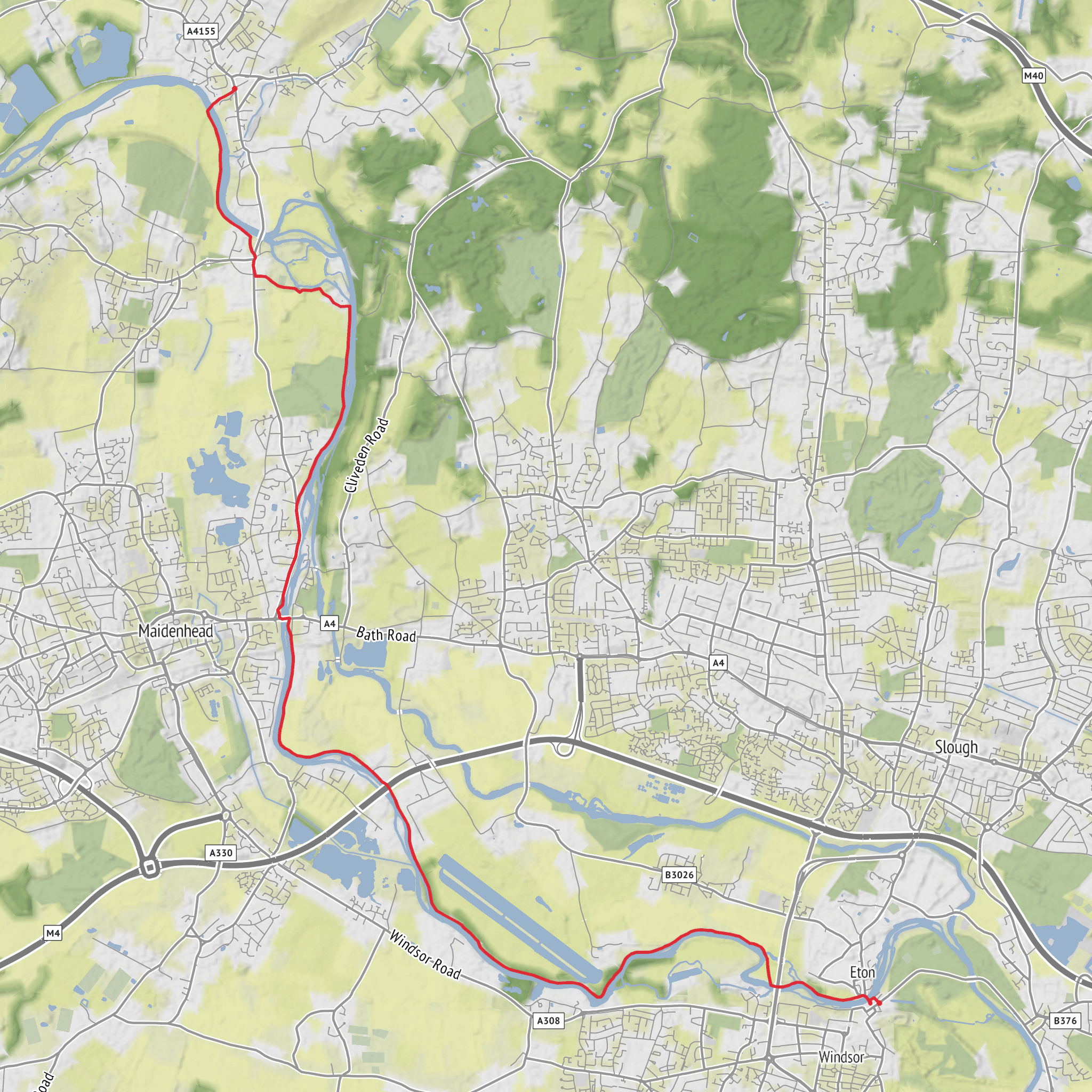
Windsor & Eton Riverside Station to Bourne End via River Thames and Merlins Mead
Download
3D Flyover
Add to list
More
18.2 km
~3 hrs 38 min
0 m
Point to Point
“From royal Windsor to quiet meadows, this Thameside ramble drifts through history, boats, and birdsong.”
This easy, almost entirely flat riverside walk runs for about 18 km / 11.2 miles with negligible ascent, making it a good choice for a relaxed full-day outing, a steady half-day fitness walk, or a point-to-point Thames Valley ramble. The route begins at Windsor & Eton Riverside Station, Datchet Road, Windsor, Berkshire SL4 1QG and finishes at Bourne End Station, Station Road, Bourne End, Buckinghamshire SL8 5QH. (nationalrail.co.uk)
From the start, the walk is shaped by the River Thames and by the long history of Windsor and Eton. Windsor itself is one of the most historically resonant river towns in England, dominated by Windsor Castle and the royal landscape around it, while Eton on the opposite bank is closely tied to Eton College and centuries of river, road, and academic history. The first stretch has a more urban feel, with handsome riverside architecture, bridges, and busy visitor activity, before the route settles into meadows, towpath walking, and quieter reaches upstream toward Maidenhead, Cookham, and Bourne End. (thames-path.org.uk)
The walking is generally straightforward underfoot: paved sections near Windsor and Eton, then a mix of riverside footpaths, towpath, compacted tracks, and meadow paths. Because the elevation gain is effectively 0 m / 0 ft, the main challenges are not hills but distance, occasional muddy patches after rain, and exposure on open riverside stretches. In wet weather, grassy sections can become slick, and after periods of high water some low-lying riverside paths may feel soft or waterlogged. Even on an easy route, 18 km / 11.2 miles still calls for comfortable footwear, water, and enough food for several hours out.
What the route feels like
Leaving Windsor, the route heads across Windsor Bridge, the historic crossing linking Windsor and Eton. This bridge is a landmark in its own right, built of iron and granite and now pedestrianised, and it gives an immediate sense of the Thames as both a natural corridor and a historic transport route. Once over the bridge, the walk follows the river through Eton and then continues along the Thames Path. (assets.simpleviewinc.com)
As the town recedes, the character changes to broad riverside scenery: open banks, grazing meadows, boat traffic in season, and long, level walking beside one of England’s best-known rivers. Around the Boveney and Dorney area, the landscape opens further. This part of the Thames floodplain is known for pasture, wet grassland, and a mix of managed and semi-natural riverside habitat. Nearby Dorney Lake adds another layer to the landscape, with its large rowing lake, meadows, arboretum, and nature reserve land. (visorando.com)
Farther on, the route approaches Maidenhead, where the riverside becomes livelier again around bridges, locks, and boating areas. One of the notable landmarks on this section is Boulter’s Lock, a classic Thames scene that often feels especially animated in warmer months, with pleasure boats, river traffic, and people gathering near the water. Beyond Maidenhead, the route continues through a mix of riverside development and greener stretches, then briefly away from the immediate river line near Cookham before returning through meadows toward Bourne End. (thamespath.co.uk)
Landmarks, nature, and wildlife
The strongest landmark presence at the start is Windsor’s royal setting. Even if the walk does not linger in the castle precincts, the proximity of Windsor Castle, the station’s Victorian setting, and the bridge crossing into Eton give the opening miles a strong sense of place. Windsor & Eton Riverside station itself dates to the mid-19th century, opening in 1849 after delays linked to local sensitivities around Windsor Castle and Eton College. (nationaltransporttrust.org.uk)
The river is the constant feature throughout. Expect classic Thames Valley scenery: willow-lined banks, pleasure craft, rowing activity, backwaters, and broad views across low meadows. Birdlife can be one of the highlights, especially if you start early or walk outside the busiest times. Depending on season and water conditions, walkers may see swans, geese, ducks, cormorants, herons, gulls, and smaller songbirds in hedgerows and waterside scrub. Around wetter meadow sections and quieter margins, dragonflies and damselflies are common in summer.
The Dorney and Maidenhead reaches are also notable for floodplain ecology. Flat
Surfaces
Unknown
Asphalt
Unpaved
Dirt
Gravel
Grass
Ground
Concrete
Wood
Paved
Comments and Reviews
User comments, reviews and discussions about the Windsor & Eton Riverside Station to Bourne End via River Thames and Merlins Mead, England.
average rating out of 5
0 rating(s)


