
Download
3D Flyover
Add to list
More
5.7 km
~1 hrs 24 min
163 m
Loop
“Explore historic villages, scenic woodlands, and panoramic views on a charming 6 km Cotswold Way loop.”
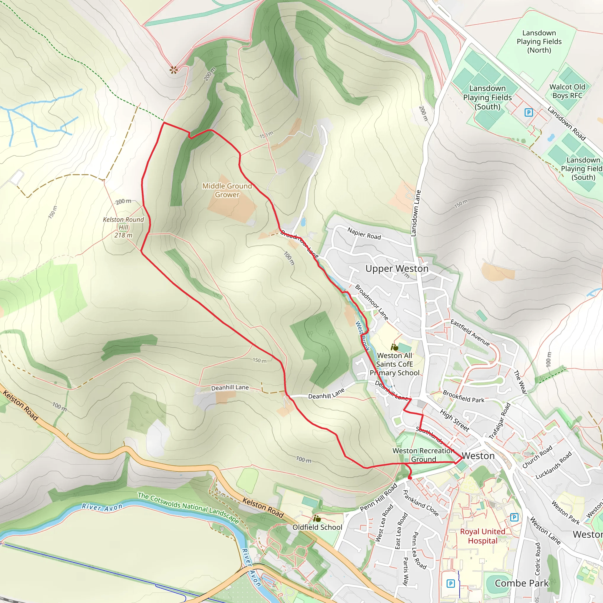
Starting near the historic city of Bath in North East Somerset, England, the Weston and Upper Weston via Cotswold Way trail offers a delightful 6 km (approximately 3.7 miles) loop with an elevation gain of around 100 meters (328 feet). This medium-difficulty trail is perfect for those looking to explore the picturesque English countryside while enjoying a moderate workout.
Getting There
To reach the trailhead, you can either drive or use public transport. If driving, head towards Bath and North East Somerset, and you can park near the Lansdown Park and Ride, which is a convenient starting point. For those using public transport, the Bath Spa railway station is well-connected to major cities. From there, you can take a local bus to the Lansdown Park and Ride.
Trail Overview
The trail begins near the Lansdown Park and Ride, leading you through a series of charming landscapes that include rolling hills, open fields, and dense woodlands. The initial part of the trail is relatively flat, making it an excellent warm-up as you head towards the village of Weston.
Key Landmarks and Points of Interest
- Weston Village: About 1.5 km (0.9 miles) into the hike, you'll reach the quaint village of Weston. This area is rich in history, with buildings dating back to the 18th century. Take a moment to admire the traditional English architecture and perhaps stop by a local café for a quick refreshment.
- Cotswold Way: As you continue, you'll join a section of the famous Cotswold Way. This long-distance footpath stretches over 164 km (102 miles) and is known for its stunning views and historical landmarks. The segment you'll be hiking offers panoramic views of the surrounding countryside.
- Upper Weston: Around the 4 km (2.5 miles) mark, you'll reach Upper Weston. This area is slightly elevated, providing excellent vantage points for photography. The elevation gain here is gentle but noticeable, adding a bit of a challenge to your hike.
Nature and Wildlife
The trail is abundant with flora and fauna. Depending on the season, you might encounter wildflowers, butterflies, and various bird species. The woodlands are home to deer and other small mammals, so keep your eyes peeled for these delightful creatures.
Historical Significance
The region around Bath is steeped in history. Bath itself is a UNESCO World Heritage site, known for its Roman-built baths and Georgian architecture. The trail passes near several historical landmarks, including old farmhouses and ancient stone walls that tell the story of England's rural past.
Navigation
For navigation, it's highly recommended to use HiiKER, which provides detailed maps and real-time updates to ensure you stay on track. The trail is well-marked, but having a reliable navigation tool can enhance your hiking experience.
Final Stretch
As you loop back towards the starting point, the trail descends gently, offering a relaxing end to your hike. The final 2 km (1.2 miles) take you through more open fields and pastures, eventually leading you back to the Lansdown Park and Ride.
This trail offers a perfect blend of natural beauty, historical intrigue, and moderate physical challenge, making it a must-visit for any hiking enthusiast.
What to expect?
Activity types
Comments and Reviews
User comments, reviews and discussions about the Weston and Upper Weston via Cotswold Way, England.
4.75
average rating out of 5
4 rating(s)
