
Download
3D Flyover
Add to list
More
11.8 km
~2 hrs 43 min
226 m
Loop
“A varied South Downs loop rises from marshy valley edges to airy chalk ridges and sweeping views.”
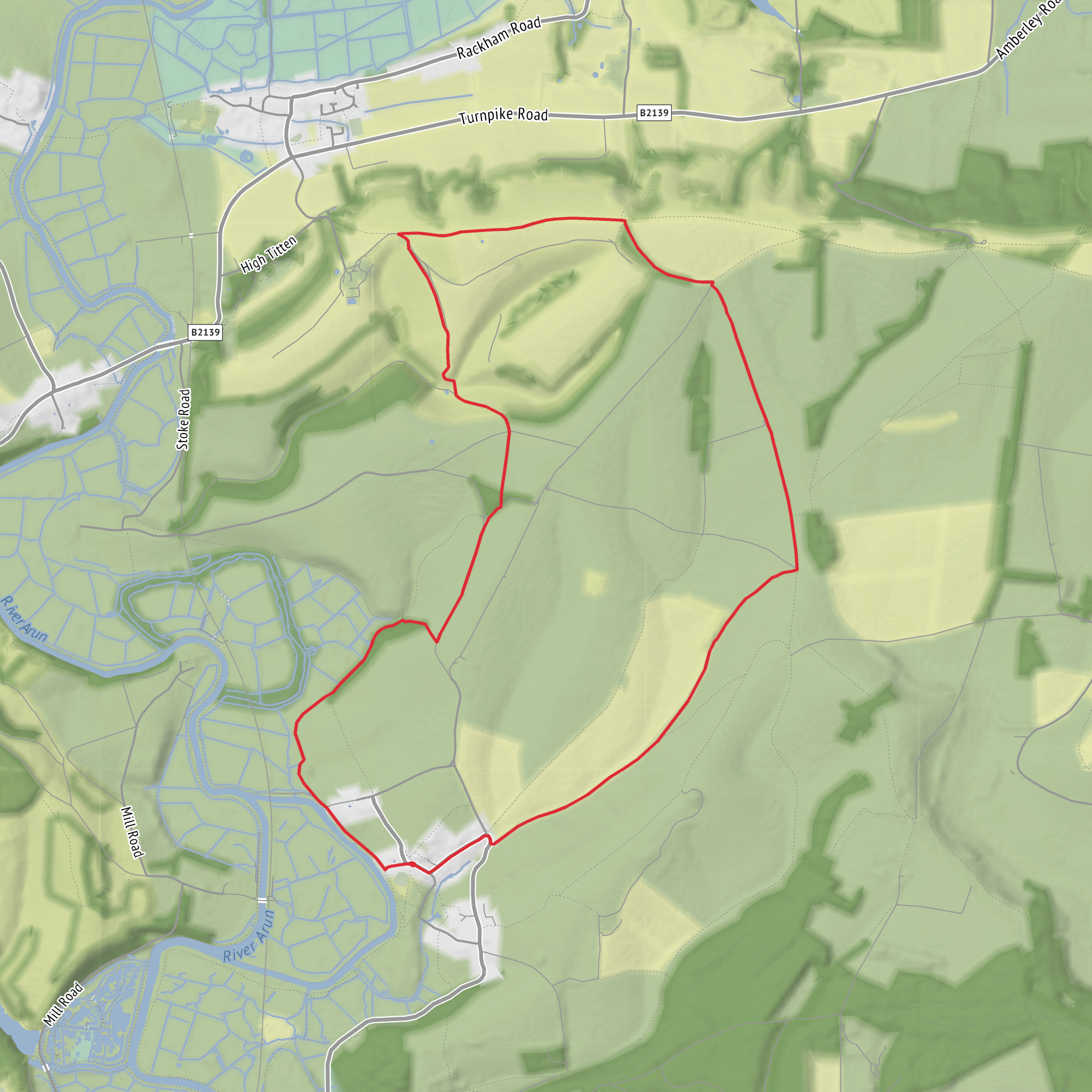
This 12 km / 7.5 mile loop on the South Downs above Amberley is a gentle but varied outing that mixes open ridge walking, broad chalk downland, wooded stretches, and long views across the Arun Valley. With around 200 m / 656 ft of ascent overall, it is best thought of as an easy walk for regular walkers, though the climbs onto and off the downs can feel sharper than the total elevation suggests, especially if the ground is dry and loose or wet and slippery on chalk. The route is closely associated with Amberley Mount and Wepham Down, both well-known high points on this part of the South Downs, and the nearest practical start point is Amberley railway station at Houghton Bridge, Amberley, West Sussex, BN18 9LT. (nationalrail.co.uk)
From the start, expect a steady transition from low-lying valley scenery into classic South Downs terrain. The lower ground around Amberley sits beside the River Arun and the wetlands of Amberley Wild Brooks, while the higher sections open onto chalk grassland and broad escarpment views. One of the pleasures of this loop is that the landscape changes quickly for a relatively short walk: village-edge paths and fields give way to steeper rising tracks, then to airy ridge walking where the horizon widens dramatically across West Sussex. The gradients are generally manageable, but the main uphill pull toward Amberley Mount is the part most likely to raise the effort level. (southdowns.gov.uk)
What to expect on the route
The route typically builds toward the high ground rather than starting with it, so pacing matters. Early sections can feel deceptively easy, but once you begin climbing toward the South Downs Way and Amberley Mount, the path becomes more exposed and the chalk underfoot can be polished and slick after rain. In dry weather, the same chalk can be dusty and slightly skiddy on descents. Good grip matters more here than the distance alone would suggest. (southdowns.gov.uk)
Once on the ridge, the walking becomes more flowing. Amberley Mount is one of the notable climbs on the South Downs Way, and from the higher ground you can expect expansive views over the patchwork fields of the Weald, the Arun Valley, and toward nearby historic landmarks. Wepham Down adds a quieter, more open downland character, with broad grassy slopes and a sense of space that is typical of this national trail landscape. If visibility is good, this is the section where walkers will want to slow down, check bearings on HiiKER, and take time over the viewpoints rather than rushing through. (gov.uk)
The route is not especially remote, but it can feel exposed in wind, sun, or winter weather because the ridge sections offer little shelter. In summer, carry more water than you might expect for a 12 km / 7.5 mile walk, as the open chalk downs can be hot and reflective. In winter or after heavy rain, expect muddy gateways, greasy descents, and colder wind on the tops than in the valley below. There may also be livestock in grazing areas, so dogs should be managed carefully where required. The South Downs National Park also advises walkers to follow countryside guidance and leave gates as found. (southdowns.gov.uk)
Landmarks, wildlife, and landscape character
A major visual feature of this area is the contrast between the chalk ridge and the wet lowlands below. Amberley Wild Brooks, near the foot of the downs, is a floodplain grazing marsh of high ecological value, and the surrounding valley often attracts wetland birds. Higher up, the chalk grassland supports a very different habitat, with seasonal wildflowers and the insect life that depends on them. On a spring or summer walk, expect butterflies, skylarks, and open grassland flora rather than dense woodland wildlife. (southdowns.gov.uk)
You may also notice gliders overhead, as this stretch of the downs is known for soaring conditions and the South Downs National Park specifically notes gliders in the Amberley area. The views can also include Amberley Castle and the chalk pits associated with Amberley Museum, both of which help tie the scenery to the area’s long human history of settlement, transport, and extraction. (southdowns.gov.uk)
Historically, this part of the South Downs is rich in layers. The South Downs Way follows an ancient route corridor across the chalk escarpment, and the wider landscape contains earthworks, burial mounds, and long evidence of prehistoric and later use. Nearby Rackham Banks and other ancient features are specifically noted in this section of the South Downs. Amberley itself has
Surfaces
Unknown
Ground
Dirt
Comments and Reviews
User comments, reviews and discussions about the Wepham Down, Amberley Mount and South Downs Loop, England.
5.0
average rating out of 5
1 rating(s)
