
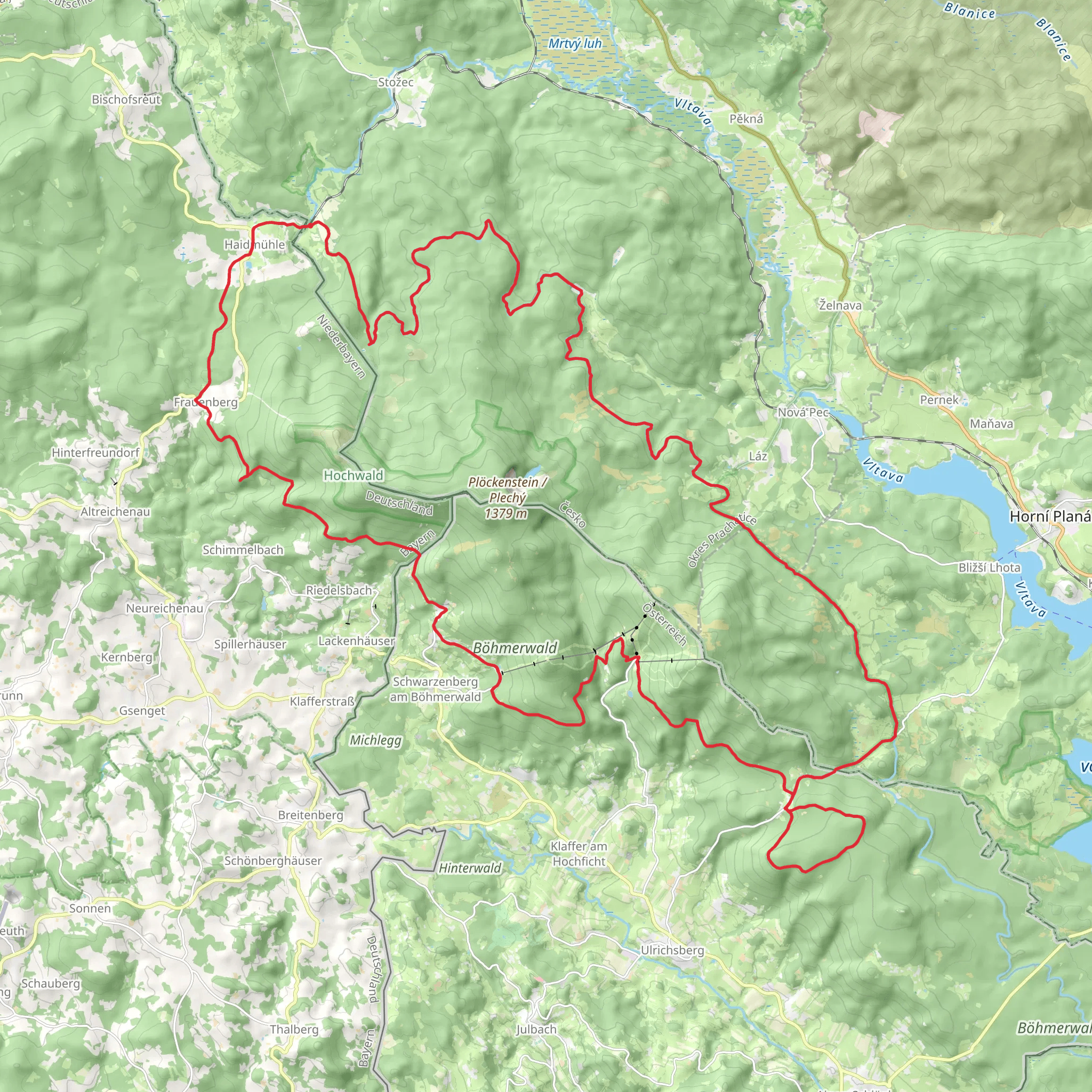
Frauenberger Steig, Nordwaldkammweg, Schwarzenbersky Kanal and Stezka Ceskem - Sumava Loop
Download
3D Flyover
Add to list
More
75.7 km
3 days
753 m
Multi Day
“A big, quiet borderland loop through shadowy spruce, springy bogs, and canal-side history—best savoured steadily.”
This is a long, forest-dominant loop of roughly 76 km (47 mi) with about 800 m (2,625 ft) of total climbing—steady rather than steep—linking classic Šumava/Bavarian Forest borderland terrain: dark spruce stands, raised bogs, canal-side track, and long ridge walking. Expect a “big day(s) out” feel: quiet woods, occasional viewpoints, and a few culturally significant waypoints tied to historic timber floating and the Iron Curtain-era border zone.
Getting to the start (public transport + car)
Because the start point is listed only as “near,” the most practical way to plan this loop is to anchor it to the Schwarzenberg Canal (Schwarzenberský plavební kanál) access area on the Czech side of Šumava, which is a common, well-known jumping-off point for routes that combine the canal with Nordwaldkammweg segments.
- By car: Aim for the Schwarzenberg Canal / Rosenauerův pomník (Rosenauer Monument) area near the village of Jelení (Hirschbergen), 384 51 Nová Pec, Czechia (this is the most recognizable landmark used by hikers visiting the canal). Parking is typically in small forest pull-ins/official lots near signed trailheads; arrive early in peak season because spaces are limited and roads are narrow.
- By public transport: The usual rail/bus gateway is Nová Pec (Czechia) on the Lipno line, then local bus/taxi onward toward Jelení. Another common approach is via Černý Kříž rail stop (seasonal service patterns can apply), then bus/taxi or a longer walk-in on marked trails. Build in extra time: connections in this region can be infrequent, especially outside summer weekends.
If you share the exact lon/lat for “Hike head,” I can pin it to the nearest specific address/landmark and tailor the access plan precisely.
What the route feels like (terrain, surfaces, and pacing)
Most of this loop is on well-made forest roads, canal towpaths, and marked hiking trails, with some narrower singletrack on ridge sections. Underfoot you’ll see: - Gravel and compacted forest track (fast, but can be monotonous and hard on feet over 47 miles) - Rooty, damp trail in darker spruce stands - Boardwalk/bridged sections where boggy ground is protected (these can be slick when wet or frosty)
With 800 m (2,625 ft) of gain over 76 km (47 mi), the climbing is spread out—think rolling ridge and gradual ascents rather than sustained steep grades. A typical split for many hikers is 2 days (roughly 38 km / 24 mi per day), but strong, efficient hikers sometimes do it as a long single push.
Key segments and landmarks you’ll pass
Frauenberger Steig (Frauenberg Steig)
This portion usually means a historic-style “Steig”: a narrower, more characterful path compared to the forestry roads elsewhere. Expect: - Tighter tread with occasional roots and short, punchy rises - More intimate forest—moss, ferns, and shaded gullies - After rain, this is one of the sections most likely to feel slippery (wet roots/rocks)
If you’re trying to keep a steady pace, plan for this segment to be slower per km than the canal or broad ridge tracks.
Nordwaldkammweg (North Forest Ridgeway)
The Nordwaldkammweg is known for long ridge travel through the Bohemian Forest/Bavarian Forest border highlands. On this loop, it typically contributes: - Sustained, gentle climbing to the ridge and then undulating terrain - Occasional openings where you can catch broader views (often weather-dependent; mist can be common) - A feeling of remoteness even when you’re not far from small settlements
Wind exposure can be higher on the ridge, and temperatures can drop quickly—pack a layer you can put on without stopping for long.
Schwarzenberg Canal (Schwarzenberský plavební kanál)
This is the signature “story” section. The canal is an early 19th-century engineering work built to move timber from the Šumava region toward the Danube system—an ingenious solution in a landscape where rivers didn’t naturally flow the “right” way for the timber trade. Walking beside it, you’ll notice: - Exceptionally gentle gradients (by design) - Straight, purposeful lines through forest, punctuated by subtle bends, sluice features, and small bridges - A very different rhythm: easy walking, but it can feel long—bring enough snacks and keep an eye on foot care
Look out for interpretive signs and monuments (often including references to Josef Rosenauer, the engineer associated with the canal). This is also one of the best places on the loop to appreciate how human history in Šumava is tied to forestry, waterways, and borderland economics.
Stezka Českem – Šumava (Czech Trail – Šumava section)
Where your loop overlaps with Stezka Českem, you’ll generally find: - Consistently good waymarking - A route that tries to maximize scenic forest character and notable natural features rather than the most direct line - More hikers in peak season, but still quiet compared to major alpine routes
Nature, wildlife, and what to look out for
This is classic **Central European
AI Planner
Days planned around your pace, with somewhere to stay each night.
Surfaces
Unknown
Gravel
Asphalt
Paved
Ground
Dirt
Sand
Grass
Unpaved
Comments and Reviews
User comments, reviews and discussions about the Frauenberger Steig, Nordwaldkammweg, Schwarzenbersky Kanal and Stezka Ceskem - Sumava Loop, Czechia.
average rating out of 5
0 rating(s)
