
Download
3D Flyover
Add to list
More
9.2 km
~2 hrs 34 min
441 m
Loop
“A windswept karst loop above Stara Baška blends sea-bright panoramas, shepherds’ stonework, and rugged island history.”
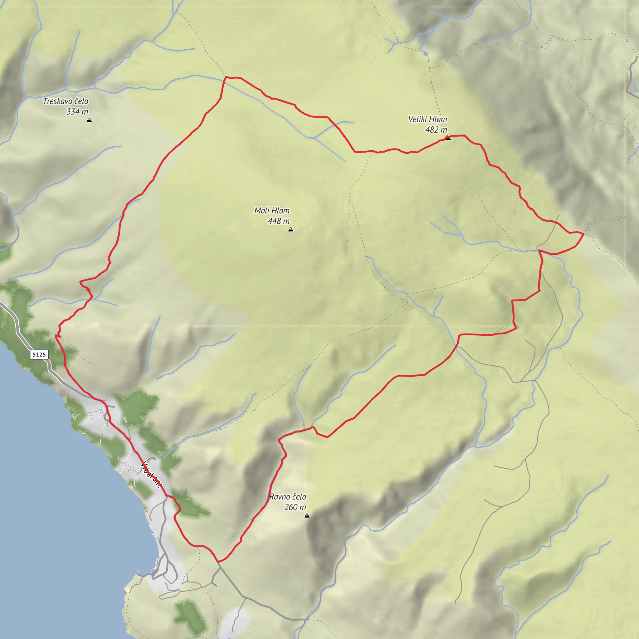
This loop explores the stark, wind-shaped hills above Stara Baška on the island of Krk, combining a steady climb, a broad summit panorama, and a return through old pastoral terrain. Although your details list the route at around 9 km / 5.6 mi with roughly 400 m / 1,312 ft of ascent, hikers should be aware that published versions of closely matching loops in this area vary, with one commonly described circuit measuring about 11.3 km / 7 mi and 516 m / 1,693 ft of ascent. That difference usually comes down to the exact start point in or near Stara Baška and whether the return uses more road or more trail. Either way, this is best treated as a medium outing with some steep, rocky sections rather than an easy coastal walk. (krk-outdoor.hr)
The route starts near the entrance to Stara Baška, 51521 Punat, Croatia, the small settlement on Krk’s southwestern coast that serves as the nearest clear landmark and practical trailhead reference. Stara Baška lies below steep karst slopes and stretches along a narrow coastal road, so parking and access can feel constrained in busy periods. If arriving by car, approach via Punat on the island road network and continue along the single road into Stara Baška; this is the only road through the village and parts of it are narrow. If using public transport, the most practical approach is usually to travel by bus to Punat first, as Punat’s bus station is connected with other towns on Krk including Baška and Krk town; from there, onward local arrangements or seasonal connections need checking in advance because direct options to the trailhead area can be limited compared with the main island settlements. HiiKER is the best tool to confirm the exact start point and route line before setting out. (visitkrk.com)
The opening climb leaves the village quickly and heads onto rocky ground where the Mediterranean feel gives way to a much barer upland landscape. Early on, expect a mix of stone, scrub, and scattered pines, but as height is gained the vegetation thins noticeably. The terrain here is classic Krk karst: pale rock, low shrubs, exposed ridges, and very little shelter from sun or wind. Underfoot, the path can be rough and uneven, so sturdy footwear is more important than the modest distance might suggest. One route description for this circuit specifically recommends sturdy shoes and carrying sufficient fluids, which is sound advice in all seasons and especially in warm weather. (krk-outdoor.hr)
On the ascent
As the trail rises, it passes features that reveal how much human use these hills have seen over time. Near Stara Baška there are cave-like pits and old excavations, including one of the pits associated with bauxite mining around 1915. These are not grand industrial ruins, but they add an unexpected layer of history to what otherwise feels like a wild limestone landscape. The climb then eases in places around Kanjina, where the route crosses ground marked by drystone walls and mrgari—traditional dry-stone sheepfold structures used for gathering and sorting sheep. These are among the most distinctive cultural landmarks on Krk and speak directly to the island’s long pastoral tradition, especially sheep breeding, which has shaped both the economy and the look of the uplands. (krk-outdoor.hr)
Before the summit, the route may pass the small water feature known as Spuhotina, a useful landmark on the descent side of some versions of the loop. Water sources in karst country can be seasonal or unreliable, so it should not be counted on for resupply. The high point, Veli Hlam at 482 m / 1,581 ft, is not especially high in absolute terms, but because it rises directly above the Adriatic it feels far more expansive than the numbers suggest. From the top, views can extend across the Kvarner islands and over to the Velebit range on the mainland in clear weather. (krk-outdoor.hr)
Ridge walking and the pass
From Veli Hlam, the route continues along the ridge toward Vratudih Pass, a saddle at roughly 350 m / 1,148 ft. This section is one of the visual highlights of the loop, with open views toward **Baška
Surfaces
Unknown
Gravel
Asphalt
Concrete
Comments and Reviews
User comments, reviews and discussions about the Veli Hlam and Vratudih Pass Loop, Croatia.
average rating out of 5
0 rating(s)

