
Download
3D Flyover
Add to list
More
6.7 km
~1 hrs 31 min
115 m
Loop
“From oak-scented Poljica, a gentle ramble drifts to quiet coves through sunlit stone and scrub.”
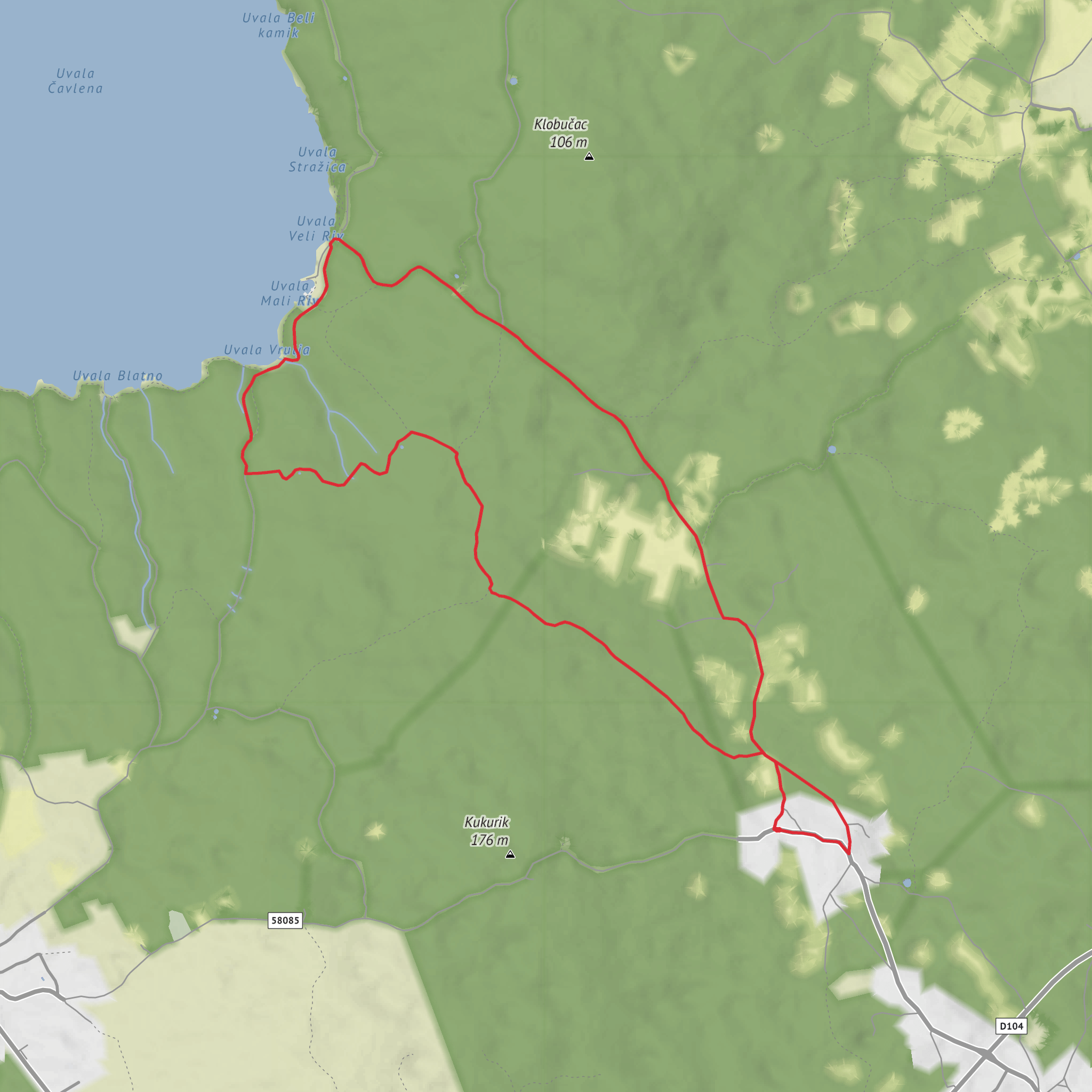
This easy coastal walk from Poljica on the island of Krk covers about 7 km / 4.3 miles with roughly 100 m / 330 ft of elevation gain, making it a good choice for walkers who want a short outing with sea views, quiet coves, and only modest climbing. The route heads out from the inland village of Poljica toward the western shore, visiting Uvala Veli Riv and Uvala Vrulja before returning. Expect a mix of village lanes, gravel or farm tracks, and stonier coastal sections where footing can become uneven despite the overall gentle grade. The bays lie northwest of Poljica, in the Malinska-Dubašnica area of Krk. (mapcarta.com)
Poljica itself is a useful landmark for planning: it is an old settlement in the wider Dubašnica area, and historical sources note that Poljica had its own parish by around 1488 while remaining tied to the orbit of the town of Krk. The broader region’s name, Dubašnica, is linked to oak woodland, from the old Slavic word dub for oak, which suits the landscape you move through on this walk—dry stone country, patches of scrub, and remnants of older rural land use. (test.lzmk.hr)
If arriving by car, the simplest approach is to drive to Poljica via the road network serving Malinska-Dubašnica and park considerately within or near the village, keeping access clear for residents and farm traffic. If using public transport, the most practical hub is Malinska, which has regular bus connections with the town of Krk; from there, onward local travel by taxi or pre-arranged transfer is usually the easiest way to reach Poljica, since inland hamlets are less straightforward than the main coastal centers. Arriva lists frequent year-round bus service between Krk and Malinska, and Malinska’s bus station is on Dubašljanska. (arriva.com.hr)
What the route feels like
The opening section from Poljica is usually the easiest underfoot, with a gradual descent from the village toward the coast. Because the total elevation gain is only around 100 m / 330 ft, the route is more about gentle undulation than sustained climbing. You are likely to lose height on the way out toward the sea and regain it gradually on the return. In warm weather, the exposed stretches can feel harder than the numbers suggest, so sun protection and extra water matter more than the elevation profile.
As the route nears Uvala Veli Riv, the character changes from inland village edge to a more maritime landscape. Uvala Veli Riv is a small bay on Krk’s west side near Poljica and Porat, and mapping places it close to local features labeled V. Riv and M. Riv, with nearby high ground such as Klobučac and the church of St. Krševan in the wider area. This part of the walk often feels quieter and more secluded than the busier resort promenades farther north around Malinska. (mapcarta.com)
From there, the route continues toward Uvala Vrulja. The name “vrulja” in the Adriatic commonly refers to a freshwater spring associated with karst terrain, often where groundwater emerges near or below sea level. Even when the spring itself is not obvious from the path, the name points to the geological character of the coast: limestone, fissured ground, and coves shaped by karst processes. That makes this a rewarding walk for anyone interested not just in scenery but in how the
Surfaces
Unknown
Dirt
Asphalt
Comments and Reviews
User comments, reviews and discussions about the Uvala Veli Riv and Uvala Vrulja from Poljica, Croatia.
average rating out of 5
0 rating(s)


