
Download
3D Flyover
Add to list
More
13.6 km
~3 hrs 7 min
241 m
Loop
“A sunlit loop through olive country, stone villages, and hidden ruins rewards steady, attentive walkers.”
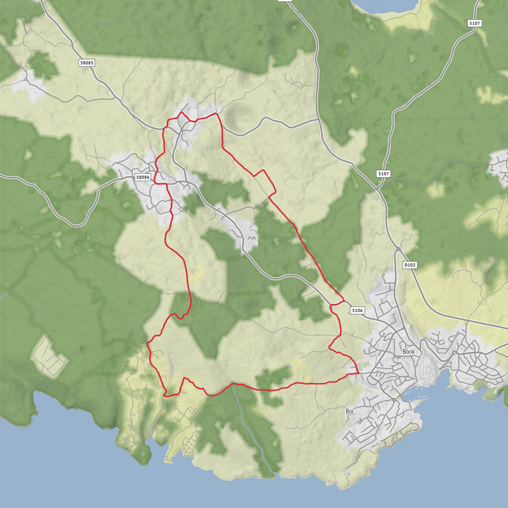
This roughly 14 km / 8.7 mi loop explores the western hinterland of Krk Town on Krk Island, linking cultivated karst fields, small villages, old stone heritage, and broad views over olive country. The official tourism route for this circuit starts and finishes by the football pitch on Josip Pupačić Street in Krk, beside the sports centre, and is listed at about 14.6 km / 9.1 mi. The official elevation gain is around 370 m / 1,214 ft, so although your estimate of 200 m is modest, hikers should plan for a hillier outing with repeated undulations rather than one single climb. The route is rated Difficult, which makes sense less because of altitude and more because of distance, exposed sections, and the need to stay attentive at junctions through fields, village lanes, and rural tracks. (visitkrk.city)
Reaching the start is straightforward by car: head for Krk Town and aim for the sports centre and football pitch on Josip Pupačić Street, which is the recognized trailhead landmark. If using public transport, the practical approach is to travel by bus to Krk Town and then walk to the sports centre area to join the loop. Krk is the main transport hub on the island, so this is the simplest access point for hikers without a car. (visitkrk.city)
The opening kilometres are usually the easiest to settle into. From Krk, the route heads northward out of town and skirts the Kimpi area, where the landscape quickly changes from urban edge to productive countryside. Expect gravel and farm tracks mixed with quieter paved stretches, dry-stone boundaries, olive groves, and open agricultural ground. This is a good section to pace conservatively, especially in warm weather, because there is limited shade once you leave town and the terrain can feel more tiring than the elevation profile suggests. (visitkrk.city)
Through Kimpi and Kaštel fields
Kimpi and Kaštel are among the defining landmarks of the walk. These are picturesque karst fields shaped by long agricultural use, and they give the route much of its character. Kimpi includes a pond that has historically served the surrounding fields and livestock; today it is noted for wetland vegetation such as sedges and water lilies and for attracting water birds. Hikers should move quietly here and keep an eye out for birdlife around the wetter margins. After rain, expect softer ground or muddy patches near low-lying areas. (krk-outdoor.hr)
Kaštel field adds a more historical note. Hidden in this agricultural zone are the remains of the Chapel of St. Anastasia, first documented in the first half of the 14th century, and the so-called Salatići Castle, a substantial ivy-draped stone structure believed to have been the country estate of a Krk noble family. These ruins are not grandly presented monuments; they are part of the landscape, easy to miss if you rush through, and they reward careful observation. This is one of the most atmospheric parts of the loop, where farming history, medieval traces, and the island’s dry-stone scenery all overlap. (visitkrk.city)
Villages, church landmarks, and local heritage
After the fields, the route passes through Kosići and Vrh, two villages that give the walk a more settled, cultural feel. The area is associated with the monumental Parish Church of St. Michael the Archangel, an important landmark in Vrh and a useful orientation point as the route transitions from open country to village streets. The villages themselves reflect the long continuity of life in this part of Krk: stone houses, enclosed plots, olive groves, and roads that still follow older rural patterns. (visitkrk.city)
Vrh is also one of the best places on the loop to pause, regroup, and check supplies. It is known for Krk prosciutto, described by the local tourism authority as the first Croatian product registered at EU level, and the village is one of the island’s better-known food stops. Even if you are not planning a meal, this section is useful for a short break before the return leg. (visitkrk.city)
Beyond Vrh, the route follows Bok od Brozića, where cultivated land continues and aromatic crops are part of the local landscape. This stretch can feel quieter and more rural again, with a mix of lanes and tracks. In summer and early autumn, heat exposure becomes one of the main challenges, so carrying more water than you think you need is wise. There may be fig trees and other cultivated plants near the route
Surfaces
Unknown
Asphalt
Gravel
Ground
Comments and Reviews
User comments, reviews and discussions about the Krk, Kimpi, Kaštel fields, Kosići and Vrh Loop, Croatia.
average rating out of 5
0 rating(s)

