
Download
3D Flyover
Add to list
More
12.6 km
~3 hrs 15 min
443 m
Loop
“A sun-washed loop above Dubrovnik blends stony climbs, fortress history, and sweeping Adriatic panoramas.”
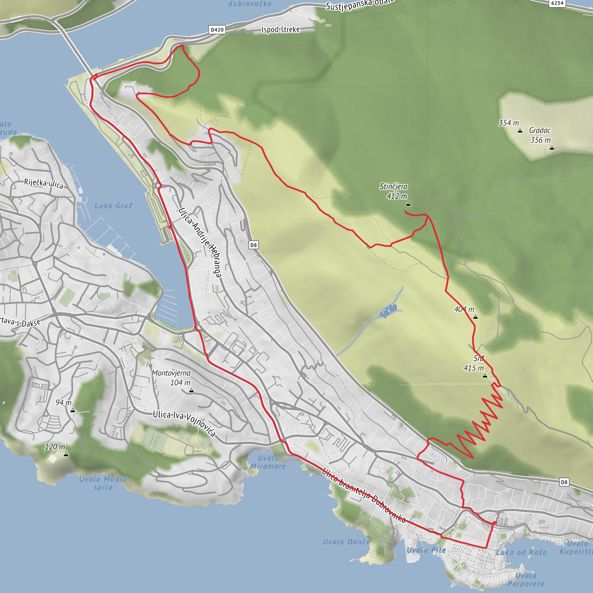
This loop links Dubrovnik’s harbor district with the high limestone ridge of Srđ, combining a steady climb, military history, broad Adriatic views, and a quieter return through the slopes above Gruž. At around 13 km / 8.1 miles with roughly 500 m / 1,640 ft of elevation gain, it fits a solid half-day outing for hikers comfortable with sustained uphill walking on rocky ground. The overall difficulty is best described as medium, though summer heat can make it feel significantly harder. The route is most closely associated with the Gruž harbor / Luka Gruž area and the Nuncijata neighborhood above Dubrovnik, which are the most useful landmarks for planning the start. (planinarenje.hr)
The character of the walk changes as you go. Lower down, you move through the urban edge of Dubrovnik, then onto old tracks and macadam roads climbing the slopes of Srđ. Higher up, the terrain opens into exposed karst with scrub, stone, and long views over the Old Town, Lokrum, Lapad, the Elaphite Islands, and the harbor below. The section between Fort Imperial and Utvrda Strinčjera is especially scenic and comparatively gentle, following a broad track across the plateau rather than a steep summit push. Official Dubrovnik Cable Car information notes that Strinčjera lies about 1.3 km / 0.8 miles northwest of Fort Imperial at roughly 400 m / 1,312 ft above sea level. (dubrovnikcablecar.com)
Getting to the start
If arriving by car, the most practical approach is to aim for the Gruž harbor / Port of Dubrovnik area or the Nuncijata hillside above it, depending on where you intend to begin the loop. Gruž is a major transport hub and a recognizable landmark for navigation, while Nuncijata gives quicker access to the uphill trail network. The Port of Dubrovnik states that Gruž is about a 30 to 40 minute walk from the Old City, and buses connect the port area with Pile and other parts of town. (portdubrovnik.hr)
For public transport, Libertas Dubrovnik is the key operator. Their official timetable shows Route 3: Nuncijata–Pile, which is useful if you want to start closer to the hillside rather than walking up from the waterfront. Libertas also provides real-time schedule information through its official channels, so it is worth checking service status before setting out, especially on Sundays and holidays when service patterns can differ. If you are staying near the Old Town, taking a bus toward Nuncijata or reaching Gruž first and then walking up can simplify the logistics. For on-trail navigation, use HiiKER to confirm the exact line of the loop and junctions on the hillside tracks. (libertasdubrovnik.hr)
Climb to Srđ
From the lower neighborhoods above Gruž, expect the first major task to be the ascent. This is where most of the day’s 500 m / 1,640 ft of climbing is concentrated. The footing is often rocky and uneven, with loose stone in places, and there is limited shade once you leave the built-up edge of the city. In cooler months the climb is straightforward for regular walkers, but in warm weather it becomes a route where water, sun protection, and an early start matter a great deal. Community route descriptions for the Srđ–Strinčjera–Nuncijata area consistently describe the route as scenic but potentially demanding in strong sun, and some note that markings can be light in places even when the terrain itself is not especially complex. (planinarenje.hr)
As height is gained, the views expand quickly. Srđ rises to a little over 400 m / 1,300+ ft above Dubrovnik, and the ridge is the city’s dominant backdrop. Tourism and cable car sources describe the summit area as one of the best viewpoints over Dubrovnik, with clear sightlines to the Old Town, Lokrum, Gruž Harbor, Lapad, and the offshore islands. This is the visual reward that defines the route, and on a clear day it is one of the most memorable urban-coastal panoramas in the Adriatic. (dubrovnikcablecar.com)
Forts, ridgeline walking, and historical context
The summit zone around Fort Imperial carries much of the route’s historical weight. The fort was built in the early 19th century during the Napoleonic era, with
Surfaces
Unknown
Asphalt
Ground
Concrete
Cobblestone
Gravel
Wood
Comments and Reviews
User comments, reviews and discussions about the Mount Srd, Utvrda Strincjera and Luka Gruz Loop, Croatia.
average rating out of 5
0 rating(s)

