Download
3D Flyover
Add to list
More
45.7 km
~2 days
1450 m
Loop
“Experience the rugged beauty and rich history of Colorado on this challenging wilderness loop trail.”
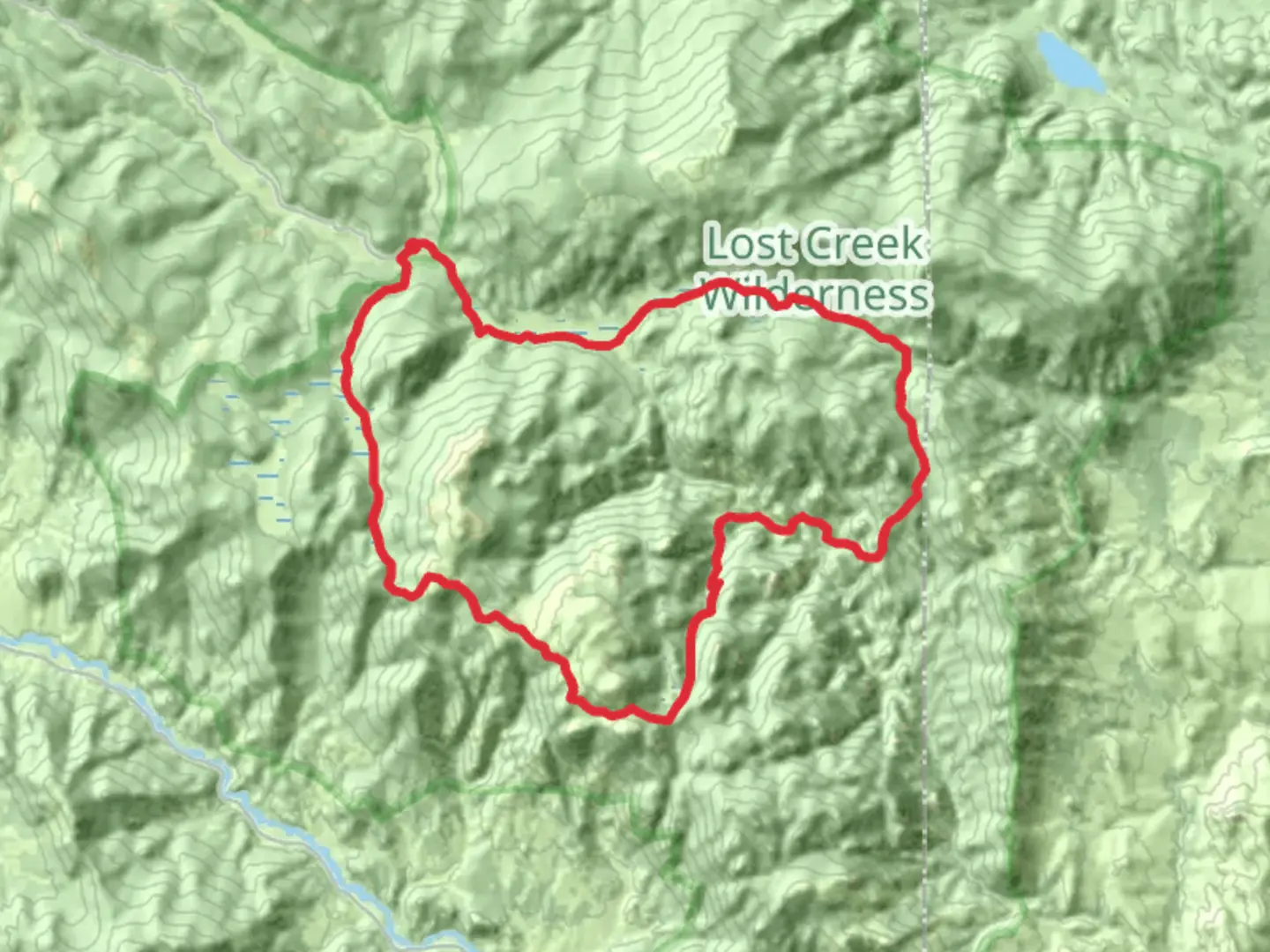
Nestled in the heart of Colorado's rugged wilderness, the Brookside - McCurdy - Wigwam Loop offers a challenging yet rewarding adventure for seasoned hikers. Spanning approximately 46 kilometers (around 28.5 miles) with an elevation gain of about 1,400 meters (4,593 feet), this loop trail is renowned for its breathtaking landscapes and diverse ecosystems. The trailhead is conveniently located near Park County, Colorado, making it accessible for those eager to explore the majestic beauty of the Lost Creek Wilderness.
Getting There
For those traveling by car, the trailhead is accessible via Tarryall Road (County Road 77), which is a scenic drive through the Pike National Forest. Parking is available at the Lost Park Campground, a well-known starting point for many hikers. If you're relying on public transport, the nearest major city is Denver. From there, you can take a bus or train to Fairplay, Colorado, and then arrange for a local taxi or shuttle service to the trailhead.
Trail Overview
The Brookside - McCurdy - Wigwam Loop is a demanding trek that requires a good level of fitness and preparation. The trail meanders through dense forests, open meadows, and rocky outcrops, offering a variety of terrains that challenge even experienced hikers. The loop is best tackled over several days, allowing ample time to appreciate the natural beauty and unique features along the way.
Key Landmarks and Sections
Brookside Section: Starting from the trailhead, the initial stretch takes you through lush pine forests and alongside babbling brooks. This section is relatively moderate, with gradual elevation changes that ease you into the hike.
McCurdy Park: As you progress, the trail ascends into McCurdy Park, a high-altitude meadow that offers panoramic views of the surrounding peaks. This area is known for its striking rock formations, including the famous McCurdy Mountain, which towers at 12,173 feet (3,710 meters). Keep an eye out for wildlife such as elk and mule deer, which are commonly spotted here.
Wigwam Trail: The final section of the loop, the Wigwam Trail, descends through a series of switchbacks into the Wigwam Creek Valley. This part of the trail is more rugged, with steep inclines and rocky paths that require careful navigation. The valley is a haven for birdwatchers, with species like the mountain bluebird and Clark's nutcracker frequently seen.
Historical Significance
The Lost Creek Wilderness, where the trail is located, holds a rich history. It was designated as a wilderness area in 1980, preserving its unique geological features and diverse habitats. The region was historically used by Native American tribes, and remnants of their presence can still be found in the form of ancient artifacts and rock art. The area also played a role during the mining boom of the late 19th century, with prospectors traversing these trails in search of fortune.
Navigation and Safety
Given the trail's complexity and remote location, it's crucial to be well-prepared. Ensure you have a reliable navigation tool like HiiKER to track your progress and stay on course. Weather conditions can change rapidly, so pack appropriate gear for rain and cold temperatures, even in summer months. Water sources are available along the trail, but it's advisable to carry a water filter or purification tablets.
Embarking on the Brookside - McCurdy - Wigwam Loop is a journey into the heart of Colorado's wilderness, offering solitude, challenge, and unparalleled natural beauty.

What to expect?
Activity types
Comments and Reviews
User comments, reviews and discussions about the Brookside - Mccurdy - Wigwam Loop, Colorado.
average rating out of 5
0 rating(s)