Download
3D Flyover
Add to list
More
8.5 km
~2 hrs 56 min
743 m
Loop
“Embark on the Left Fork Cutler Creek Trail for a thrilling, challenging hike through Colorado's historic and rugged San Juan Mountains.”
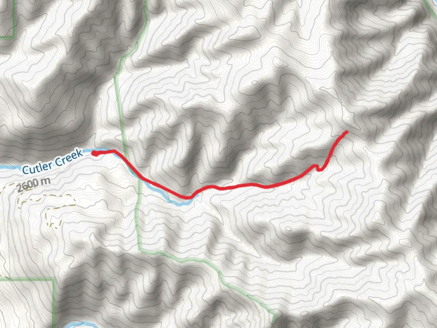
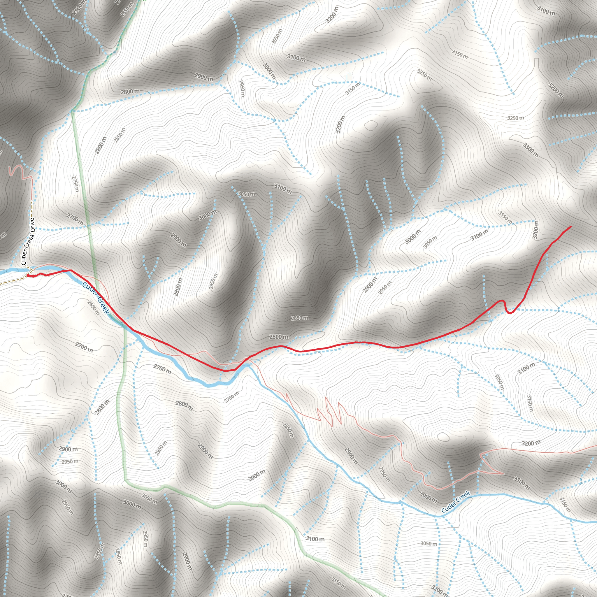
The Left Fork Cutler Creek Trail, nestled in the rugged terrain near Ouray County, Colorado, offers an adventurous loop that spans approximately 8 kilometers (about 5 miles) with an elevation gain of roughly 700 meters (around 2300 feet). This trail is not for the faint of heart, as it's estimated to be Extra Difficult due to steep grades, potential for loose rock, and often unpredictable weather conditions.
Getting to the Trailhead
To reach the trailhead, you can drive or take public transportation to the vicinity of Ouray County. If driving, head towards the Amphitheater Campground located just outside of Ouray. The trailhead is accessible from the campground area, which serves as a convenient starting point for your hike. Parking is available here, but it can fill up quickly during peak seasons, so an early start is advisable.
Navigating the Trail
As you embark on the Left Fork Cutler Creek Trail, you'll immediately be greeted by the dense forest canopy and the sound of Cutler Creek. The trail begins with a moderate incline that quickly turns into a series of switchbacks. The ascent is steady and will test your endurance. It's essential to have a reliable navigation tool like HiiKER to track your progress and ensure you're on the right path, as the trail can be quite rugged and less defined in places.
Landmarks and Scenery
Approximately 2 kilometers (1.2 miles) into the hike, you'll encounter the first significant landmark: an old miners' cabin. This dilapidated structure is a silent testament to the region's rich mining history, which dates back to the late 19th century when the area was bustling with prospectors.
Continuing the ascent, the trail offers breathtaking views of the surrounding San Juan Mountains. Keep an eye out for local wildlife, including mule deer, black bears, and a variety of bird species. The flora is equally impressive, with wildflowers blooming in late spring and early summer, adding splashes of color to the landscape.
Challenging Terrain and Precautions
The trail's most challenging section begins around the 4-kilometer (2.5-mile) mark, where the path narrows and the terrain becomes rockier. Here, the elevation gain is most pronounced, and hikers should be cautious of loose stones and steep drop-offs. Proper footwear with good grip and ankle support is crucial, as is a walking stick or trekking poles for additional stability.
As you approach the loop's summit, the trail can be covered in snow or ice, depending on the season. It's vital to check weather conditions before your hike and be prepared with appropriate gear, including microspikes if necessary.
Descent and Loop Completion
After reaching the highest point of the trail, the descent begins. It's equally challenging, with the potential for slippery conditions, so maintaining a slow and steady pace is wise. The loop will eventually lead you back to the trailhead at the Amphitheater Campground.
Access and Conservation
The Left Fork Cutler Creek Trail is located on public land, and hikers are encouraged to practice Leave No Trace principles to preserve the area's natural beauty. Pack out all trash, stay on designated trails, and respect wildlife habitats.
Preparation and Safety
Given the trail's difficulty, it's essential to come prepared with plenty of water, high-energy snacks, and layers of clothing to adapt to changing temperatures. Inform someone of your hiking plans and expected return time, and consider hiking with a companion for safety.
Remember, the Left Fork Cutler Creek Trail offers a challenging yet rewarding experience for seasoned hikers seeking to immerse themselves in Colorado's rugged wilderness. With the right preparation and respect for the natural environment, it's a hike that offers a glimpse into the area's historical significance and the enduring beauty of the San Juan Mountains.
Comments and Reviews
User comments, reviews and discussions about the Left Fork Cutler Creek Trail, Colorado.
4.5
average rating out of 5
4 rating(s)
