Download
Preview
Add to list
More
21.6 km
~5 hrs 22 min
635 m
Multi-Day
“Embark on the Mummy Pass trail, a vibrant trek through Colorado's Rockies, offering historical richness and diverse natural splendors.”
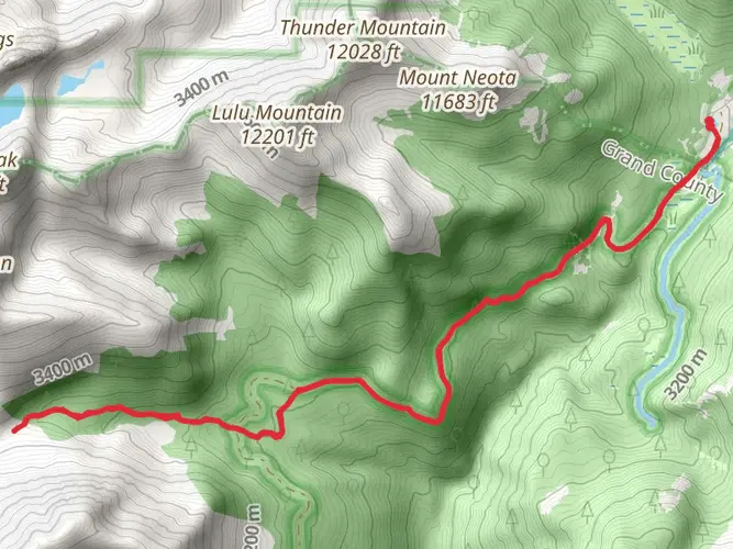
The Mummy Pass is a captivating trail nestled in the rugged terrain near Larimer County, Colorado, offering hikers a chance to explore the scenic beauty of the Rocky Mountains. Spanning approximately 22 kilometers (about 13.7 miles) with an elevation gain of around 600 meters (roughly 1968 feet), this point-to-point trail is rated as medium difficulty, making it accessible to hikers with a reasonable level of fitness.
Getting to the Trailhead
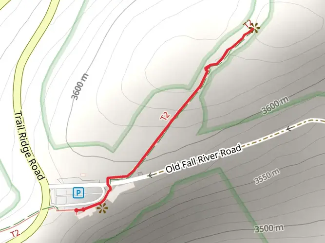
To reach the trailhead, you can drive to the Cache La Poudre River valley, which is northwest of Fort Collins. The nearest significant landmark is the Corral Creek trailhead, which serves as the starting point for the Mummy Pass trail. For those relying on public transportation, options may be limited, so it's advisable to check local resources for the latest schedules and routes that can get you as close as possible to the trailhead. From there, you may need to arrange a taxi or a ride-share service to reach the starting point.
Navigating the Trail
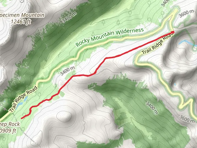
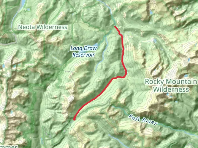
As you embark on your journey, it's essential to have a reliable navigation tool. HiiKER is an excellent resource for trail maps and can help you stay on track. The trail begins with a gentle incline through dense forests, where the sound of the Cache La Poudre River accompanies your steps. The path is well-defined, and as you ascend, you'll notice the vegetation transitioning to subalpine and alpine ecosystems.
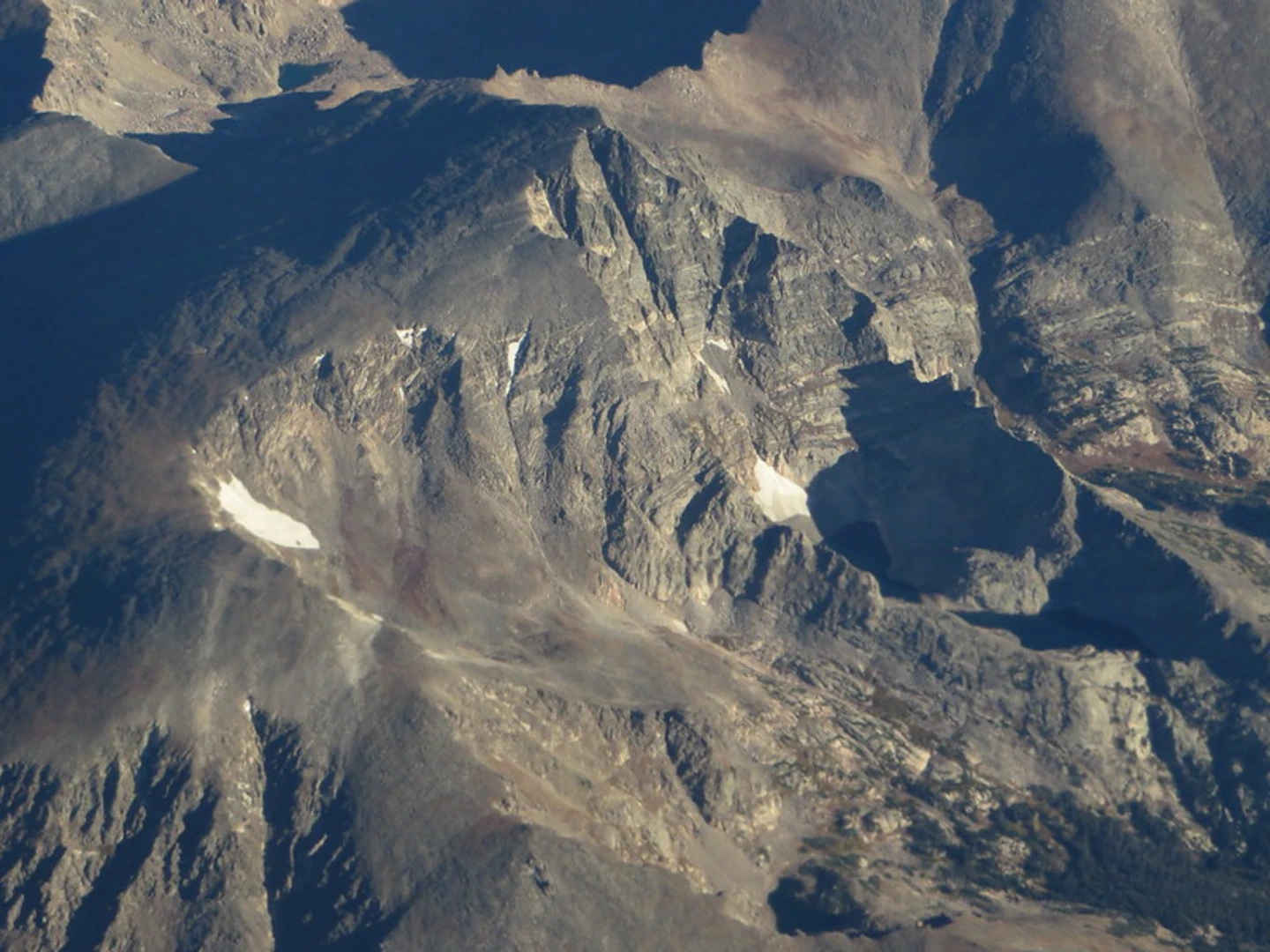
Landmarks and Natural Beauty
Approximately 5 kilometers (3.1 miles) into the hike, you'll encounter the first significant landmark, the Mummy Pass Creek, which is a perfect spot to rest and enjoy the serene environment. The trail continues to weave through meadows dotted with wildflowers during the summer months, offering a kaleidoscope of colors against the backdrop of towering peaks.
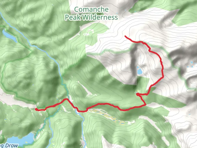
As you approach the halfway mark, the trail becomes more challenging, with steeper sections that will test your endurance. However, the reward is the breathtaking vistas of the surrounding mountains, including views of the Mummy Range. Keep an eye out for wildlife such as elk, mule deer, and an array of bird species that call this area home.
Historical Significance
The region is steeped in history, with the nearby Rocky Mountain National Park having been established in the early 20th century to protect the natural beauty of the area. The Mummy Pass itself is part of a network of trails that have been used for centuries, first by Indigenous peoples and later by settlers and explorers.
Preparing for the Hike
Before setting out, ensure you're prepared with adequate water, food, and layers of clothing to adapt to the changing weather conditions that are common in the mountains. The trail can be completed in a single long day by fit hikers, but some may choose to camp along the way, taking advantage of designated backcountry sites (permits may be required).
Remember that the trail's high elevation can affect even the most experienced hikers, so acclimatize appropriately and be mindful of signs of altitude sickness. Lastly, practice Leave No Trace principles to help preserve the beauty and integrity of the trail for future adventurers.

Frequently asked questions
How long is The Mummy Pass hike in Larimer County, Colorado?
The Mummy Pass covers 21.56 km, which is about 13.4 miles. With 635 m of elevation gain, roughly 2,083 feet, it is a medium-difficulty route that is better suited to a full day hike or a short backpacking trip than a quick outing.
How hard is The Mummy Pass hike and how much climbing does The Mummy Pass involve?
The Mummy Pass is rated medium difficulty and gains 635 m of elevation over 21.56 km. That combination means the route is long enough to require endurance, but the total climbing is moderate by Rocky Mountain standards compared with steeper summit-focused hikes in the area.
Is The Mummy Pass a day hike or an overnight backpacking route?
The Mummy Pass is listed as a multi-day trail, so it is best thought of as a backpacking route or a long point-to-point outing rather than a short half-day walk. At 21.56 km with 635 m of ascent, strong hikers may cover it in a day, but many will prefer to split the distance over more than one day.
Where is the trailhead for The Mummy Pass hike?
The Mummy Pass is in Larimer County, Colorado, in the Rocky Mountain region northwest of Fort Collins. The route is commonly associated with the Corral Creek side of the Cache La Poudre corridor, while Mummy-area access on the Rocky Mountain National Park side is tied to the Lawn Lake trailhead near Horseshoe Park and Endovalley.
Is there parking for The Mummy Pass hike?
Parking depends on which end of The Mummy Pass is used. On the Rocky Mountain National Park side, Lawn Lake Trailhead parking is reached from Highway 34 via the Endovalley road near Horseshoe Park, and spaces can fill early in peak season. On the Corral Creek side, trailhead access is more remote, so a car shuttle is often the simplest setup for a point-to-point trip.
Can dogs go on The Mummy Pass hike?
Dog access on The Mummy Pass depends on the section being hiked. Rocky Mountain National Park does not allow pets on park trails, so any approach or exit using the Lawn Lake side is not dog-friendly. Rules can differ outside the park boundary on national forest land, but the park section alone means dogs are not a safe assumption for the full route.
Do you need a permit or park pass for The Mummy Pass?
A valid entrance pass is required for any part of The Mummy Pass that enters Rocky Mountain National Park. If the trip includes overnight wilderness camping inside the park, a separate wilderness camping permit is also required. That matters for a multi-day route because permit needs can change depending on where the night is spent.
Comments and Reviews
User comments, reviews and discussions about the The Mummy Pass, Colorado.
4.25
average rating out of 5
4 rating(s)