
Download
3D Flyover
Add to list
More
10.6 km
~2 hrs 56 min
488 m
Loop
“Embark on a rugged ascent through Colorado's mining heritage for alpine splendor and wildlife encounters.”
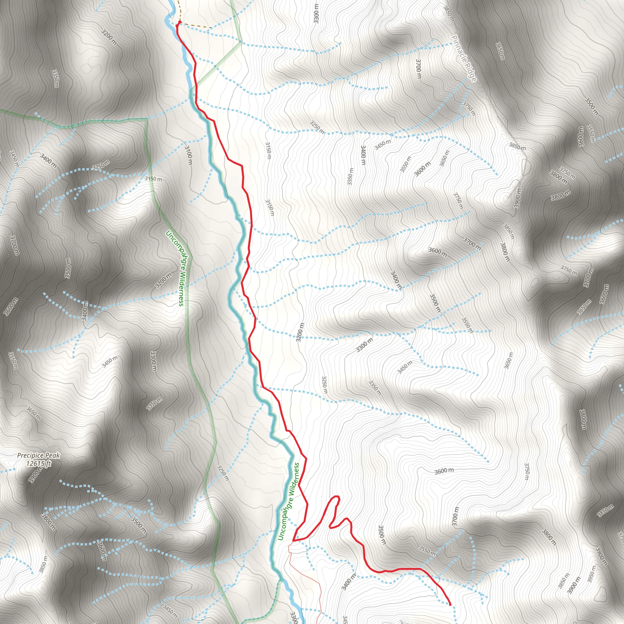
Nestled in the heart of the San Juan Mountains near Hinsdale County, Colorado, the Porphyry Basin via Middle Fork Trail offers an exhilarating and challenging hiking experience. This approximately 11 km (6.8 miles) loop trail, with an elevation gain of around 400 meters (1,312 feet), is not for the faint of heart but rewards the intrepid hiker with breathtaking views and a sense of accomplishment.
Getting to the Trailhead To reach the trailhead, hikers can drive to the nearest significant landmark, the town of Ouray, Colorado. From Ouray, take Highway 550 south for about 11 km (7 miles) to County Road 7, also known as the Middle Fork Road. Follow this dirt road for approximately 6 km (3.7 miles) to the trailhead. The road is typically accessible by high-clearance vehicles, and parking is available near the start of the trail. Public transportation options are limited in this remote area, so driving is the most feasible way to reach the trailhead.
The Hike Itself As you embark on the Porphyry Basin via Middle Fork Trail, the initial stretch will take you through dense forests of aspen and spruce, with the gentle sound of the Middle Fork of the Cimarron River accompanying you. The trail then begins a steady ascent, and the terrain becomes more rugged, with rocky switchbacks testing your endurance.
Landmarks and Scenery After approximately 3 km (1.9 miles), you'll reach the treeline, where the landscape opens up to reveal alpine meadows dotted with wildflowers in the summer months. The trail continues to climb, offering panoramic views of the surrounding peaks, including the impressive Uncompahgre Peak, which stands as a sentinel over the region.
Historical Significance The San Juan Mountains are rich in mining history, and as you hike, you'll encounter remnants of this past, including old mine shafts and the ruins of miners' cabins. These relics serve as a reminder of the 19th-century silver rush that brought prospectors to these mountains in search of fortune.
Wildlife Encounters The area is home to a diverse array of wildlife. Keep an eye out for marmots, pikas, and if you're lucky, you may spot elk or deer grazing in the distance. Remember to keep a safe distance from all wildlife and to not feed any animals you encounter.
Navigation and Safety Navigating the trail can be challenging, so it's recommended to use a reliable navigation tool like HiiKER to track your progress and ensure you stay on the correct path. The weather in the high country can change rapidly, so be prepared with appropriate gear and clothing. It's also wise to start early to avoid afternoon thunderstorms common in the Rockies.
Final Ascent and Descent The last push to the basin is the most strenuous, with a steep incline leading you to the trail's highest point. Here, at around 5.5 km (3.4 miles), you'll be rewarded with stunning views of Porphyry Basin's vibrant turquoise lakes set against a backdrop of rugged mountain peaks. Take a moment to rest and enjoy the scenery before beginning your descent along the same path, completing the loop back to the trailhead.
Preparation and Planning Due to the trail's difficulty and remote location, it's essential to be well-prepared. Bring plenty of water, high-energy snacks, and a first-aid kit. Check the weather forecast before heading out, and inform someone of your hiking plans. Remember that cell service may be unreliable, so plan accordingly.
The Porphyry Basin via Middle Fork Trail is a challenging yet rewarding hike that offers a glimpse into Colorado's wild heart. With its stunning alpine scenery, historical artifacts, and abundant wildlife, it's a hike that will leave a lasting impression on those who undertake it.
Comments and Reviews
User comments, reviews and discussions about the Porphyry Basin via Middle Fork Trail, Colorado.
4.83
average rating out of 5
6 rating(s)



