Download
Preview
Add to list
More
5.6 km
~1 hrs 40 min
326 m
Loop
“Embark on a 6 km journey through captivating landscapes, historical relics, and breathtaking vistas near Fremont County.”
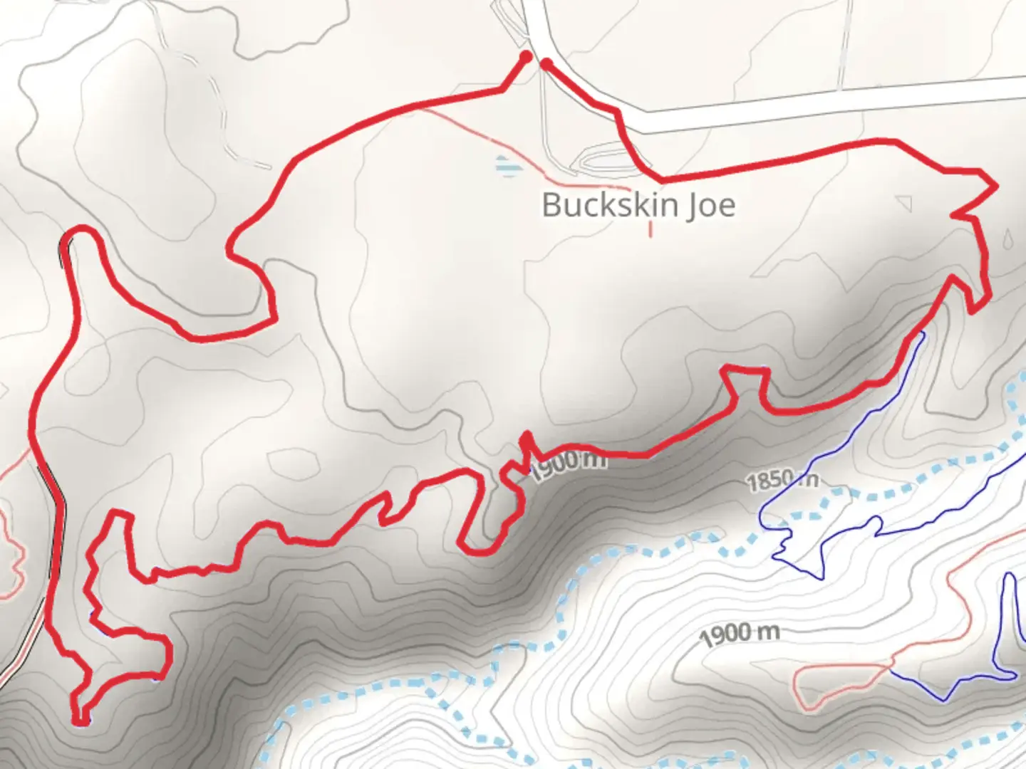
Starting your adventure near Fremont County, Colorado, the Point Alta Vista Trail and One Track Mind Loop offers a captivating 6 km (approximately 3.7 miles) journey with an elevation gain of around 300 meters (984 feet). This loop trail is rated medium in difficulty, making it suitable for moderately experienced hikers.
Getting There
To reach the trailhead, you can drive or use public transport. If driving, head towards the nearest significant landmark, the Royal Gorge Bridge and Park. From there, it's a short drive to the trailhead. For those using public transport, the nearest bus stop is in Cañon City, from where you can take a taxi or rideshare service to the trailhead.
Trail Navigation
Using HiiKER for navigation is highly recommended to ensure you stay on track and make the most of your hike. The app provides detailed maps and real-time updates, which are invaluable for this trail.
Trail Highlights
The trail begins with a gentle ascent, allowing you to warm up as you take in the surrounding pine forests and rocky outcrops. About 1 km (0.6 miles) in, you'll encounter the first significant viewpoint, offering panoramic views of the Royal Gorge and the Arkansas River below. This is a great spot for a quick rest and some photos.
Historical Significance
As you continue, you'll come across remnants of old mining operations. Fremont County has a rich mining history dating back to the late 19th century, and these relics serve as a fascinating glimpse into the past. Interpretive signs along the trail provide more information about the area's mining heritage.
Flora and Fauna
The trail is home to a variety of wildlife, including mule deer, elk, and occasionally black bears. Birdwatchers will also enjoy spotting species like the mountain bluebird and red-tailed hawk. The flora is equally diverse, with ponderosa pines, junipers, and a variety of wildflowers, especially vibrant in the spring and early summer.
Mid-Trail Features
Around the 3 km (1.8 miles) mark, you'll reach Point Alta Vista, the highest point of the trail. Here, the elevation gain of approximately 150 meters (492 feet) from the start is most noticeable. The views are breathtaking, offering a 360-degree panorama of the surrounding mountains and valleys. This is an ideal spot for a longer break and perhaps a picnic.
One Track Mind Loop
The descent begins as you transition into the One Track Mind Loop. This section of the trail is slightly more challenging due to its steeper and rockier terrain. However, it rewards hikers with unique geological formations and additional historical sites, including an old railway track that once served the mining operations.
Final Stretch
The last 2 km (1.2 miles) of the trail are relatively flat, allowing for a leisurely finish. You'll pass through a serene meadow before re-entering the forest, eventually looping back to the trailhead. This section is perfect for cooling down and reflecting on the diverse landscapes and historical insights you've encountered.
Practical Tips
- Bring plenty of water, especially during the hotter months.
- Wear sturdy hiking boots to navigate the rocky sections safely.
- Check the weather forecast before heading out, as conditions can change rapidly in this region.
- Use HiiKER to stay updated on trail conditions and any potential hazards.
This trail offers a well-rounded hiking experience, combining natural beauty, historical intrigue, and moderate physical challenge.

What to expect?
Activity types
Comments and Reviews
User comments, reviews and discussions about the Point Alta Vista Trail and One Track Mind Loop, Colorado.
4.57
average rating out of 5
14 rating(s)