Download
3D Flyover
Add to list
More
99.7 km
~4 days
117 m
Multi-Day
“Embark on a historic 62-mile journey through Colorado's diverse landscapes on the serene High Line Canal Trail.”
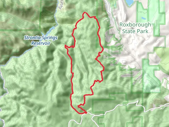
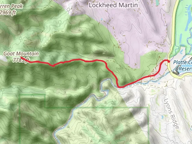
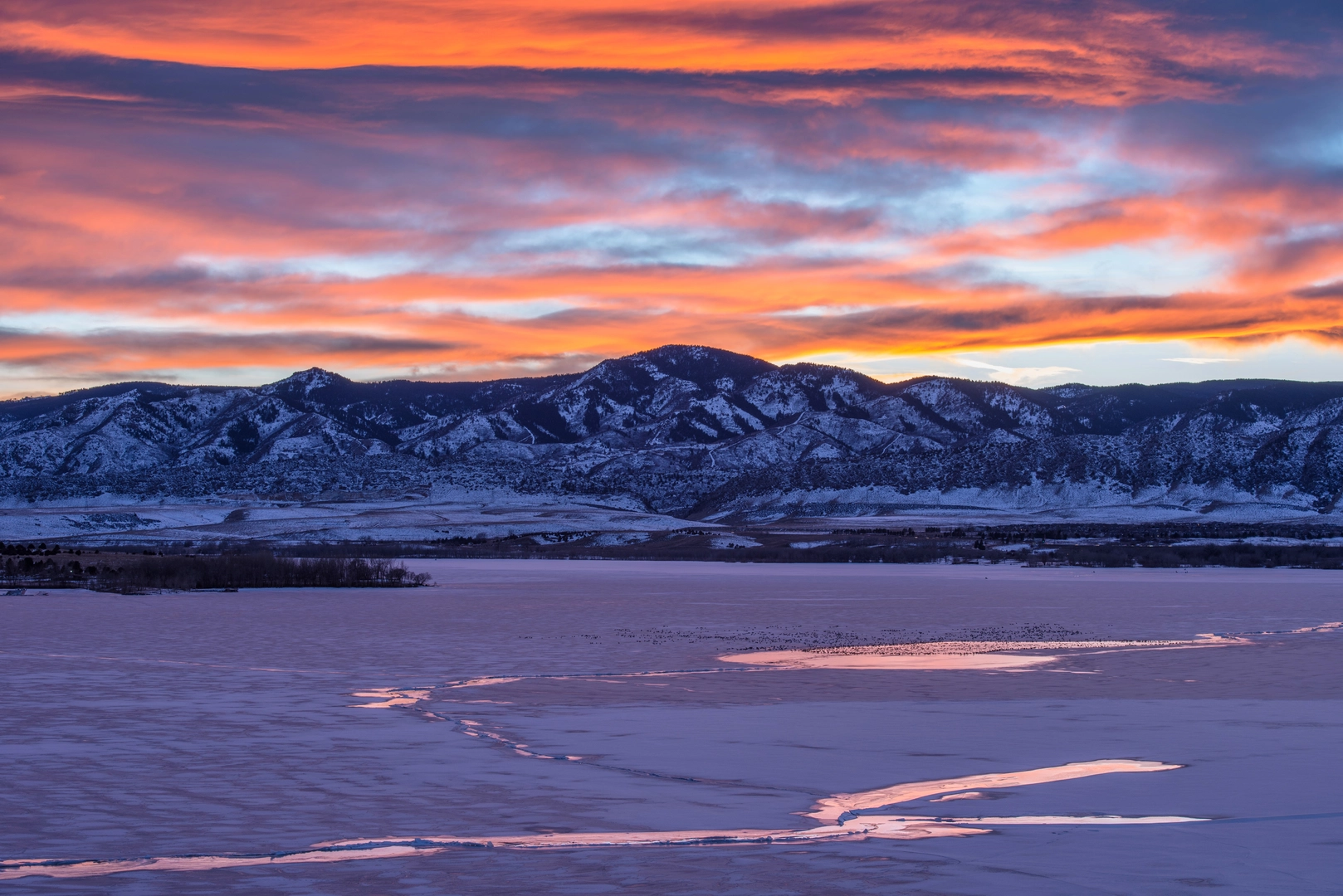
The High Line Canal Trail, stretching approximately 62 miles (100 km) with a minimal elevation gain of about 330 feet (100 meters), offers an immersive experience through the diverse landscapes near Douglas County, Colorado. This point-to-point trail is rated medium in difficulty, making it accessible to hikers with a moderate level of fitness.
Getting to the Trailhead
To begin your journey on the High Line Canal Trail, you'll want to make your way to the starting point near Douglas County. If driving, you can navigate to the trailhead located in the vicinity of Waterton Canyon, which is a well-known landmark in the area. For those opting for public transportation, local bus services can get you close to the trailhead, and from there, a short taxi or ride-sharing service will complete your journey to the starting point.
Navigating the Trail
As you embark on the trail, you'll find that the path is well-marked, but having a reliable navigation tool like HiiKER can be invaluable for staying on track and being aware of upcoming waypoints. The trail meanders through suburban areas, open spaces, and rural environments, offering a unique cross-section of the region's geography.
Historical Significance and Landmarks
The High Line Canal, originally designed for irrigation in the 1880s, has become a significant historical feature in the area. As you hike, you'll encounter various landmarks that speak to the canal's past, including old pumping stations and sections of the original canal infrastructure. The trail itself is a testament to the region's agricultural history and the development of irrigation systems in the American West.
Flora and Fauna
Nature enthusiasts will appreciate the diverse ecosystems along the trail. From cottonwood groves to native grasslands, the area is home to a variety of plant species. Wildlife sightings may include deer, coyotes, and numerous bird species, making it a delightful trail for birdwatchers.
Trail Experience
The trail's gentle grade and serene environment make it a favorite for hikers, runners, and cyclists alike. As you progress along the route, you'll pass through several parks and recreational areas, perfect for rest stops or picnics. The trail is also dotted with informative signs that provide insights into the natural and cultural history of the area.
Preparation and Planning
Before setting out, ensure you have adequate water and sun protection, as some stretches of the trail offer limited shade. Seasonal weather conditions can affect the trail's difficulty, so it's wise to check the forecast and plan accordingly. While the trail is not particularly challenging in terms of elevation, its length requires a good level of endurance, so consider breaking the hike into manageable sections if you're not up for completing it in one go.
Remember, the High Line Canal Trail is a shared-use path, so be mindful of other trail users and practice good trail etiquette. Enjoy the journey along this historic and scenic Colorado trail.

What to expect?
Frequently asked questions
How long is the High Line Canal Trail in Colorado, and how many days does it usually take to hike?
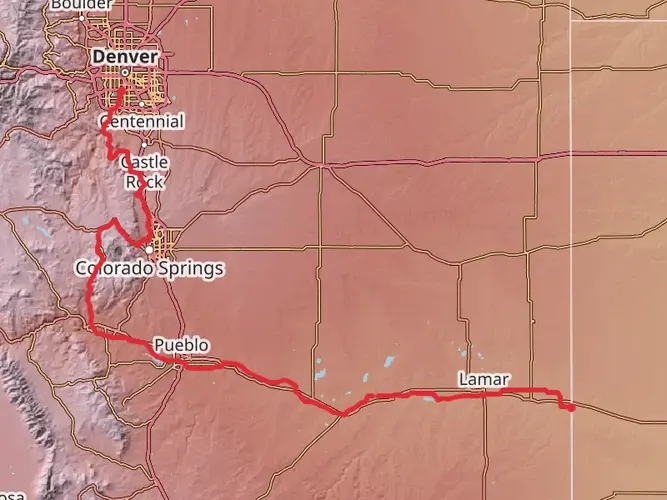
The High Line Canal Trail is 99.66 km, or about 62 miles, with only 117 m of elevation gain, so it is far more about distance than climbing. Strong hikers can cover long sections in a day, but many people break it into several outings or a 2- to 4-day walk because it is a point-to-point route stretching from the Waterton Canyon area across the Denver metro corridor.
Where does the High Line Canal Trail start near Douglas County, and where can you park for the High Line Canal Trail?
The western start of the High Line Canal Trail is by Waterton Canyon in Douglas County, where the canal begins near the South Platte River diversion structure. A common access point is the Waterton Canyon Trailhead area on Waterton Road, and parking is available there, with the High Line Canal access just south of the main Waterton Canyon parking area.
Is the High Line Canal Trail difficult, or is the High Line Canal Trail good for beginners?
The High Line Canal Trail is generally an easy hike because the total elevation gain is only 117 m across nearly 100 km. The main challenge is endurance and logistics rather than steep terrain, so beginners often do best by choosing shorter point-to-point or out-and-back sections in Douglas County instead of attempting the full trail at once.
Is the High Line Canal Trail flat enough for a long walk or easy multi-day hike?
Yes. The High Line Canal Trail is notably flat for its length, gaining only 117 m over 99.66 km, which works out to a very gentle grade overall. That makes it suitable for long-distance walking, casual section hiking, and multi-day itineraries where steady mileage matters more than mountain climbing.
Are dogs allowed on the High Line Canal Trail in Douglas County?
Dogs are generally allowed on the High Line Canal Trail, but rules can vary by the agency managing each section because the route passes through multiple jurisdictions. In Douglas County, the trail corridor includes both standard trail sections and some designated dog off-leash areas shown on county mapping, so leash expectations can change depending on the exact segment being used.
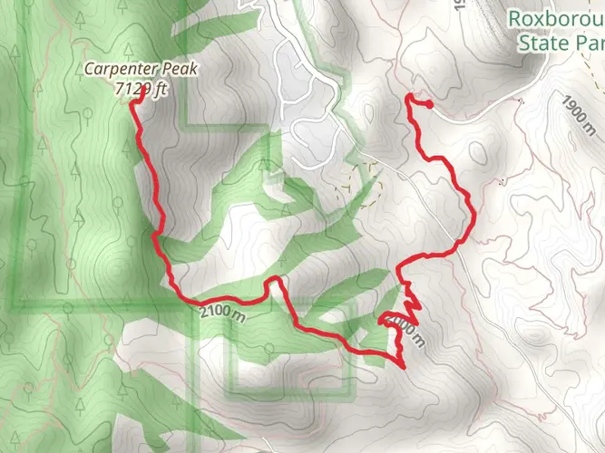
What is the best section of the High Line Canal Trail to start with near Waterton Canyon?
A popular first section is the canal’s beginning near Waterton Canyon, where the route follows the historic canal corridor from the diversion area near the South Platte. This stretch is a practical introduction because it has trailhead access, parking, and a straightforward path, and it lets hikers see the canal’s origin in Douglas County before committing to longer segments.
What kind of surface and scenery does the High Line Canal Trail have in Douglas County?
In Douglas County, the High Line Canal Trail follows a broad historic canal corridor with gentle grades and a mix of open-space and suburban-edge scenery. The western miles near Waterton Canyon are among the more natural-feeling sections, and across the full route the trail transitions through Douglas, Arapahoe, Denver, and Adams counties, so the setting changes from quieter stretches to more urban segments.
Comments and Reviews
User comments, reviews and discussions about the High Line Canal Trail, Colorado.
4.67
average rating out of 5
6 rating(s)