
Download
3D Flyover
Add to list
More
33.0 km
~6 hrs 56 min
203 m
Loop
“Explore Denver's diverse landscapes on this 33-kilometer scenic hike blending history, nature, and urban charm.”
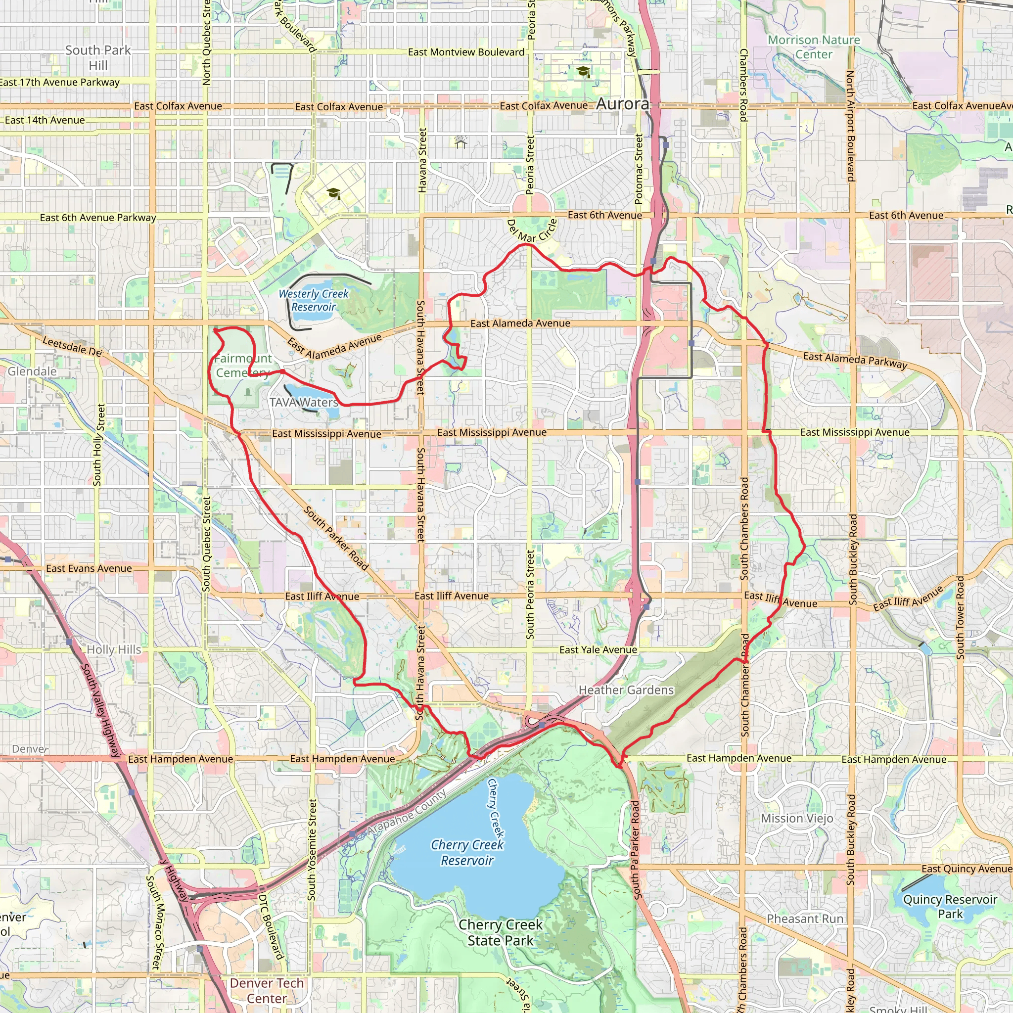
Starting near Denver, Colorado, the High Line Canal Regional Trail and Cherry Creek Loop Trail offers a scenic and moderately challenging hike spanning approximately 33 kilometers (20.5 miles) with an elevation gain of around 200 meters (656 feet). This loop trail is a fantastic way to explore the natural beauty and historical significance of the region.
Getting There
To reach the trailhead, you can either drive or use public transportation. If driving, head towards the nearest significant landmark, the South Platte River Greenway, which is easily accessible from downtown Denver. For those using public transport, the RTD (Regional Transportation District) offers bus services that can drop you off near the trailhead. Check the RTD website for the most current routes and schedules.
Trail Overview
The trail begins near the South Platte River Greenway and quickly immerses you in a diverse landscape. The first few kilometers are relatively flat, making it an excellent warm-up as you traverse through urban parks and green spaces. As you continue, you'll encounter a mix of paved and unpaved sections, so be prepared for varying terrain.
Significant Landmarks and Nature
Around the 5-kilometer (3.1-mile) mark, you'll come across the historic Four Mile House, a significant landmark dating back to the 1850s. This house served as a stage stop and tavern for travelers heading to Denver during the Gold Rush era. It's worth taking a short detour to explore this well-preserved piece of history.
Continuing along the trail, you'll pass through several parks, including Cherry Creek State Park. This area is a haven for birdwatchers, with over 300 species of birds recorded. Keep an eye out for bald eagles, great blue herons, and various waterfowl as you hike along the creek.
Wildlife and Flora
The trail is home to a variety of wildlife, including deer, foxes, and the occasional coyote. The flora is equally diverse, with cottonwood trees lining the canal and wildflowers blooming in the spring and summer months. The changing seasons offer a different experience each time you visit, from vibrant fall foliage to lush green landscapes in the summer.
Navigation and Safety
Given the trail's length and the mix of urban and natural environments, it's advisable to use a reliable navigation tool like HiiKER to stay on track. The trail is well-marked, but having a digital map can help you navigate the more complex sections, especially where the trail intersects with other paths and roads.
Elevation and Terrain
The elevation gain is gradual, making it accessible for hikers of varying skill levels. The highest point of the trail offers panoramic views of the surrounding area, including the distant Rocky Mountains. This vantage point is roughly 16 kilometers (10 miles) into the hike, providing a rewarding midpoint for your journey.
Amenities and Facilities
There are several rest areas and facilities along the trail, including picnic spots and restrooms. Cherry Creek State Park offers additional amenities such as water fountains and shaded areas, making it a great place to take a break and refuel.
Final Stretch
As you loop back towards the starting point, the trail meanders through more urban landscapes, offering a contrast to the natural beauty experienced earlier. The final kilometers bring you back to the South Platte River Greenway, completing the loop and providing a sense of accomplishment.
This trail offers a perfect blend of history, nature, and urban exploration, making it a must-visit for anyone looking to experience the diverse landscapes of the Denver area.
AI Planner
Days planned around your pace, with somewhere to stay each night.
What to expect?
Activity types
Comments and Reviews
User comments, reviews and discussions about the High Line Canal Regional Trail and Cherry Creek Loop Trail, Colorado.
4.62
average rating out of 5
13 rating(s)
