Download
Preview
Add to list
More
5.7 km
~1 hrs 21 min
126 m
Loop
“The Serpentine Loop Road North offers a scenic, historically rich, and moderately challenging 6 km hike through diverse ecosystems.”
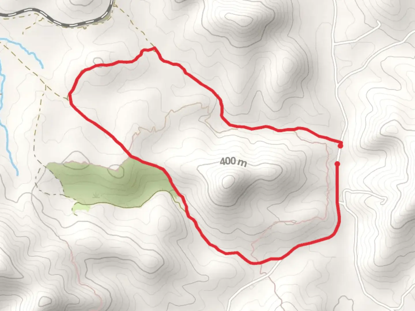
Starting near Tuolumne County, California, the Serpentine Loop Road North is a captivating 6 km (approximately 3.7 miles) loop trail with an elevation gain of around 100 meters (328 feet). This medium-difficulty trail offers a blend of natural beauty, historical significance, and a moderate challenge suitable for most hikers.
Getting There
To reach the trailhead, you can drive or use public transport. If driving, head towards Tuolumne County and look for parking near the intersection of Buchanan Road and Italian Bar Road. For those using public transport, the nearest significant landmark is the town of Sonora, California. From Sonora, you can take a local bus or taxi to the trailhead area.
Trail Navigation
For navigation, it is highly recommended to use the HiiKER app, which provides detailed maps and real-time updates to ensure you stay on the correct path.
Trail Highlights
Flora and Fauna
As you embark on the Serpentine Loop Road North, you'll be greeted by a diverse array of flora and fauna. The trail meanders through mixed conifer forests, featuring towering pines and oaks. Keep an eye out for local wildlife, including deer, squirrels, and a variety of bird species. During spring and early summer, the trail is adorned with wildflowers, adding vibrant colors to your hike.
Geological Features
One of the most striking aspects of this trail is its serpentine rock formations. These greenish rocks are rich in minerals and provide a unique geological backdrop. The serpentine soil also supports a variety of rare plant species that you won't find in other types of soil.
Historical Significance
The region around Tuolumne County is steeped in history, particularly from the Gold Rush era. As you hike, you'll come across remnants of old mining operations, including rusted equipment and abandoned shafts. These historical artifacts offer a glimpse into the past and the lives of those who once sought fortune in these hills.
Key Landmarks
Halfway Point
At approximately 3 km (1.85 miles) into the hike, you'll reach a scenic overlook that offers panoramic views of the surrounding landscape. This is a great spot to take a break, hydrate, and enjoy the scenery.
Creek Crossing
Around the 4 km (2.5 miles) mark, the trail crosses a small creek. Depending on the season, the water level can vary, so be prepared for a potentially wet crossing. The creek area is also a good spot to observe local amphibians and aquatic plants.
Trail Conditions
The trail is well-marked but can be rocky and uneven in sections. Good hiking boots are recommended to navigate these areas safely. During the rainy season, parts of the trail can become muddy, so check weather conditions before heading out.
Safety Tips
- Always carry enough water, especially during the hotter months.
- Be aware of your surroundings and watch for wildlife.
- Use the HiiKER app for real-time navigation and updates.
- Inform someone of your hiking plans and expected return time.
By preparing adequately and being mindful of the trail's features and conditions, you'll have a rewarding and enjoyable hiking experience on the Serpentine Loop Road North.

What to expect?
Activity types
Comments and Reviews
User comments, reviews and discussions about the Serpentine Loop Road North, California.
5.0
average rating out of 5
4 rating(s)