
Twin Peaks and Mount Sutro Loop via Sutro Tower Trail and Steep Ravine Trail
Download
3D Flyover
Add to list
More
7.3 km
~2 hrs 7 min
394 m
Loop
“Traverse San Francisco's urban heart and natural vistas on the Twin Peaks and Mount Sutro Loop.”
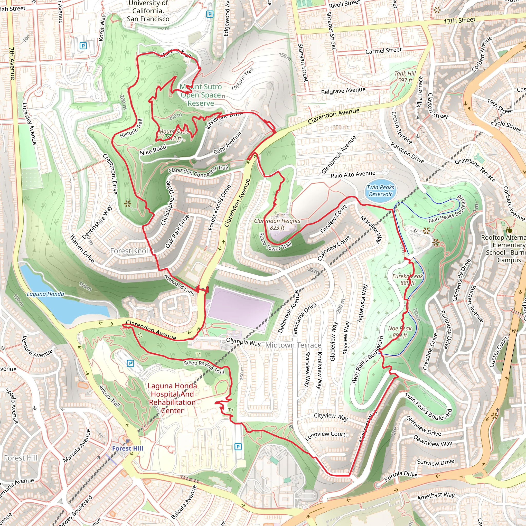
Embarking on the Twin Peaks and Mount Sutro Loop, hikers will experience a diverse array of landscapes and views that encapsulate the essence of San Francisco's natural beauty. This approximately 7 km (4.3 miles) loop with an elevation gain of around 300 meters (984 feet) begins near the urban heart of San Francisco County, California, offering a moderate challenge suitable for those with some hiking experience.
Getting to the Trailhead The trailhead is accessible by both public transportation and car. For those opting for public transit, several Muni bus lines run close to the starting point. By car, parking can be found along the nearby streets, but be mindful of any parking restrictions. Utilizing HiiKER for navigation will help in pinpointing the exact starting location and assist with real-time tracking along the trail.
The Journey Commences Setting out from the trailhead, hikers are immediately greeted by the lush surroundings of Mount Sutro. The early stretch of the trail is a gentle ascent through eucalyptus groves, which provide a fragrant and shaded environment. The trail is well-maintained, with clear signage to guide adventurers as they make their way towards the first notable landmark, Sutro Tower.
Sutro Tower and Surroundings The imposing Sutro Tower, visible from various points in San Francisco, is a key navigational beacon on the trail. As hikers approach, they'll be treated to the history of this iconic structure, which has been a part of the city's skyline since 1973. The area around the tower offers panoramic views of the city and beyond, making it a perfect spot for a brief rest and photo opportunity.
Ascending Twin Peaks Continuing on, the trail becomes more challenging as it winds towards Twin Peaks, two of the highest summits in San Francisco. The climb is steady, and hikers will gain most of the elevation in this section. Upon reaching the peaks, the reward is a 360-degree vista that includes the Golden Gate Bridge, Alcatraz Island, and downtown San Francisco. The peaks themselves are a natural landmark with significant historical value, as native tribes once used them as lookout points.
The Descent and Steep Ravine Trail The descent from Twin Peaks is a sharp contrast to the ascent, with the Steep Ravine Trail living up to its name. The trail here is narrower and can be quite rugged, so careful footing is essential. The dense greenery and occasional stream crossings provide a tranquil atmosphere as hikers navigate their way down.
Mount Sutro and Return Looping back towards Mount Sutro, the trail eases as it enters the Mount Sutro Open Space Reserve. This area is a testament to conservation efforts, with native plants and wildlife thriving thanks to ongoing restoration projects. The final stretch is a serene walk through more eucalyptus groves, leading back to the trailhead where the journey began.
Flora and Fauna Throughout the hike, the diversity of plant life is evident, with a mix of native and introduced species. Wildlife sightings may include various bird species, such as the red-tailed hawk, and on rare occasions, hikers might spot a coyote or raccoon.
Preparation and Safety Hikers should come prepared with adequate water, snacks, and layers of clothing to adapt to the microclimates encountered along the trail. Sturdy hiking shoes are recommended due to the mixed terrain. Always check the weather before setting out and be aware that fog can roll in quickly, reducing visibility.
By using HiiKER to track progress and navigate, hikers can ensure they stay on the correct path and enjoy all that the Twin Peaks and Mount Sutro Loop has to offer.
What to expect?
Activity types
Comments and Reviews
User comments, reviews and discussions about the Twin Peaks and Mount Sutro Loop via Sutro Tower Trail and Steep Ravine Trail, California.
4.57
average rating out of 5
7 rating(s)
