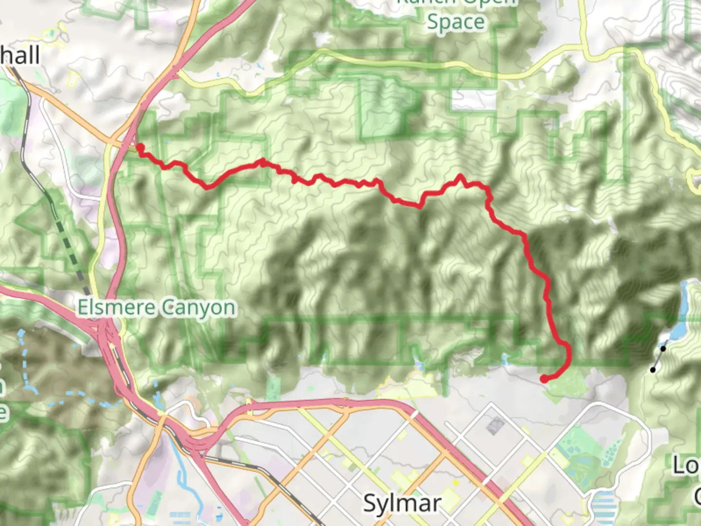
Santa Clara Trail - Wilson Canyon Saddle - May Canyon Road
Download
3D Flyover
Add to list
More
13.7 km
~4 hrs 15 min
905 m
Point-to-Point
“Experience the diverse beauty of Southern California on a rewarding 14-kilometer trek through scenic canyons and historical landscapes.”
The Santa Clara Trail to Wilson Canyon Saddle and May Canyon Road is a moderately challenging point-to-point hike located near Los Angeles County, California. Spanning approximately 14 kilometers (about 8.7 miles) with an elevation gain of around 900 meters (roughly 2950 feet), this trail offers a rewarding experience for those looking to explore the natural beauty of the region.
Getting to the Trailhead To reach the trailhead, hikers can drive to the vicinity of the intersection of Little Tujunga Canyon Road and Gold Creek Road, which is the nearest landmark to the starting point. For those opting for public transportation, check local transit schedules for the closest routes and stops. Parking is typically available near the trailhead, but it's advisable to arrive early as it can fill up quickly, especially on weekends.
The Hike As you embark on the Santa Clara Trail, you'll be greeted by a mix of chaparral-covered hillsides and oak woodlands. The initial section of the trail is relatively gentle, allowing hikers to warm up as they prepare for the more strenuous climb ahead. Approximately 2 kilometers (1.2 miles) in, the trail begins to ascend more steeply, offering panoramic views of the surrounding canyons and the distant San Gabriel Mountains.
Wildlife and Flora Throughout the hike, keep an eye out for the diverse wildlife that inhabits the area, including mule deer, coyotes, and various bird species. The trail is also home to a variety of plant life, from the fragrant sagebrush to the colorful wildflowers that bloom in the spring.
Historical Significance The region holds historical significance, with the nearby San Fernando Valley playing a crucial role in the early development of Southern California. The area's trails and canyons have been used for centuries, first by Native American tribes and later by Spanish missionaries and settlers.
Reaching Wilson Canyon Saddle As you approach the halfway mark, around 7 kilometers (4.3 miles), you'll reach the Wilson Canyon Saddle. This is a perfect spot to take a break and enjoy the vistas before continuing on to May Canyon Road. The descent into May Canyon is gradual and offers a different perspective of the landscape, with lush vegetation and the chance to spot a trickling stream during wetter months.
Conclusion of the Trail The trail concludes at May Canyon Road, where hikers can arrange for a pick-up or, if planned accordingly, leave a second vehicle for the return journey. It's important to note that since this is a point-to-point hike, you'll need to consider transportation back to the starting point if you're not doing a car shuttle.
Preparation and Safety Before setting out, ensure you have adequate water, sun protection, and sturdy hiking boots, as the terrain can be rugged in places. It's also wise to check the weather forecast and trail conditions, as the trail can become quite hot during summer months or muddy after rain. For navigation, the HiiKER app can be a valuable tool to keep you on track and informed about the trail ahead.
Remember to leave no trace, respect the wildlife, and enjoy the natural beauty of the Santa Clara Trail to Wilson Canyon Saddle and May Canyon Road.

What to expect?
Activity types
Comments and Reviews
User comments, reviews and discussions about the Santa Clara Trail - Wilson Canyon Saddle - May Canyon Road, California.
4.43
average rating out of 5
7 rating(s)