Download
Preview
Add to list
More
13.5 km
~3 hrs 49 min
679 m
Point-to-Point
“Embark on a scenic 8-mile hike through Vasquez Rocks' geological wonders, diverse ecosystems, and historical paths with moderate climbs.”
Embarking on the Pacific Crest Trail from Vasquez Rocks, hikers will traverse approximately 13 kilometers (about 8 miles) of diverse landscapes with an elevation gain of around 600 meters (nearly 2000 feet). This point-to-point section of the trail, rated as medium difficulty, offers a blend of natural beauty and historical significance.
Getting to the Trailhead
The trailhead is accessible near Los Angeles County, California. For those driving, the starting point is most conveniently reached by heading towards Agua Dulce, with parking available near Vasquez Rocks Natural Area Park. Public transportation options are limited, but one can take a bus to the nearest town and then a taxi to the trailhead.
Navigating the Trail
As you set out, the HiiKER app will be an invaluable tool for navigation, providing detailed maps and waypoints to ensure you stay on the correct path. The trail is well-marked, but always keep an eye on your navigation to avoid any wrong turns.
Vasquez Rocks: A Geological Marvel
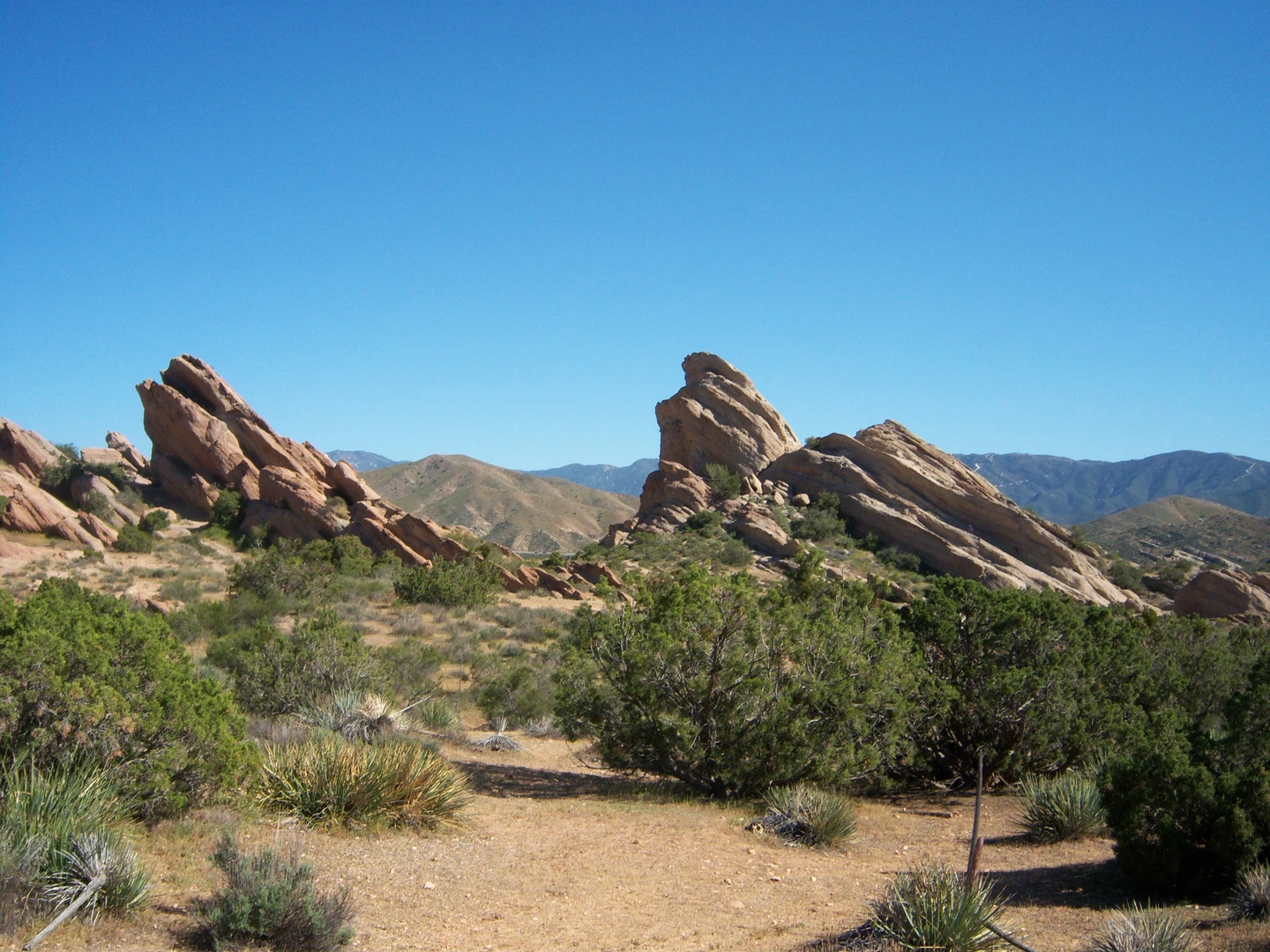
The journey begins with the iconic Vasquez Rocks, known for their jagged, angular formations that thrust upward from the earth. These rocks, which have been featured in numerous films and TV shows, are a result of rapid erosion and were historically used as a hideout by bandit Tiburcio Vásquez, hence their name.
Flora and Fauna
As you progress, the trail meanders through chaparral, oak woodlands, and grasslands. Keep an eye out for the vibrant wildflowers in the spring, and the occasional Joshua tree, a hallmark of the Mojave Desert ecosystem. Wildlife is abundant, with the possibility of spotting mule deer, coyotes, and a variety of lizards and snakes. Birdwatchers may also glimpse the California quail or the red-tailed hawk soaring above.
Historical Significance
The area is rich in history, with the trail passing near the San Andreas Fault, a crucial geological feature responsible for shaping much of California's landscape. Additionally, the region has a deep Native American heritage, with the Tataviam people having inhabited the area for centuries before Spanish and Mexican influences arrived.
Elevation and Terrain
The trail offers a moderate climb, with the most significant elevation gain occurring in the first half of the hike. The terrain is a mix of sandy paths, rocky outcrops, and compacted dirt trails, which can be challenging but are generally manageable for hikers with some experience.
Preparation and Safety
Before setting out, ensure you have adequate water, as sources along this section are scarce. Sun protection is also crucial, as the trail offers little shade. Always check the weather forecast and be prepared for sudden changes in conditions. It's advisable to inform someone of your hiking plans and expected return time.
End of the Trail
The endpoint of this section of the Pacific Crest Trail is marked by a gradual descent into more level ground, signaling the conclusion of this particular adventure. From here, hikers can arrange for pickup or if planned accordingly, continue on to the next segment of the PCT for a longer journey.

What to expect?
Activity types
Comments and Reviews
User comments, reviews and discussions about the Pacific Crest Trail from Vasquez Rocks, California.
4.33
average rating out of 5
3 rating(s)