Download
3D Flyover
Add to list
More
9.8 km
~2 hrs 1 min
32 m
Out and Back
“The Compton Creek Path is a flat, scenic trail accessible for most hikers, blending nature and urban landscapes.”
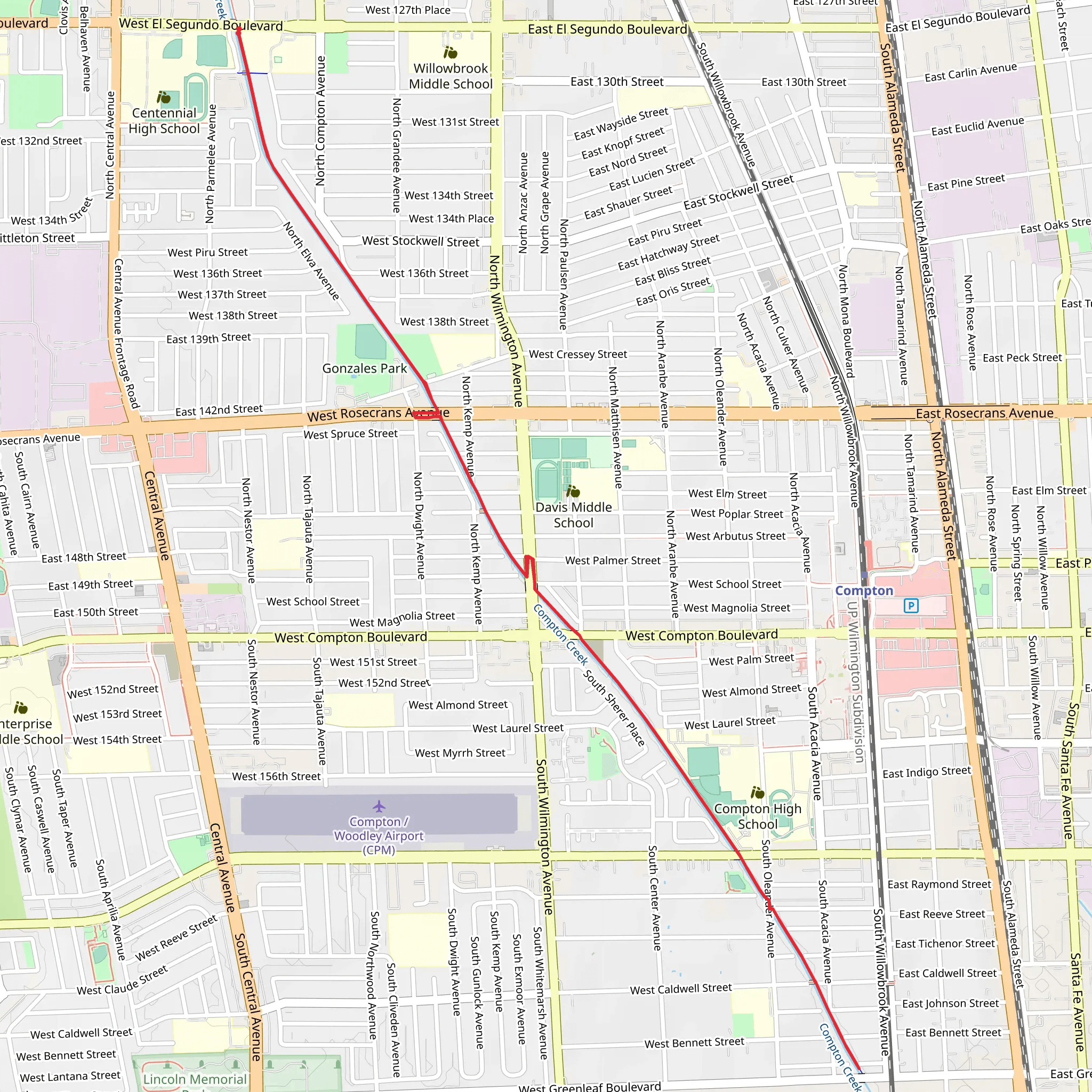
Starting near Los Angeles County, California, the Compton Creek Path is an inviting 10 km (approximately 6.2 miles) out-and-back trail with virtually no elevation gain, making it accessible for a wide range of hikers. The trailhead is conveniently located near the Compton Creek Natural Park at George Washington Elementary School, which serves as a significant landmark for those unfamiliar with the area.
Getting There
For those using public transport, the Metro Blue Line (now known as the A Line) provides easy access. You can disembark at the Compton Station, which is a short walk from the trailhead. If you're driving, parking is available at the Compton Creek Natural Park, but it's advisable to arrive early, especially on weekends, to secure a spot.
Trail Overview
The Compton Creek Path is a relatively flat trail, making it suitable for hikers of all skill levels. The path is well-maintained and clearly marked, so navigation is straightforward. For those who prefer digital navigation tools, HiiKER offers detailed maps and real-time updates to ensure you stay on track.
Points of Interest
Nature and Wildlife
As you embark on the trail, you'll notice the lush greenery that lines Compton Creek. The area is home to a variety of bird species, including herons and egrets, which are often seen wading in the creek. Keep an eye out for native plants like the California sycamore and mulefat, which add to the trail's natural beauty.
Historical Significance
Compton Creek has a rich history tied to the development of Los Angeles County. The creek was once a vital water source for the Tongva people, the original inhabitants of the Los Angeles Basin. As you walk along the path, you might reflect on how this waterway has sustained communities for centuries.
Trail Highlights
At approximately 2 km (1.2 miles) into the hike, you'll come across the Compton Creek Wetlands, a restored area that serves as a habitat for local wildlife. This section is particularly scenic and offers a great spot for birdwatching or a quick rest.
Around the 5 km (3.1 miles) mark, you'll reach the turnaround point near the intersection of El Segundo Boulevard and South Alameda Street. This area is more urban, providing a stark contrast to the natural surroundings of the earlier sections of the trail.
Practical Tips
- Water and Snacks: There are no water fountains along the trail, so bring plenty of water and some snacks to keep your energy levels up.
- Sun Protection: The trail is mostly exposed, so sunscreen, hats, and sunglasses are recommended.
- Footwear: Comfortable walking shoes are sufficient given the flat terrain.
Safety and Etiquette
While the trail is generally safe, it's always a good idea to hike with a buddy or inform someone of your plans. Be mindful of cyclists and joggers who also frequent the path. Always stay to the right and be courteous to other trail users.
The Compton Creek Path offers a unique blend of urban and natural environments, making it a rewarding hike for those looking to explore a different side of Los Angeles County.
What to expect?
Activity types
Comments and Reviews
User comments, reviews and discussions about the Compton Creek Path, California.
4.5
average rating out of 5
2 rating(s)
