Download
3D Flyover
Add to list
More
43.8 km
~2 days
1990 m
Point-to-Point
“Experience the breathtaking beauty and intense challenge of Northern California's rugged High Tip via Lost Coast Trail.”
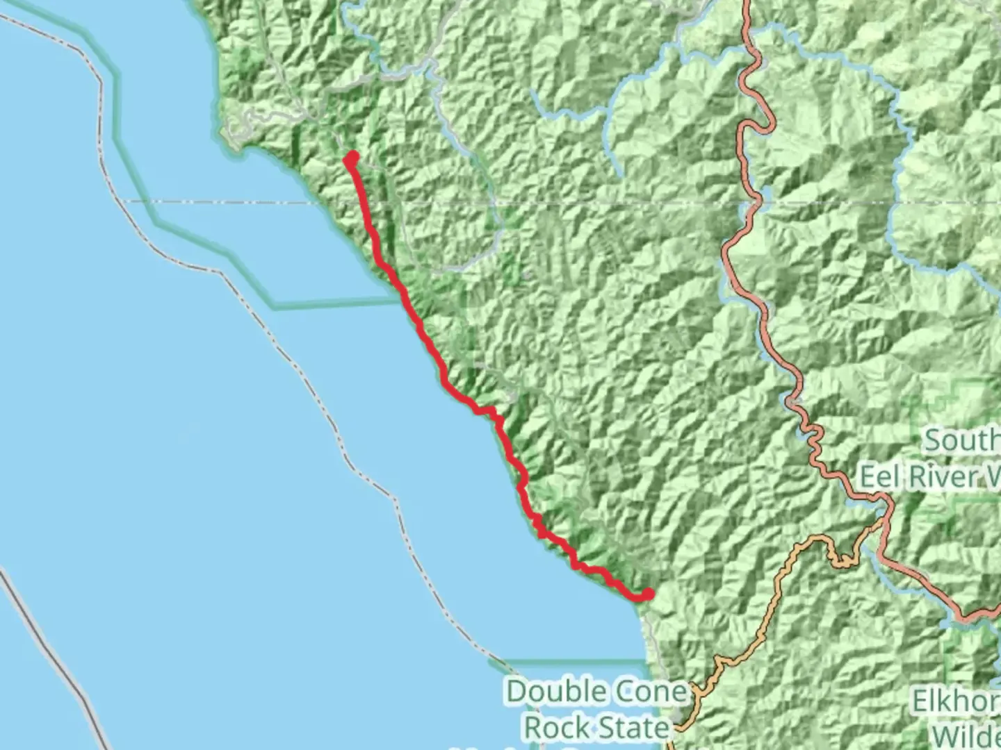
Nestled along the rugged and remote coastline of Northern California, the High Tip via Lost Coast Trail offers an exhilarating adventure for seasoned hikers. This point-to-point trail stretches approximately 44 kilometers (27 miles) and boasts an elevation gain of around 1,900 meters (6,234 feet), making it an extra difficult trek that demands preparation and respect for the elements.
Getting There
The trailhead is located near Humboldt County, California, a region known for its breathtaking natural beauty and rich history. To reach the starting point, hikers can drive to the Mattole Beach trailhead, which is accessible via Lighthouse Road from the town of Petrolia. For those relying on public transport, the nearest major city is Eureka, California. From Eureka, you can take a bus to the town of Petrolia, though services may be infrequent, so planning ahead is crucial.
Trail Overview
The High Tip via Lost Coast Trail is renowned for its dramatic coastal scenery, where the mountains meet the Pacific Ocean. This trail is part of the larger Lost Coast Trail, which is one of the few stretches of California's coastline that remains undeveloped. The journey begins at Mattole Beach, where hikers are immediately greeted by the sound of crashing waves and the sight of expansive sandy beaches.
Key Landmarks and Sections
Mattole Beach to Punta Gorda Lighthouse (0-5 km / 0-3 miles): The initial section of the trail is relatively flat, allowing hikers to ease into the journey. The Punta Gorda Lighthouse, a historic landmark built in 1912, stands as a testament to the region's maritime history. This lighthouse once guided ships along this treacherous stretch of coast and is a popular spot for photography.
Punta Gorda Lighthouse to Spanish Flat (5-15 km / 3-9 miles): As you continue, the trail becomes more challenging, with rocky terrain and tidal zones that require careful timing and navigation. The use of HiiKER is recommended to ensure you stay on track. Spanish Flat offers a reprieve with its grassy meadows and stunning ocean views, making it an ideal spot for a rest.
Spanish Flat to Big Flat (15-30 km / 9-19 miles): This section is characterized by steep ascents and descents, testing your endurance and hiking skills. The trail meanders through lush forests and offers glimpses of diverse wildlife, including black bears, Roosevelt elk, and a variety of bird species. Keep an eye out for sea lions basking on the rocks below.
Big Flat to Black Sands Beach (30-44 km / 19-27 miles): The final stretch of the trail is both rewarding and demanding. The path hugs the coastline, providing panoramic views of the Pacific Ocean. Black Sands Beach marks the end of the journey, with its unique dark sands and the sound of the ocean waves providing a fitting conclusion to this epic hike.
Historical Significance
The Lost Coast region is steeped in history, from the indigenous peoples who originally inhabited the area to the early European settlers and lighthouse keepers. The isolation of the Lost Coast has preserved much of its natural beauty and historical sites, offering hikers a glimpse into the past as they traverse this rugged landscape.
Preparation and Safety
Given the trail's difficulty rating, thorough preparation is essential. Hikers should be equipped with appropriate gear, including sturdy footwear, weather-appropriate clothing, and sufficient food and water supplies. Tidal charts are crucial for planning safe passage through tidal zones, and HiiKER can assist with navigation and real-time updates. Cell service is limited, so a satellite communication device is recommended for emergencies.
Embarking on the High Tip via Lost Coast Trail is a journey into one of California's most pristine and challenging wilderness areas. With its combination of natural beauty, historical intrigue, and physical demands, this trail promises an unforgettable experience for those who are well-prepared and ready for adventure.

What to expect?
Activity types
Comments and Reviews
User comments, reviews and discussions about the High Tip via Lost Coast Trail, California.
average rating out of 5
0 rating(s)