
Download
3D Flyover
Add to list
More
6.7 km
~1 hrs 48 min
275 m
Out and Back
“Experience the historic and scenic Cal Neva trail for a moderate hike amidst diverse landscapes.”
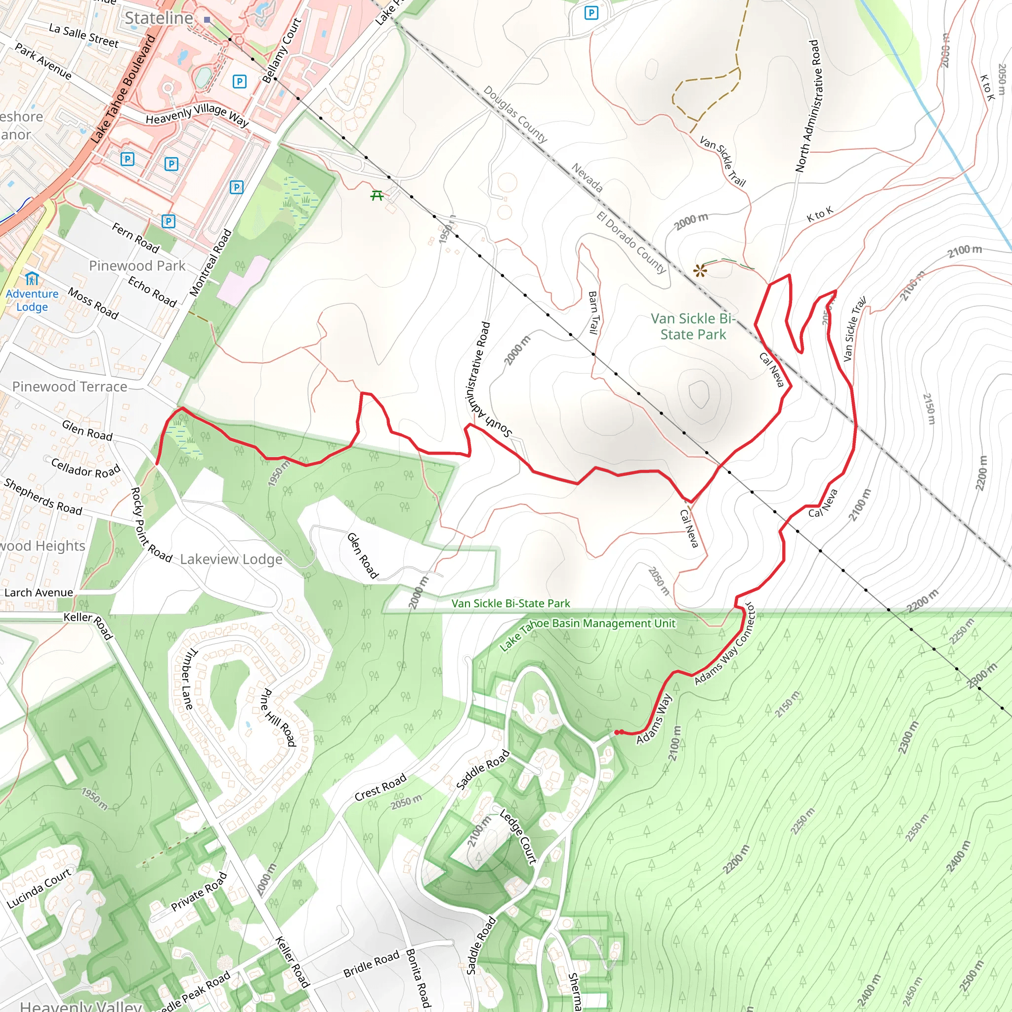
The Cal Neva trail, nestled near El Dorado County in California, offers hikers a moderately challenging experience with its approximately 7 km (4.3 miles) out-and-back route. The trail boasts an elevation gain of around 200 meters (656 feet), providing a workout that's not too strenuous but still rewarding.
Getting to the Trailhead To reach the starting point of the Cal Neva trail, hikers can drive to the vicinity of El Dorado County. The trailhead is accessible by car, and parking is typically available in designated areas near the start of the trail. For those opting for public transportation, check local transit schedules for the nearest routes and stops. Once at the trailhead, you can use the HiiKER app to ensure you're at the correct location and to help navigate the trail.
Navigating the Trail As you embark on your hike, the path will lead you through a diverse landscape of dense forests and open meadows. The trail is well-marked, but it's always wise to have a navigation tool like HiiKER on hand to track your progress and ensure you stay on the right path.
Landmarks and Scenery The Cal Neva trail is rich in natural beauty, with towering pines and the occasional sighting of local wildlife, such as deer and various bird species. Approximately halfway through the hike, you'll encounter a serene stream, a perfect spot to take a break and enjoy the tranquility of nature.
Historical Significance The region around the Cal Neva trail is steeped in history. The area was once a hotspot during the California Gold Rush in the mid-1800s, and hikers can sense the echoes of the past as they traverse the same landscapes that fortune seekers once hurriedly crossed.
Flora and Fauna Throughout the hike, the trail is lined with an array of plant life, including wildflowers in the spring and summer months that add a splash of color to the greenery. Keep an eye out for the local fauna; besides the deer and birds, if you're lucky, you might spot smaller mammals like squirrels and chipmunks.
Preparation Tips Before setting out on the Cal Neva trail, ensure you're prepared with adequate water, snacks, and layers of clothing to adjust to changing temperatures. The trail can be rocky in places, so sturdy hiking boots are recommended. Don't forget to check the weather forecast and plan accordingly.
Remember, the Cal Neva trail offers a glimpse into California's natural and historical richness, making it a rewarding experience for those looking to explore the beauty of El Dorado County. Whether you're a seasoned hiker or someone looking to enjoy a day hike, the Cal Neva trail is a splendid choice for an outdoor adventure.
What to expect?
Activity types
Comments and Reviews
User comments, reviews and discussions about the Cal Neva, California.
4.4
average rating out of 5
5 rating(s)

